Property Record
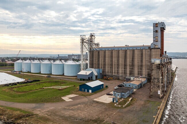
400 Main St, Superior, WI 54880

Property Detail
400 Main St
Duluth, MN-WI
ALL THAT PART OF LOTS 1 & 2 IN THE PLAT OF CONNORS POINT & THAT PART OF BLK 500 IN THE PLAT OF WEST SUPERIOR SWEETSER DIV
03-803-01004-00
Douglas
Commercialnec
Wisconsin
W1
1,2
B and X Area of moderate flood hazard, usually the area between the limits of the 100-year and 500-year floods.
24.54 AC
2025
Superior
2025
Duluth
021100
NEARBY LISTINGS FOR SALE OR LEASE
DEMOGRAPHICS near 400 Main St
1 mile
3 mile
5 mile
2025 Total Population
2,252
21,727
61,410
2030 Population
2,213
21,415
60,399
Pop Growth 2025-2030
(1.73%)
(1.44%)
(1.65%)
Average Age
39
40
39
2025 Total Households
1,114
9,678
28,110
HH Growth 2025-2030
(1.80%)
(1.47%)
(1.67%)
Median Household Inc
$35,968
$58,758
$53,485
Avg Household Size
1.90
2.10
2.00
2025 Avg HH Vehicles
1.00
2.00
2.00
Median Home Value
$132,758
$179,259
$193,535
Median Year Built
1963
1953
1949
Nearby Places
Map Layers
Map Styles
 Street
 Aerial
Layers
 Traffic
 Biking
Places
Listings with unknown addresses are not visible on the map
- Restaurants
- Banks
- Shops
- Fitness
- Groceries
PUBLIC TRANSPORTATION
AIRPORT
Duluth International
Drive
Walk
Distance
Duluth International
26 min
12.9 mi
Freight Ports
Port Milwaukee
Drive
Walk
Distance
Port Milwaukee
446 min
393.9 mi
Nearby Properties
Address
Land Use
TOTAL SIZE
Lot Size
Zoning
Address
Land Use
TOTAL SIZE
Lot Size
Zoning
175 AC
W1
Address
Land Use
TOTAL SIZE
Lot Size
Zoning
2.81 AC
PDD
Address
Land Use
TOTAL SIZE
Lot Size
Zoning
1.45 AC
C3
Address
Land Use
TOTAL SIZE
Lot Size
Zoning
107,796 SF
9.19 AC
Address
Land Use
TOTAL SIZE
Lot Size
Zoning
68,296 SF
0.38 AC
Address
Land Use
TOTAL SIZE
Lot Size
Zoning
8.50 AC
W1
Address
Land Use
TOTAL SIZE
Lot Size
Zoning
1.36 AC
C2
Address
Land Use
TOTAL SIZE
Lot Size
Zoning
2.47 AC
C2
Address
Land Use
TOTAL SIZE
Lot Size
Zoning
5,392 SF
24.92 AC
Address
Land Use
TOTAL SIZE
Lot Size
Zoning
4.17 AC
C2
Address
Land Use
TOTAL SIZE
Lot Size
Zoning
6.94 AC
Address
Land Use
TOTAL SIZE
Lot Size
Zoning
71,967 SF
0.16 AC
Address
Land Use
TOTAL SIZE
Lot Size
Zoning
52.06 AC
M2
Address
Land Use
TOTAL SIZE
Lot Size
Zoning
24,389 SF
1.68 AC
Address
Land Use
TOTAL SIZE
Lot Size
Zoning
85,370 SF
1.05 AC
Address
Land Use
TOTAL SIZE
Lot Size
Zoning
96,000 SF
1.35 AC
Address
Land Use
TOTAL SIZE
Lot Size
Zoning
2 AC
R3
Address
Land Use
TOTAL SIZE
Lot Size
Zoning
92,040 SF
2.18 AC
C2
Address
Land Use
TOTAL SIZE
Lot Size
Zoning
72,748 SF
5.23 AC
R3
Address
Land Use
TOTAL SIZE
Lot Size
Zoning
6.01 AC
M2
Address
Land Use
TOTAL SIZE
Lot Size
Zoning
0.68 AC
R3
Address
Land Use
TOTAL SIZE
Lot Size
Zoning
2.44 AC
C2
Address
Land Use
TOTAL SIZE
Lot Size
Zoning
1.63 AC
Address
Land Use
TOTAL SIZE
Lot Size
Zoning
47,046 SF
4.38 AC
Address
Land Use
TOTAL SIZE
Lot Size
Zoning
20.01 AC
Address
Land Use
TOTAL SIZE
Lot Size
Zoning
66,688 SF
1.03 AC
C2
Address
Land Use
TOTAL SIZE
Lot Size
Zoning
1.34 AC
Address
Land Use
TOTAL SIZE
Lot Size
Zoning
42,000 SF
0.32 AC
Address
Land Use
TOTAL SIZE
Lot Size
Zoning
3.42 AC
R3
The World's #1 Commercial Real Estate Marketplace
Connect with us
© 2026 CoStar Group
The information above has been obtained from sources believed reliable. While we do not doubt its accuracy we have not verified it and make no guarantee, warranty or representation about it. It is your responsibility to independently confirm its accuracy and completeness. Any projections, opinions, assumptions, or estimates used are for example only and do not represent the current or future performance of the property. The value of this transaction to you depends on tax and other factors which should be evaluated by your tax, financial, and legal advisors. You and your advisors should conduct a careful, independent investigation of the property to determine to your satisfaction the suitability of the property for your needs.