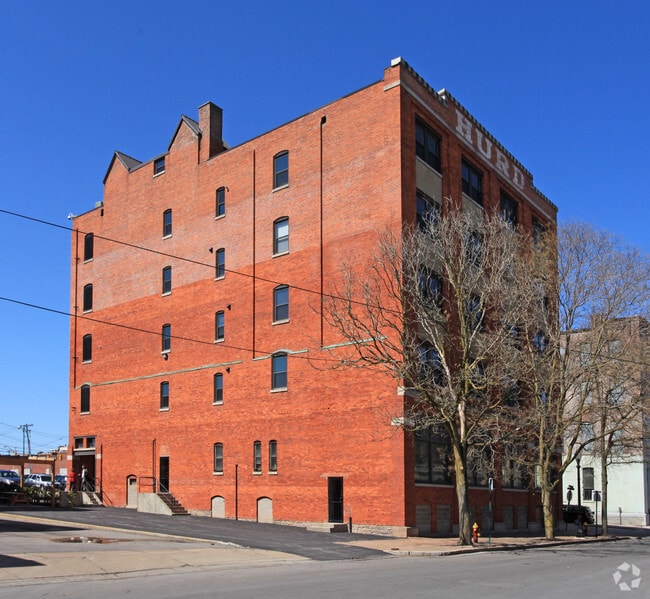
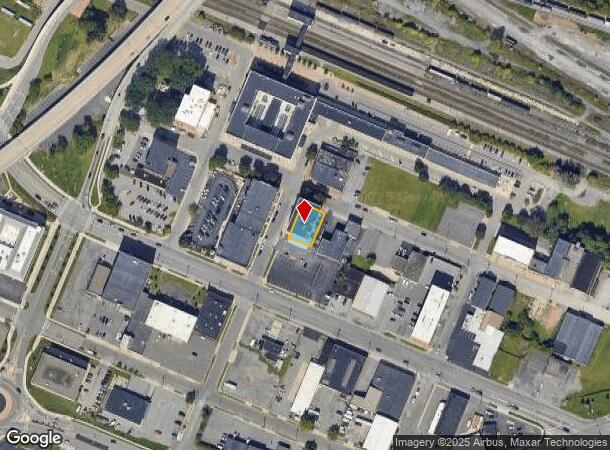
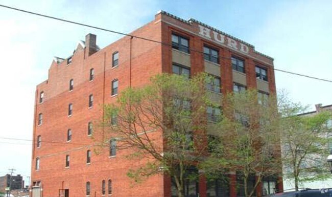
Property Record
400 Main St, Utica, NY 13501
NEARBY LISTINGS FOR SALE OR LEASE
Property Detail
400 Main St
318-044-0001-019-000-0000
3-07-05-001 71X10070 318.044-0001-019.000/0000
Commercialofficeresidentialmixeduse
Oneida
X
New York
36065C0751F
19.000
2025
0.16 AC
2024
Utica
021201
Utica/Rome
33,500 SF
Utica-Rome, NY
DEMOGRAPHICS near 400 Main St
1 Mile
3 Mile
5 Mile
2024 Total Population
12,263
67,491
99,478
2029 Population
11,914
66,003
97,525
Pop Growth 2024-2029
(2.85%)
(2.20%)
(1.96%)
Average Age
35
38
40
2024 Total Households
5,095
26,748
40,764
HH Growth 2024-2029
(2.47%)
(2.12%)
(1.94%)
Median Household Inc
$28,395
$43,149
$53,309
Avg Household Size
2.30
2.30
2.30
2024 Avg HH Vehicles
1.00
1.00
1.00
Median Home Value
$76,183
$129,654
$153,603
Median Year Built
1947
1948
1951
Nearby Places
- Restaurants
- Banks
- Shops
- Fitness
- Groceries
PUBLIC TRANSPORTATION
COMMUTER RAIL
DRIVE
WALK
Distance
0 min
1 min
0.0 mi
DRIVE
WALK
Distance
1 min
2 min
0.1 mi
Nearby Properties
Address
Land Use
TOTAL SIZE
Lot Size
Zoning
Address
Land Use
TOTAL SIZE
Lot Size
Zoning
271,000 SF
16.50 AC
Address
Land Use
TOTAL SIZE
Lot Size
Zoning
742,550 SF
2.03 AC
Address
Land Use
TOTAL SIZE
Lot Size
Zoning
446,163 SF
24.07 AC
05 - COMME
Address
Land Use
TOTAL SIZE
Lot Size
Zoning
127,002 SF
89.68 AC
Address
Land Use
TOTAL SIZE
Lot Size
Zoning
9.79 AC
Address
Land Use
TOTAL SIZE
Lot Size
Zoning
276,146 SF
304.48 AC
Address
Land Use
TOTAL SIZE
Lot Size
Zoning
98,832 SF
1.61 AC
Address
Land Use
TOTAL SIZE
Lot Size
Zoning
279,786 SF
121 AC
Address
Land Use
TOTAL SIZE
Lot Size
Zoning
236,597 SF
2.10 AC
Address
Land Use
TOTAL SIZE
Lot Size
Zoning
109,000 SF
13.56 AC
01 - NOT Z
Address
Land Use
TOTAL SIZE
Lot Size
Zoning
131,534 SF
16 AC
05 - COMME
Address
Land Use
TOTAL SIZE
Lot Size
Zoning
55,172 SF
81.24 AC
Address
Land Use
TOTAL SIZE
Lot Size
Zoning
6,000 SF
1.46 AC
Address
Land Use
TOTAL SIZE
Lot Size
Zoning
12,692 SF
20.24 AC
Address
Land Use
TOTAL SIZE
Lot Size
Zoning
205,097 SF
7.90 AC
Address
Land Use
TOTAL SIZE
Lot Size
Zoning
53,777 SF
Address
Land Use
TOTAL SIZE
Lot Size
Zoning
55,916 SF
4.50 AC
Address
Land Use
TOTAL SIZE
Lot Size
Zoning
129,948 SF
6.90 AC
Address
Land Use
TOTAL SIZE
Lot Size
Zoning
132,972 SF
30.76 AC
Address
Land Use
TOTAL SIZE
Lot Size
Zoning
87,120 SF
2.31 AC
Address
Land Use
TOTAL SIZE
Lot Size
Zoning
12,544 SF
21.80 AC
Address
Land Use
TOTAL SIZE
Lot Size
Zoning
3,472 SF
1.06 AC
Address
Land Use
TOTAL SIZE
Lot Size
Zoning
163,404 SF
2.58 AC
Address
Land Use
TOTAL SIZE
Lot Size
Zoning
65,120 SF
1.79 AC
Address
Land Use
TOTAL SIZE
Lot Size
Zoning
47,732 SF
0.86 AC
DS
Address
Land Use
TOTAL SIZE
Lot Size
Zoning
209,608 SF
2.10 AC
Address
Land Use
TOTAL SIZE
Lot Size
Zoning
142,770 SF
34.25 AC
Address
Land Use
TOTAL SIZE
Lot Size
Zoning
148,962 SF
31.10 AC
Address
Land Use
TOTAL SIZE
Lot Size
Zoning
31,023 SF
1.72 AC
Address
Land Use
TOTAL SIZE
Lot Size
Zoning
83,783 SF
0.53 AC
The World's #1 Commercial Real Estate Marketplace
Connect with us
© 2025 CoStar Group
The information above has been obtained from sources believed reliable. While we do not doubt its accuracy we have not verified it and make no guarantee, warranty or representation about it. It is your responsibility to independently confirm its accuracy and completeness. Any projections, opinions, assumptions, or estimates used are for example only and do not represent the current or future performance of the property. The value of this transaction to you depends on tax and other factors which should be evaluated by your tax, financial, and legal advisors. You and your advisors should conduct a careful, independent investigation of the property to determine to your satisfaction the suitability of the property for your needs.