Property Record
400 N 3Rd Ave, Fruitport, MI 49415
NEARBY LISTINGS FOR SALE OR LEASE
-
-
View all Fruitport listings for lease on LoopNet.com
Property Detail
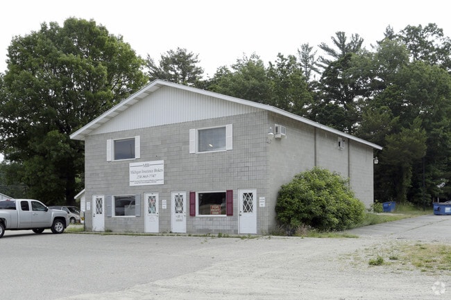
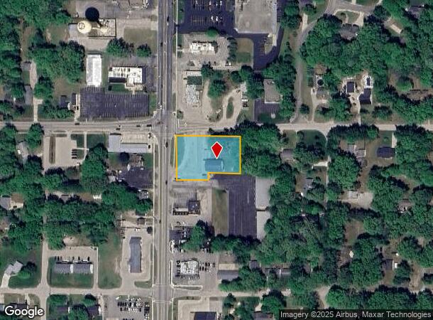
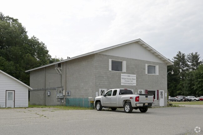
400 N 3Rd Ave
Muskegon, MI
Village Of Fruitport
41-150-003-0008-00
VILLAGE OF FRUITPORT SEC 36 T9N R16W BLK 3 N 75 FT OF W 130 FT OF LOT 7 EXC S 45 FT THEROF AND W 258 FT OF LOT 8 .98 AC
Commercialnec
Muskegon
X
Michigan
26121C0294E
7-8
2024
1 AC
2025
Norton Shores
002800
West Michigan
1,344 SF
DEMOGRAPHICS near 400 N 3Rd Ave
1 Mile
3 Mile
5 Mile
2024 Total Population
2,012
12,291
40,966
2029 Population
2,029
12,683
42,234
Pop Growth 2024-2029
+ 0.84%
+ 3.19%
+ 3.10%
Average Age
42
42
42
2024 Total Households
790
4,794
16,419
HH Growth 2024-2029
+ 0.89%
+ 3.27%
+ 3.22%
Median Household Inc
$86,079
$74,484
$71,282
Avg Household Size
2.50
2.50
2.40
2024 Avg HH Vehicles
2.00
2.00
2.00
Median Home Value
$187,535
$262,373
$243,164
Median Year Built
1971
1989
1982
Nearby Places
Map Layers
Map Styles
 Street
 Aerial
- Restaurants
- Banks
- Shops
- Fitness
- Groceries
SALE & LEASE HISTORY
LISTING DATE
SALE/LEASE

Mar 02, 2023
For Lease
Nearby Properties
Address
Land Use
TOTAL SIZE
Lot Size
Zoning
Address
Land Use
TOTAL SIZE
Lot Size
Zoning
273,059 SF
30.59 AC
PUD
Address
Land Use
TOTAL SIZE
Lot Size
Zoning
207,571 SF
22 AC
LI
Address
Land Use
TOTAL SIZE
Lot Size
Zoning
65,152 SF
9.77 AC
PUD
Address
Land Use
TOTAL SIZE
Lot Size
Zoning
55,600 SF
LI
Address
Land Use
TOTAL SIZE
Lot Size
Zoning
250,000 SF
19.08 AC
GI
Address
Land Use
TOTAL SIZE
Lot Size
Zoning
169,420 SF
15.20 AC
PUD
Address
Land Use
TOTAL SIZE
Lot Size
Zoning
91,682 SF
21.93 AC
PUD
Address
Land Use
TOTAL SIZE
Lot Size
Zoning
118,532 SF
8.16 AC
REC
Address
Land Use
TOTAL SIZE
Lot Size
Zoning
63,512 SF
6.22 AC
PUD
Address
Land Use
TOTAL SIZE
Lot Size
Zoning
215,706 SF
23.21 AC
PUD
Address
Land Use
TOTAL SIZE
Lot Size
Zoning
356,647 SF
53.83 AC
PUD
Address
Land Use
TOTAL SIZE
Lot Size
Zoning
54,100 SF
6.60 AC
PUD
Address
Land Use
TOTAL SIZE
Lot Size
Zoning
88,970 SF
6.46 AC
PUD
Address
Land Use
TOTAL SIZE
Lot Size
Zoning
25,250 SF
2.81 AC
PUD
Address
Land Use
TOTAL SIZE
Lot Size
Zoning
38,563 SF
B-3
Address
Land Use
TOTAL SIZE
Lot Size
Zoning
71,360 SF
8.27 AC
B-3
Address
Land Use
TOTAL SIZE
Lot Size
Zoning
60,762 SF
4.61 AC
PUD
Address
Land Use
TOTAL SIZE
Lot Size
Zoning
19,108 SF
2 AC
PUD
Address
Land Use
TOTAL SIZE
Lot Size
Zoning
107,120 SF
5.93 AC
PUD
Address
Land Use
TOTAL SIZE
Lot Size
Zoning
27,184 SF
3.89 AC
PUD
Address
Land Use
TOTAL SIZE
Lot Size
Zoning
13 AC
MHP
Address
Land Use
TOTAL SIZE
Lot Size
Zoning
105,948 SF
6.71 AC
PUD
Address
Land Use
TOTAL SIZE
Lot Size
Zoning
167,290 SF
33.43 AC
B-3
Address
Land Use
TOTAL SIZE
Lot Size
Zoning
32,797 SF
B-3
Address
Land Use
TOTAL SIZE
Lot Size
Zoning
103,604 SF
14.65 AC
GI
Address
Land Use
TOTAL SIZE
Lot Size
Zoning
47,319 SF
2 AC
PUD
Address
Land Use
TOTAL SIZE
Lot Size
Zoning
16,290 SF
16.74 AC
R-6
Address
Land Use
TOTAL SIZE
Lot Size
Zoning
75,791 SF
5.58 AC
GI
Address
Land Use
TOTAL SIZE
Lot Size
Zoning
133,800 SF
10 AC
B-3
Address
Land Use
TOTAL SIZE
Lot Size
Zoning
12,518 SF
4.76 AC
PUD
The World's #1 Commercial Real Estate Marketplace
Connect with us
© 2025 CoStar Group
The information above has been obtained from sources believed reliable. While we do not doubt its accuracy we have not verified it and make no guarantee, warranty or representation about it. It is your responsibility to independently confirm its accuracy and completeness. Any projections, opinions, assumptions, or estimates used are for example only and do not represent the current or future performance of the property. The value of this transaction to you depends on tax and other factors which should be evaluated by your tax, financial, and legal advisors. You and your advisors should conduct a careful, independent investigation of the property to determine to your satisfaction the suitability of the property for your needs.