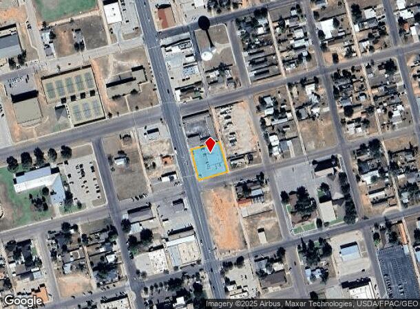
Property Record
400 N Main St, Andrews, TX 79714

NEARBY LISTINGS FOR SALE OR LEASE
Property Detail
400 N Main St
Other Market Areas
White-Southwest
Andrews, TX
WHITE-SOUTHWEST BLK 16 LOT 7, 8 & 9
000000090515
Andrews
Commercialnec
Texas
2025
7-9
2025
0.48 AC
950300
Panhandle Area
6,000 SF
DEMOGRAPHICS near 400 N Main St
1 Mile
3 Mile
5 Mile
2024 Total Population
9,989
16,080
16,997
2029 Population
9,910
15,899
16,793
Pop Growth 2024-2029
(0.79%)
(1.13%)
(1.20%)
Average Age
35
35
35
2024 Total Households
3,428
5,434
5,731
HH Growth 2024-2029
(0.85%)
(1.16%)
(1.26%)
Median Household Inc
$72,255
$77,228
$77,735
Avg Household Size
2.80
2.90
2.90
2024 Avg HH Vehicles
2.00
2.00
2.00
Median Home Value
$155,140
$170,910
$172,253
Median Year Built
1970
1976
1977
Nearby Places
Map Layers
Map Styles
 Street
 Aerial
- Restaurants
- Banks
- Shops
- Fitness
- Groceries
PUBLIC TRANSPORTATION
AIRPORT
Midland International Air And Space Port
DRIVE
WALK
Distance
Midland International Air And Space Port
53 min
43.8 mi
SALE & LEASE HISTORY
LISTING DATE
SALE/LEASE

May 10, 2017
For Sale
Feb 22, 2017
For Sale
Nearby Properties
Address
Land Use
TOTAL SIZE
Lot Size
Zoning
Address
Land Use
TOTAL SIZE
Lot Size
Zoning
220,937 SF
24.19 AC
Address
Land Use
TOTAL SIZE
Lot Size
Zoning
98,940 SF
10.08 AC
Address
Land Use
TOTAL SIZE
Lot Size
Zoning
104,148 SF
30.10 AC
Address
Land Use
TOTAL SIZE
Lot Size
Zoning
100,450 SF
10.51 AC
Address
Land Use
TOTAL SIZE
Lot Size
Zoning
164,084 SF
5.79 AC
Address
Land Use
TOTAL SIZE
Lot Size
Zoning
317,100 SF
16.23 AC
Address
Land Use
TOTAL SIZE
Lot Size
Zoning
98,940 SF
11.52 AC
Address
Land Use
TOTAL SIZE
Lot Size
Zoning
93,100 SF
26.24 AC
Address
Land Use
TOTAL SIZE
Lot Size
Zoning
113,638 SF
6.67 AC
Address
Land Use
TOTAL SIZE
Lot Size
Zoning
193,418 SF
292.77 AC
Address
Land Use
TOTAL SIZE
Lot Size
Zoning
46,495 SF
2.43 AC
Address
Land Use
TOTAL SIZE
Lot Size
Zoning
262,632 SF
11.52 AC
Address
Land Use
TOTAL SIZE
Lot Size
Zoning
38,397 SF
4.66 AC
Address
Land Use
TOTAL SIZE
Lot Size
Zoning
0.17 AC
Address
Land Use
TOTAL SIZE
Lot Size
Zoning
20,104 SF
4.48 AC
Address
Land Use
TOTAL SIZE
Lot Size
Zoning
38,721 SF
1.69 AC
Address
Land Use
TOTAL SIZE
Lot Size
Zoning
67,900 SF
0.97 AC
Address
Land Use
TOTAL SIZE
Lot Size
Zoning
67,275 SF
40.65 AC
Address
Land Use
TOTAL SIZE
Lot Size
Zoning
119,196 SF
8.57 AC
Address
Land Use
TOTAL SIZE
Lot Size
Zoning
48,650 SF
2.07 AC
Address
Land Use
TOTAL SIZE
Lot Size
Zoning
33,998 SF
4.48 AC
Address
Land Use
TOTAL SIZE
Lot Size
Zoning
28,020 SF
2.78 AC
Address
Land Use
TOTAL SIZE
Lot Size
Zoning
76,959 SF
2.62 AC
Address
Land Use
TOTAL SIZE
Lot Size
Zoning
43,530 SF
2 AC
Address
Land Use
TOTAL SIZE
Lot Size
Zoning
41,024 SF
3.09 AC
Address
Land Use
TOTAL SIZE
Lot Size
Zoning
22,583 SF
0.96 AC
Address
Land Use
TOTAL SIZE
Lot Size
Zoning
21,110 SF
10.03 AC
Address
Land Use
TOTAL SIZE
Lot Size
Zoning
30,194 SF
2.73 AC
Address
Land Use
TOTAL SIZE
Lot Size
Zoning
54,240 SF
9.51 AC
Address
Land Use
TOTAL SIZE
Lot Size
Zoning
21,594 SF
3 AC
The World's #1 Commercial Real Estate Marketplace
Connect with us
© 2026 CoStar Group
The information above has been obtained from sources believed reliable. While we do not doubt its accuracy we have not verified it and make no guarantee, warranty or representation about it. It is your responsibility to independently confirm its accuracy and completeness. Any projections, opinions, assumptions, or estimates used are for example only and do not represent the current or future performance of the property. The value of this transaction to you depends on tax and other factors which should be evaluated by your tax, financial, and legal advisors. You and your advisors should conduct a careful, independent investigation of the property to determine to your satisfaction the suitability of the property for your needs.