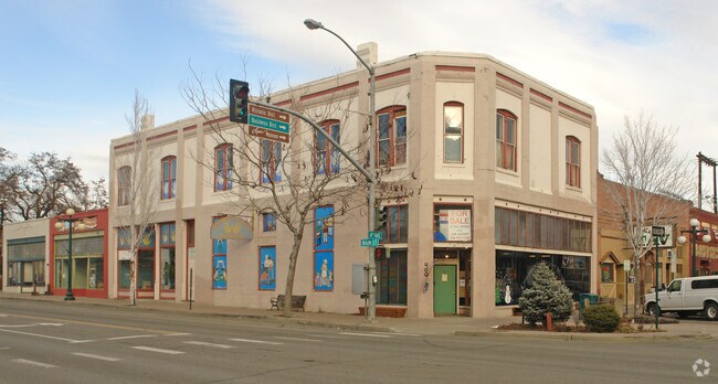
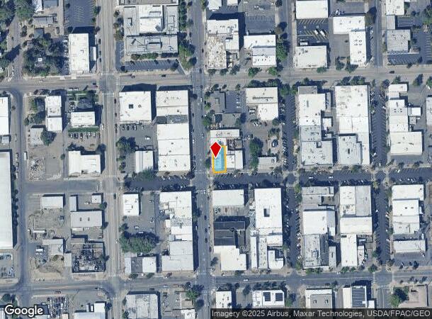
Property Record
400 N Main St, Ellensburg, WA 98926
NEARBY LISTINGS FOR SALE OR LEASE
Property Detail
400 N Main St
Ellensburg, WA
Original Add
306933
TWN EBURG; ORIGINAL ADD. TAX 2 OF LOTS 4 & 5 BLOCK 10
Storebuilding
Kittitas
X
Washington
53037C1281D
4,5
2024
0.08 AC
2025
Washington State Area
975600
Other Market Areas
6,856 SF
DEMOGRAPHICS near 400 N Main St
1 Mile
3 Mile
5 Mile
2024 Total Population
8,152
23,365
25,777
2029 Population
9,045
25,974
28,652
Pop Growth 2024-2029
+ 10.95%
+ 11.17%
+ 11.15%
Average Age
36
35
36
2024 Total Households
3,795
10,172
11,086
HH Growth 2024-2029
+ 11.30%
+ 11.73%
+ 11.69%
Median Household Inc
$52,269
$54,308
$57,543
Avg Household Size
2.10
2.20
2.30
2024 Avg HH Vehicles
2.00
2.00
2.00
Median Home Value
$302,487
$358,825
$370,583
Median Year Built
1964
1989
1989
Nearby Places
- Restaurants
- Banks
- Shops
- Fitness
- Groceries
PUBLIC TRANSPORTATION
AIRPORT
Yakima Air Trml/McAllister Field
DRIVE
WALK
Distance
Yakima Air Trml/McAllister Field
52 min
39.5 mi
Freight Ports
Port of Tacoma
DRIVE
WALK
Distance
Port of Tacoma
144 min
119.4 mi
SALE & LEASE HISTORY
LISTING DATE
SALE/LEASE

Feb 05, 2024
For Lease
Nearby Properties
Address
Land Use
TOTAL SIZE
Lot Size
Zoning
Address
Land Use
TOTAL SIZE
Lot Size
Zoning
331,903 SF
15.37 AC
Address
Land Use
TOTAL SIZE
Lot Size
Zoning
225,455 SF
12.45 AC
KC-A-3
Address
Land Use
TOTAL SIZE
Lot Size
Zoning
135,900 SF
10.06 AC
ECC-II
Address
Land Use
TOTAL SIZE
Lot Size
Zoning
212,223 SF
7.15 AC
EIH
Address
Land Use
TOTAL SIZE
Lot Size
Zoning
121,937 SF
7.88 AC
ERM
Address
Land Use
TOTAL SIZE
Lot Size
Zoning
89,748 SF
4.17 AC
ERM
Address
Land Use
TOTAL SIZE
Lot Size
Zoning
77,376 SF
7.97 AC
ERM
Address
Land Use
TOTAL SIZE
Lot Size
Zoning
51,171 SF
2.69 AC
Address
Land Use
TOTAL SIZE
Lot Size
Zoning
70,284 SF
9.96 AC
ERS
Address
Land Use
TOTAL SIZE
Lot Size
Zoning
68,344 SF
9.96 AC
ERS
Address
Land Use
TOTAL SIZE
Lot Size
Zoning
45,125 SF
1.83 AC
CT
Address
Land Use
TOTAL SIZE
Lot Size
Zoning
55,944 SF
0.50 AC
ECC
Address
Land Use
TOTAL SIZE
Lot Size
Zoning
64,266 SF
3.20 AC
ERM
Address
Land Use
TOTAL SIZE
Lot Size
Zoning
57,777 SF
3.45 AC
ERM
Address
Land Use
TOTAL SIZE
Lot Size
Zoning
63,006 SF
4.48 AC
ERM
Address
Land Use
TOTAL SIZE
Lot Size
Zoning
63,296 SF
2.36 AC
ERM
Address
Land Use
TOTAL SIZE
Lot Size
Zoning
59,108 SF
4.28 AC
ERM
Address
Land Use
TOTAL SIZE
Lot Size
Zoning
100 AC
ERS
Address
Land Use
TOTAL SIZE
Lot Size
Zoning
56,854 SF
4.55 AC
RH
Address
Land Use
TOTAL SIZE
Lot Size
Zoning
42,435 SF
1.47 AC
ECT
Address
Land Use
TOTAL SIZE
Lot Size
Zoning
37,243 SF
2.06 AC
ECT
Address
Land Use
TOTAL SIZE
Lot Size
Zoning
48,106 SF
3.17 AC
ECC
Address
Land Use
TOTAL SIZE
Lot Size
Zoning
56,715 SF
4.47 AC
RS
Address
Land Use
TOTAL SIZE
Lot Size
Zoning
58,800 SF
5.40 AC
Address
Land Use
TOTAL SIZE
Lot Size
Zoning
49,575 SF
4.37 AC
ECH
Address
Land Use
TOTAL SIZE
Lot Size
Zoning
39,808 SF
2.13 AC
ERM
Address
Land Use
TOTAL SIZE
Lot Size
Zoning
86,334 SF
5.43 AC
ERS
Address
Land Use
TOTAL SIZE
Lot Size
Zoning
33,373 SF
1.44 AC
ECH
Address
Land Use
TOTAL SIZE
Lot Size
Zoning
41,912 SF
2.26 AC
ERM
Address
Land Use
TOTAL SIZE
Lot Size
Zoning
43,078 SF
3.98 AC
ECN
The World's #1 Commercial Real Estate Marketplace
Connect with us
© 2025 CoStar Group
The information above has been obtained from sources believed reliable. While we do not doubt its accuracy we have not verified it and make no guarantee, warranty or representation about it. It is your responsibility to independently confirm its accuracy and completeness. Any projections, opinions, assumptions, or estimates used are for example only and do not represent the current or future performance of the property. The value of this transaction to you depends on tax and other factors which should be evaluated by your tax, financial, and legal advisors. You and your advisors should conduct a careful, independent investigation of the property to determine to your satisfaction the suitability of the property for your needs.