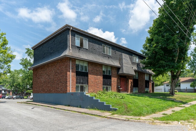
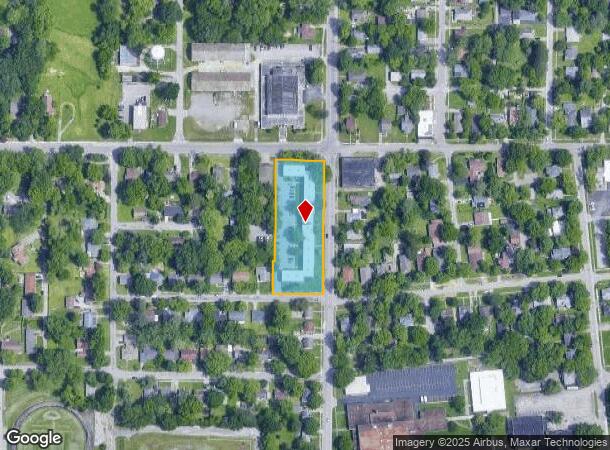
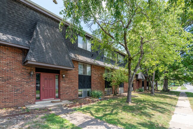
Property Record
400 N Oakland Ave, Carbondale, IL 62901
NEARBY LISTINGS FOR SALE OR LEASE
Property Detail
400 N Oakland Ave
Carbondale-Marion, IL
Ra Taylors Sub
15-20-228-030
LOT 1 - RA TAYLORS SUB & LOTS 1- 5 & S 80' OF LOTS 22 & 23 - RE-SURVEY OF TANNERS SUB & VACATED STREET & ALLEYS 2002/548 0650
Commercialcondominium
Jackson
X
Illinois
17199C0150D
1,22,23
2024
1.42 AC
2024
Marion/I-64 & South
010800
Other Market Areas
34,670 SF
DEMOGRAPHICS near 400 N Oakland Ave
1 Mile
3 Mile
5 Mile
2024 Total Population
9,483
24,461
30,520
2029 Population
9,515
24,392
30,390
Pop Growth 2024-2029
+ 0.34%
(0.28%)
(0.43%)
Average Age
35
35
36
2024 Total Households
4,459
10,991
13,642
HH Growth 2024-2029
+ 0.40%
(0.26%)
(0.44%)
Median Household Inc
$23,823
$28,021
$33,985
Avg Household Size
1.90
1.90
2.00
2024 Avg HH Vehicles
1.00
1.00
2.00
Median Home Value
$105,717
$136,503
$147,808
Median Year Built
1972
1978
1978
Nearby Places
Map Layers
Map Styles
 Street
 Aerial
- Restaurants
- Banks
- Shops
- Fitness
- Groceries
PUBLIC TRANSPORTATION
COMMUTER RAIL
DRIVE
WALK
Distance
4 min
1.2 mi
Nearby Properties
Address
Land Use
TOTAL SIZE
Lot Size
Zoning
Address
Land Use
TOTAL SIZE
Lot Size
Zoning
Address
Land Use
TOTAL SIZE
Lot Size
Zoning
32,610 SF
27.03 AC
Address
Land Use
TOTAL SIZE
Lot Size
Zoning
16.78 AC
Address
Land Use
TOTAL SIZE
Lot Size
Zoning
9,360 SF
1.56 AC
Address
Land Use
TOTAL SIZE
Lot Size
Zoning
17,700 SF
18.37 AC
Address
Land Use
TOTAL SIZE
Lot Size
Zoning
17.78 AC
Address
Land Use
TOTAL SIZE
Lot Size
Zoning
17,820 SF
9 AC
Address
Land Use
TOTAL SIZE
Lot Size
Zoning
6,750 SF
4.53 AC
Address
Land Use
TOTAL SIZE
Lot Size
Zoning
24,936 SF
3.76 AC
Address
Land Use
TOTAL SIZE
Lot Size
Zoning
119,175 SF
2.84 AC
Address
Land Use
TOTAL SIZE
Lot Size
Zoning
18.41 AC
Address
Land Use
TOTAL SIZE
Lot Size
Zoning
79,800 SF
2.50 AC
Address
Land Use
TOTAL SIZE
Lot Size
Zoning
Address
Land Use
TOTAL SIZE
Lot Size
Zoning
10.15 AC
Address
Land Use
TOTAL SIZE
Lot Size
Zoning
13,440 SF
0.83 AC
Address
Land Use
TOTAL SIZE
Lot Size
Zoning
1.21 AC
Address
Land Use
TOTAL SIZE
Lot Size
Zoning
88,081 SF
11.29 AC
Address
Land Use
TOTAL SIZE
Lot Size
Zoning
61,600 SF
6.99 AC
Address
Land Use
TOTAL SIZE
Lot Size
Zoning
3.88 AC
Address
Land Use
TOTAL SIZE
Lot Size
Zoning
3,072 SF
1.89 AC
Address
Land Use
TOTAL SIZE
Lot Size
Zoning
0.85 AC
Address
Land Use
TOTAL SIZE
Lot Size
Zoning
84,810 SF
7.50 AC
Address
Land Use
TOTAL SIZE
Lot Size
Zoning
1.64 AC
Address
Land Use
TOTAL SIZE
Lot Size
Zoning
2,800 SF
3.58 AC
Address
Land Use
TOTAL SIZE
Lot Size
Zoning
4,080 SF
0.85 AC
Address
Land Use
TOTAL SIZE
Lot Size
Zoning
5,532 SF
7.93 AC
Address
Land Use
TOTAL SIZE
Lot Size
Zoning
3,768 SF
2.01 AC
The World's #1 Commercial Real Estate Marketplace
Connect with us
© 2026 CoStar Group
The information above has been obtained from sources believed reliable. While we do not doubt its accuracy we have not verified it and make no guarantee, warranty or representation about it. It is your responsibility to independently confirm its accuracy and completeness. Any projections, opinions, assumptions, or estimates used are for example only and do not represent the current or future performance of the property. The value of this transaction to you depends on tax and other factors which should be evaluated by your tax, financial, and legal advisors. You and your advisors should conduct a careful, independent investigation of the property to determine to your satisfaction the suitability of the property for your needs.