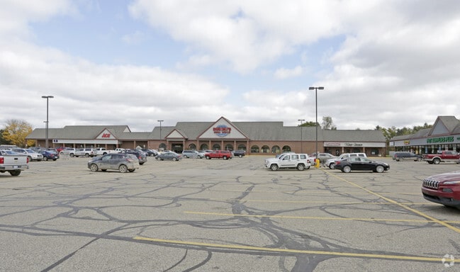
Property Record
400 N Ortonville Rd, Ortonville, MI 48462


NEARBY LISTINGS FOR SALE OR LEASE
Property Detail
400 N Ortonville Rd
02-12-276-003
T5N, R8E, SEC 12 PART OF NE 1/4 BEG AT PT DIST N 00-01-25 W 602.43 FT FROM E 1/4 COR, TH S 87-53-30 W 714.93 FT, TH N
Supermarket
Oakland
X
Michigan
26125C0180F
12.27 AC
2024
St Clair & Lapeer Counties
2025
Detroit
123100
Detroit-Warren-Dearborn, MI
73,164 SF
DEMOGRAPHICS near 400 N Ortonville Rd
1 Mile
3 Mile
5 Mile
2024 Total Population
1,704
8,387
18,783
2029 Population
1,682
8,315
18,589
Pop Growth 2024-2029
(1.29%)
(0.86%)
(1.03%)
Average Age
43
43
43
2024 Total Households
644
3,135
6,881
HH Growth 2024-2029
(1.24%)
(0.83%)
(1.02%)
Median Household Inc
$90,290
$96,678
$101,542
Avg Household Size
2.60
2.60
2.70
2024 Avg HH Vehicles
3.00
3.00
3.00
Median Home Value
$275,961
$298,562
$304,269
Median Year Built
1978
1979
1981
Nearby Places
Map Layers
Map Styles
 Street
 Aerial
- Restaurants
- Banks
- Shops
- Fitness
- Groceries
PUBLIC TRANSPORTATION
AIRPORT
Bishop International
DRIVE
WALK
Distance
Bishop International
47 min
29.0 mi
SALE & LEASE HISTORY
LISTING DATE
SALE/LEASE

Sep 25, 2022
For Sale
Sep 25, 2016
For Lease
Nov 05, 2018
For Lease
Nearby Properties
Address
Land Use
TOTAL SIZE
Lot Size
Zoning
Address
Land Use
TOTAL SIZE
Lot Size
Zoning
352.82 AC
REC
Address
Land Use
TOTAL SIZE
Lot Size
Zoning
53,794 SF
10.04 AC
Address
Land Use
TOTAL SIZE
Lot Size
Zoning
27.50 AC
REC
Address
Land Use
TOTAL SIZE
Lot Size
Zoning
22,981 SF
2.63 AC
AI
Address
Land Use
TOTAL SIZE
Lot Size
Zoning
14.24 AC
REC
Address
Land Use
TOTAL SIZE
Lot Size
Zoning
19,344 SF
2.63 AC
AI
Address
Land Use
TOTAL SIZE
Lot Size
Zoning
31,813 SF
68.53 AC
FI
Address
Land Use
TOTAL SIZE
Lot Size
Zoning
46,800 SF
2.71 AC
AI
Address
Land Use
TOTAL SIZE
Lot Size
Zoning
11,197 SF
2.35 AC
BI
Address
Land Use
TOTAL SIZE
Lot Size
Zoning
23,326 SF
4.35 AC
AI
Address
Land Use
TOTAL SIZE
Lot Size
Zoning
2,756 SF
140 AC
AR
Address
Land Use
TOTAL SIZE
Lot Size
Zoning
75,000 SF
20.27 AC
AI
Address
Land Use
TOTAL SIZE
Lot Size
Zoning
12,060 SF
2.30 AC
AI
Address
Land Use
TOTAL SIZE
Lot Size
Zoning
12,800 SF
14.24 AC
Address
Land Use
TOTAL SIZE
Lot Size
Zoning
17,363 SF
68.53 AC
FI
Address
Land Use
TOTAL SIZE
Lot Size
Zoning
17,031 SF
5.02 AC
AI
Address
Land Use
TOTAL SIZE
Lot Size
Zoning
1,368 SF
69.35 AC
AI
Address
Land Use
TOTAL SIZE
Lot Size
Zoning
3,291 SF
1.83 AC
AI
Address
Land Use
TOTAL SIZE
Lot Size
Zoning
4,120 SF
1.39 AC
AI
Address
Land Use
TOTAL SIZE
Lot Size
Zoning
7,800 SF
2.50 AC
AI
Address
Land Use
TOTAL SIZE
Lot Size
Zoning
31,220 SF
1.61 AC
AI
Address
Land Use
TOTAL SIZE
Lot Size
Zoning
5,137 SF
4.74 AC
Address
Land Use
TOTAL SIZE
Lot Size
Zoning
3,822 SF
Address
Land Use
TOTAL SIZE
Lot Size
Zoning
3,822 SF
0.76 AC
AI
Address
Land Use
TOTAL SIZE
Lot Size
Zoning
5,992 SF
1.47 AC
AI
Address
Land Use
TOTAL SIZE
Lot Size
Zoning
9,294 SF
1.93 AC
AI
Address
Land Use
TOTAL SIZE
Lot Size
Zoning
1,582 SF
15.24 AC
AI
Address
Land Use
TOTAL SIZE
Lot Size
Zoning
3,680 SF
1.52 AC
AI
Address
Land Use
TOTAL SIZE
Lot Size
Zoning
24,200 SF
2.49 AC
AI
The World's #1 Commercial Real Estate Marketplace
Connect with us
© 2026 CoStar Group
The information above has been obtained from sources believed reliable. While we do not doubt its accuracy we have not verified it and make no guarantee, warranty or representation about it. It is your responsibility to independently confirm its accuracy and completeness. Any projections, opinions, assumptions, or estimates used are for example only and do not represent the current or future performance of the property. The value of this transaction to you depends on tax and other factors which should be evaluated by your tax, financial, and legal advisors. You and your advisors should conduct a careful, independent investigation of the property to determine to your satisfaction the suitability of the property for your needs.