Property Record
400 N Park Ave, Breckenridge, CO 80424
NEARBY LISTINGS FOR SALE OR LEASE
-
-
View all Breckenridge listings for sale on LoopNet.com
Property Detail
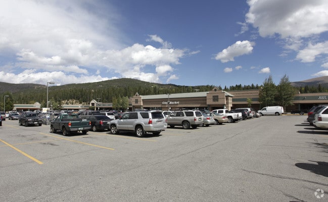
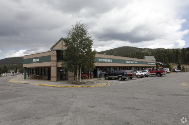
400 N Park Ave
Breckenridge, CO
Parkway Center Sub Amended
303969
LOT 3 BLOCK 2 PARKWAY CENTER SUB AMENDED # 1
Commercialacreage
Summit
X
Colorado
08117C0481F
3
2023
7.67 AC
2024
Colorado Ski Area
000406
Other Market Areas
79,391 SF
DEMOGRAPHICS near 400 N Park Ave
1 Mile
3 Mile
5 Mile
2024 Total Population
2,995
6,826
8,651
2029 Population
2,883
6,572
8,353
Pop Growth 2024-2029
(3.74%)
(3.72%)
(3.44%)
Average Age
39
39
40
2024 Total Households
1,346
2,960
3,743
HH Growth 2024-2029
(3.42%)
(3.41%)
(3.13%)
Median Household Inc
$93,273
$108,135
$110,981
Avg Household Size
2.20
2.30
2.30
2024 Avg HH Vehicles
2.00
2.00
2.00
Median Home Value
$660,919
$869,967
$840,049
Median Year Built
1986
1990
1991
Nearby Places
Map Layers
Map Styles
 Street
 Aerial
- Restaurants
- Banks
- Shops
- Fitness
- Groceries
Nearby Properties
Address
Land Use
TOTAL SIZE
Lot Size
Zoning
Address
Land Use
TOTAL SIZE
Lot Size
Zoning
169,088 SF
2.89 AC
LUD 22
Address
Land Use
TOTAL SIZE
Lot Size
Zoning
93,953 SF
2.64 AC
LUD 18-2
Address
Land Use
TOTAL SIZE
Lot Size
Zoning
109,254 SF
4.15 AC
LUD 23
Address
Land Use
TOTAL SIZE
Lot Size
Zoning
38,183 SF
3.86 AC
PUD
Address
Land Use
TOTAL SIZE
Lot Size
Zoning
47,633 SF
1.08 AC
LUD 19
Address
Land Use
TOTAL SIZE
Lot Size
Zoning
80,994 SF
0.75 AC
LUD 23
Address
Land Use
TOTAL SIZE
Lot Size
Zoning
4.61 AC
UNKNOWN
Address
Land Use
TOTAL SIZE
Lot Size
Zoning
34,443 SF
1.11 AC
LUD 18-2
Address
Land Use
TOTAL SIZE
Lot Size
Zoning
Address
Land Use
TOTAL SIZE
Lot Size
Zoning
13,017 SF
2.87 AC
LUD 19
Address
Land Use
TOTAL SIZE
Lot Size
Zoning
2.75 AC
LUD 9
Address
Land Use
TOTAL SIZE
Lot Size
Zoning
8,645 SF
2.34 AC
PUD
Address
Land Use
TOTAL SIZE
Lot Size
Zoning
18,397 SF
0.39 AC
LUD 19
Address
Land Use
TOTAL SIZE
Lot Size
Zoning
16,727 SF
6.98 AC
LUD 33
Address
Land Use
TOTAL SIZE
Lot Size
Zoning
51,089 SF
0.43 AC
LUD 21
Address
Land Use
TOTAL SIZE
Lot Size
Zoning
15,706 SF
0.70 AC
LUD 5
Address
Land Use
TOTAL SIZE
Lot Size
Zoning
8,655 SF
0.29 AC
LUD 19
Address
Land Use
TOTAL SIZE
Lot Size
Zoning
8,364 SF
0.78 AC
LUD 20
Address
Land Use
TOTAL SIZE
Lot Size
Zoning
7,579 SF
0.36 AC
LUD 19
Address
Land Use
TOTAL SIZE
Lot Size
Zoning
13,558 SF
0.40 AC
LUD 19
Address
Land Use
TOTAL SIZE
Lot Size
Zoning
27,325 SF
0.56 AC
LUD 18-2
Address
Land Use
TOTAL SIZE
Lot Size
Zoning
7,314 SF
0.25 AC
LUD 19
Address
Land Use
TOTAL SIZE
Lot Size
Zoning
8,255 SF
0.26 AC
LUD 19
Address
Land Use
TOTAL SIZE
Lot Size
Zoning
17,112 SF
0.37 AC
NR-2
Address
Land Use
TOTAL SIZE
Lot Size
Zoning
7,735 SF
0.22 AC
LUD 18-2
Address
Land Use
TOTAL SIZE
Lot Size
Zoning
28,061 SF
0.62 AC
LUD 23
Address
Land Use
TOTAL SIZE
Lot Size
Zoning
10,019 SF
0.13 AC
LUD 19
Address
Land Use
TOTAL SIZE
Lot Size
Zoning
7,041 SF
0.11 AC
LUD 19
The World's #1 Commercial Real Estate Marketplace
Connect with us
© 2026 CoStar Group
The information above has been obtained from sources believed reliable. While we do not doubt its accuracy we have not verified it and make no guarantee, warranty or representation about it. It is your responsibility to independently confirm its accuracy and completeness. Any projections, opinions, assumptions, or estimates used are for example only and do not represent the current or future performance of the property. The value of this transaction to you depends on tax and other factors which should be evaluated by your tax, financial, and legal advisors. You and your advisors should conduct a careful, independent investigation of the property to determine to your satisfaction the suitability of the property for your needs.