Property Record
400 N Robinson Dr, Waco, TX 76706
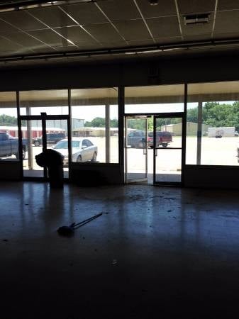

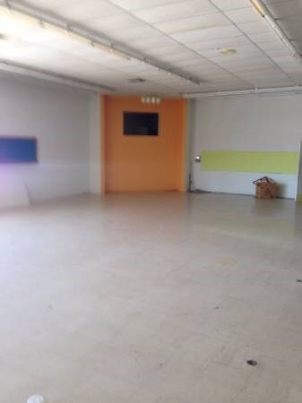
Property Detail
400 N Robinson Dr
Waco, TX
ROBINSON PLAZA LOT 1E BLOCK A ACRES .298
44-014000-000104-5
MCLENNAN
Commercialnec
Texas
C
1e
AE The base floodplain where base flood elevations are provided. AE Zones are now used on new format FIRMs instead of A1-A30 Zones.
0.30 AC
2024
Waco
2025
Other Market Areas
002100
NEARBY LISTINGS FOR SALE OR LEASE
DEMOGRAPHICS near 400 N Robinson Dr
1 mile
3 mile
5 mile
2025 Total Population
3,633
16,961
67,376
2030 Population
3,771
17,629
69,747
Pop Growth 2025-2030
+ 3.80%
+ 3.94%
+ 3.52%
Average Age
39
38
34
2025 Total Households
1,305
6,450
24,469
HH Growth 2025-2030
+ 3.83%
+ 3.98%
+ 3.68%
Median Household Inc
$79,916
$75,054
$53,897
Avg Household Size
2.80
2.60
2.50
2025 Avg HH Vehicles
2.00
2.00
2.00
Median Home Value
$314,451
$279,982
$231,108
Median Year Built
1991
1994
1987
Nearby Places
Map Layers
Map Styles
 Street
 Aerial
Layers
 Traffic
 Biking
Places
Listings with unknown addresses are not visible on the map
- Restaurants
- Banks
- Shops
- Fitness
- Groceries
PUBLIC TRANSPORTATION
AIRPORT
Waco Regional
Drive
Walk
Distance
Waco Regional
25 min
13.5 mi
Freight Ports
Port of Houston
Drive
Walk
Distance
Port of Houston
215 min
187.7 mi
SALE & LEASE HISTORY
LISTING DATE
SALE/LEASE

Mar 17, 2017
For Lease
Nearby Properties
Address
Land Use
TOTAL SIZE
Lot Size
Zoning
Address
Land Use
TOTAL SIZE
Lot Size
Zoning
347,331 SF
50.71 AC
C2
Address
Land Use
TOTAL SIZE
Lot Size
Zoning
78.95 AC
Address
Land Use
TOTAL SIZE
Lot Size
Zoning
285,829 SF
17.35 AC
Address
Land Use
TOTAL SIZE
Lot Size
Zoning
255,615 SF
18.58 AC
Address
Land Use
TOTAL SIZE
Lot Size
Zoning
263,557 SF
12 AC
Address
Land Use
TOTAL SIZE
Lot Size
Zoning
291,167 SF
13.61 AC
R
Address
Land Use
TOTAL SIZE
Lot Size
Zoning
674,900 SF
87.44 AC
M2
Address
Land Use
TOTAL SIZE
Lot Size
Zoning
106,633 SF
1.98 AC
C2
Address
Land Use
TOTAL SIZE
Lot Size
Zoning
34,723 SF
0.72 AC
Address
Land Use
TOTAL SIZE
Lot Size
Zoning
219,869 SF
11.13 AC
C2
Address
Land Use
TOTAL SIZE
Lot Size
Zoning
342,646 SF
63.20 AC
Address
Land Use
TOTAL SIZE
Lot Size
Zoning
70.76 AC
O2
Address
Land Use
TOTAL SIZE
Lot Size
Zoning
98,592 SF
15.16 AC
Address
Land Use
TOTAL SIZE
Lot Size
Zoning
131,844 SF
22.84 AC
Address
Land Use
TOTAL SIZE
Lot Size
Zoning
47,912 SF
7.20 AC
Address
Land Use
TOTAL SIZE
Lot Size
Zoning
59,334 SF
0.59 AC
C2
Address
Land Use
TOTAL SIZE
Lot Size
Zoning
74,786 SF
2.28 AC
C2
Address
Land Use
TOTAL SIZE
Lot Size
Zoning
12,658 SF
115.68 AC
M1
Address
Land Use
TOTAL SIZE
Lot Size
Zoning
400.45 AC
R
Address
Land Use
TOTAL SIZE
Lot Size
Zoning
76,872 SF
2.14 AC
C2
Address
Land Use
TOTAL SIZE
Lot Size
Zoning
100,482 SF
4.50 AC
O2
Address
Land Use
TOTAL SIZE
Lot Size
Zoning
6,486 SF
11.24 AC
Address
Land Use
TOTAL SIZE
Lot Size
Zoning
208,629 SF
49.69 AC
M2
Address
Land Use
TOTAL SIZE
Lot Size
Zoning
65,559 SF
2.93 AC
Address
Land Use
TOTAL SIZE
Lot Size
Zoning
71,951 SF
3.62 AC
C2
Address
Land Use
TOTAL SIZE
Lot Size
Zoning
77,188 SF
6.62 AC
Address
Land Use
TOTAL SIZE
Lot Size
Zoning
44,340 SF
5.28 AC
Address
Land Use
TOTAL SIZE
Lot Size
Zoning
71,900 SF
30 AC
R
Address
Land Use
TOTAL SIZE
Lot Size
Zoning
80,311 SF
3.09 AC
C2
Address
Land Use
TOTAL SIZE
Lot Size
Zoning
50,220 SF
5.03 AC
The World's #1 Commercial Real Estate Marketplace
Connect with us
© 2026 CoStar Group
The information above has been obtained from sources believed reliable. While we do not doubt its accuracy we have not verified it and make no guarantee, warranty or representation about it. It is your responsibility to independently confirm its accuracy and completeness. Any projections, opinions, assumptions, or estimates used are for example only and do not represent the current or future performance of the property. The value of this transaction to you depends on tax and other factors which should be evaluated by your tax, financial, and legal advisors. You and your advisors should conduct a careful, independent investigation of the property to determine to your satisfaction the suitability of the property for your needs.