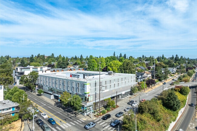
Property Record
400 Ne 45Th St, Seattle, WA 98105

Save to a Folder
{{folder.Name}}
{{folder.ListingIds.length}} Properties
{{folder.ListingIds.length}} Property
Create a New Folder
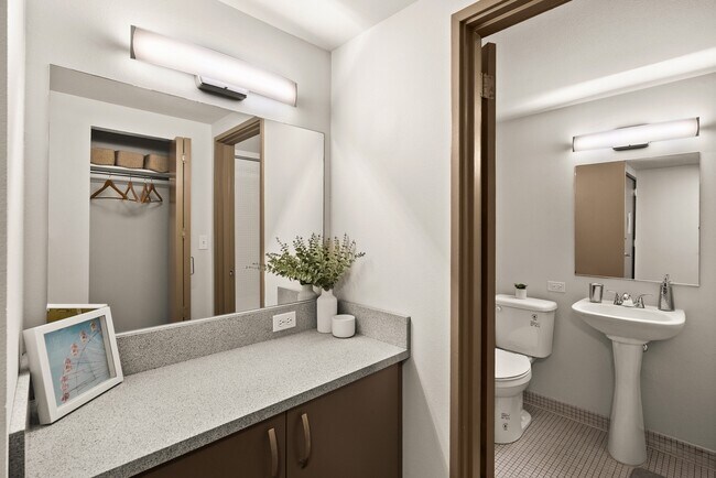
Property Detail
400 Ne 45Th St
189000-0005
DANIELS UNIVERSITY GROVE LOTS 1 THRU 5 & 24 THRU 26 BLK 1 TGW PORTION VACATED ALLEY IN SD BLK 1 LYING SOUTH OF PRODUCTION EAST OF SOUTH LINE OF NORTH 14 FT SD LOT 26 SD VACATION EXTENDING TO EAST MGN OF 4TH AVE NE LESS PORTION THOF CONVEYED TO CITY O
Apartment
King
NC3P-55 (M
Washington
B and X Area of moderate flood hazard, usually the area between the limits of the 100-year and 500-year floods.
2
2026
1.13 AC
2025
Wallingford
005201
Seattle/Puget Sound
50,232 SF
Seattle-Tacoma-Bellevue, WA
NEARBY LISTINGS FOR SALE OR LEASE
DEMOGRAPHICS near 400 Ne 45Th St
1 mile
3 mile
5 mile
2025 Total Population
56,720
308,191
582,065
2030 Population
59,107
322,986
611,192
Pop Growth 2025-2030
+ 4.21%
+ 4.80%
+ 5.00%
Average Age
31
37
38
2025 Total Households
21,927
145,978
286,910
HH Growth 2025-2030
+ 4.99%
+ 5.14%
+ 5.34%
Median Household Inc
$74,463
$128,761
$122,974
Avg Household Size
2.00
1.90
1.90
2025 Avg HH Vehicles
1.00
1.00
1.00
Median Home Value
$1,079,335
$1,043,268
$1,014,903
Median Year Built
1975
1975
1980
Nearby Places
Map Layers
Map Styles
 Street
 Aerial
Layers
 Traffic
 Biking
Places
Listings with unknown addresses are not visible on the map
- Restaurants
- Banks
- Shops
- Fitness
- Groceries
PUBLIC TRANSPORTATION
COMMUTER RAIL
King Street (Seattle) Station (Sounder South Line - Central Puget Sound Regional Transit Authority Rail (Link Light Rail/Sounder))
Drive
Walk
Distance
King Street (Seattle) Station (Sounder South Line - Central Puget Sound Regional Transit Authority Rail (Link Light Rail/Sounder))
9 min
4.8 mi
AIRPORT
Seattle-Tacoma International
Drive
Walk
Distance
Seattle-Tacoma International
27 min
18.0 mi
Seattle Paine Field International
Drive
Walk
Distance
Seattle Paine Field International
29 min
19.8 mi
Freight Ports
Port of Seattle
Drive
Walk
Distance
Port of Seattle
15 min
8.5 mi
SALE & LEASE HISTORY
LISTING DATE
SALE/LEASE

Sep 25, 2016
For Lease
May 08, 2017
For Lease
Nearby Properties
Address
Land Use
TOTAL SIZE
Lot Size
Zoning
Address
Land Use
TOTAL SIZE
Lot Size
Zoning
471.20 AC
MIO-37-LR1
Address
Land Use
TOTAL SIZE
Lot Size
Zoning
36,864 SF
8.02 AC
SM-UP 95 (
Address
Land Use
TOTAL SIZE
Lot Size
Zoning
716,128 SF
1.41 AC
SM-SLU 175
Address
Land Use
TOTAL SIZE
Lot Size
Zoning
7,549 SF
59.34 AC
MIO-105-LR
Address
Land Use
TOTAL SIZE
Lot Size
Zoning
90,184 SF
16.66 AC
C1-75 (M)
Address
Land Use
TOTAL SIZE
Lot Size
Zoning
612,844 SF
0.09 AC
SM-U/R 75-
Address
Land Use
TOTAL SIZE
Lot Size
Zoning
436,497 SF
1.64 AC
SM-SLU 175
Address
Land Use
TOTAL SIZE
Lot Size
Zoning
6,740 SF
46.38 AC
C2-55 (M)
Address
Land Use
TOTAL SIZE
Lot Size
Zoning
107.93 AC
NR3
Address
Land Use
TOTAL SIZE
Lot Size
Zoning
957,631 SF
1.85 AC
SM-SLU 175
Address
Land Use
TOTAL SIZE
Lot Size
Zoning
430,191 SF
8.85 AC
SM-UP 95 (
Address
Land Use
TOTAL SIZE
Lot Size
Zoning
443,118 SF
0.27 AC
SM-SLU 175
Address
Land Use
TOTAL SIZE
Lot Size
Zoning
42,500 SF
90.92 AC
NR3
Address
Land Use
TOTAL SIZE
Lot Size
Zoning
444,757 SF
0.30 AC
SM-SLU 145
Address
Land Use
TOTAL SIZE
Lot Size
Zoning
95,721 SF
0.62 AC
SM-SLU 175
Address
Land Use
TOTAL SIZE
Lot Size
Zoning
339,591 SF
0.64 AC
SM-SLU 175
Address
Land Use
TOTAL SIZE
Lot Size
Zoning
310,584 SF
1.18 AC
C1-55 (M)
Address
Land Use
TOTAL SIZE
Lot Size
Zoning
241,955 SF
12.81 AC
LR2 (M)
Address
Land Use
TOTAL SIZE
Lot Size
Zoning
368,064 SF
0.22 AC
SM-SLU 175
Address
Land Use
TOTAL SIZE
Lot Size
Zoning
13,055 SF
0.27 AC
SM-SLU 175
Address
Land Use
TOTAL SIZE
Lot Size
Zoning
418,999 SF
2.51 AC
SM-SLU 175
Address
Land Use
TOTAL SIZE
Lot Size
Zoning
282,162 SF
0.35 AC
SM-SLU 175
Address
Land Use
TOTAL SIZE
Lot Size
Zoning
261,364 SF
1.43 AC
SM-SLU 175
Address
Land Use
TOTAL SIZE
Lot Size
Zoning
24,020 SF
2.09 AC
SM-SLU 240
Address
Land Use
TOTAL SIZE
Lot Size
Zoning
211,066 SF
0.68 AC
SM-SLU 100
Address
Land Use
TOTAL SIZE
Lot Size
Zoning
20,289 SF
10.76 AC
MIO-50-LR3
Address
Land Use
TOTAL SIZE
Lot Size
Zoning
536,697 SF
0.97 AC
SM-SLU 175
Address
Land Use
TOTAL SIZE
Lot Size
Zoning
6.30 AC
SM-UP 95 (
Address
Land Use
TOTAL SIZE
Lot Size
Zoning
164,220 SF
0.73 AC
SM-SLU 175
Address
Land Use
TOTAL SIZE
Lot Size
Zoning
216,820 SF
1.22 AC
SM-SLU/R 6
The World's #1 Commercial Real Estate Marketplace
Connect with us
© 2026 CoStar Group
The information above has been obtained from sources believed reliable. While we do not doubt its accuracy we have not verified it and make no guarantee, warranty or representation about it. It is your responsibility to independently confirm its accuracy and completeness. Any projections, opinions, assumptions, or estimates used are for example only and do not represent the current or future performance of the property. The value of this transaction to you depends on tax and other factors which should be evaluated by your tax, financial, and legal advisors. You and your advisors should conduct a careful, independent investigation of the property to determine to your satisfaction the suitability of the property for your needs.