Property Record
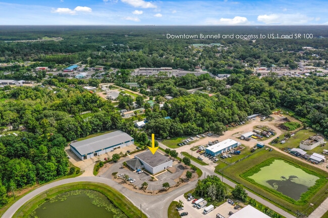
400 Ninth St, Bunnell, FL 32110


Property Detail
400 Ninth St
10-12-30-4990-00000-0100
PALM INDUSTRIAL PARK PHASE 1 & 2 MB 35 PG 34 LOT 10 (1.13 ACRES) OR 1339/1765 OR 1658/1045 OR 2443/112
Lightindustrial
Flagler
L-1
Florida
B and X Area of moderate flood hazard, usually the area between the limits of the 100-year and 500-year floods.
10
2024
1.13 AC
2025
Flagler County
060206
Other Market Areas
16,440 SF
Deltona-Daytona Beach-Ormond Beach, FL
NEARBY LISTINGS FOR SALE OR LEASE
DEMOGRAPHICS near 400 Ninth St
1 mile
3 mile
5 mile
2025 Total Population
2,161
13,149
43,287
2030 Population
2,457
15,044
49,650
Pop Growth 2025-2030
+ 13.70%
+ 14.41%
+ 14.70%
Average Age
43
45
45
2025 Total Households
840
5,263
17,215
HH Growth 2025-2030
+ 14.05%
+ 14.52%
+ 14.81%
Median Household Inc
$48,333
$60,033
$63,878
Avg Household Size
2.30
2.40
2.50
2025 Avg HH Vehicles
1.00
2.00
2.00
Median Home Value
$331,543
$384,090
$372,594
Median Year Built
1990
2004
2004
Nearby Places
Map Layers
Map Styles
 Street
 Aerial
Transit
 Traffic
 Biking
Places
Listings with unknown addresses are not visible on the map
- Restaurants
- Banks
- Shops
- Fitness
- Groceries
PUBLIC TRANSPORTATION
AIRPORT
Daytona Beach International
Drive
Walk
Distance
Daytona Beach International
39 min
27.1 mi
SALE & LEASE HISTORY
LISTING DATE
SALE/LEASE

Aug 16, 2022
For Sale
Nearby Properties
Address
Land Use
TOTAL SIZE
Lot Size
Zoning
Address
Land Use
TOTAL SIZE
Lot Size
Zoning
320,259 SF
83.19 AC
P
Address
Land Use
TOTAL SIZE
Lot Size
Zoning
236,316 SF
61.38 AC
PSP
Address
Land Use
TOTAL SIZE
Lot Size
Zoning
138,991 SF
18.66 AC
P
Address
Land Use
TOTAL SIZE
Lot Size
Zoning
121,173 SF
10 AC
AC
Address
Land Use
TOTAL SIZE
Lot Size
Zoning
64,208 SF
8.41 AC
PSP
Address
Land Use
TOTAL SIZE
Lot Size
Zoning
220,314 SF
17.41 AC
MPD
Address
Land Use
TOTAL SIZE
Lot Size
Zoning
89,590 SF
9.90 AC
B-1
Address
Land Use
TOTAL SIZE
Lot Size
Zoning
59,889 SF
0.75 AC
R-3A
Address
Land Use
TOTAL SIZE
Lot Size
Zoning
67,008 SF
5.34 AC
B-1
Address
Land Use
TOTAL SIZE
Lot Size
Zoning
32,679 SF
101.42 AC
L-1
Address
Land Use
TOTAL SIZE
Lot Size
Zoning
112,200 SF
49.38 AC
L-1
Address
Land Use
TOTAL SIZE
Lot Size
Zoning
163,592 SF
10 AC
IND-1
Address
Land Use
TOTAL SIZE
Lot Size
Zoning
41,710 SF
11.97 AC
L-1
Address
Land Use
TOTAL SIZE
Lot Size
Zoning
4,158 SF
3.73 AC
P
Address
Land Use
TOTAL SIZE
Lot Size
Zoning
43,990 SF
4.84 AC
P
Address
Land Use
TOTAL SIZE
Lot Size
Zoning
18,852 SF
3.23 AC
COM-2
Address
Land Use
TOTAL SIZE
Lot Size
Zoning
38,420 SF
4.83 AC
C-2(F)
Address
Land Use
TOTAL SIZE
Lot Size
Zoning
76,339 SF
4 AC
B-1
Address
Land Use
TOTAL SIZE
Lot Size
Zoning
66,485 SF
28.20 AC
Address
Land Use
TOTAL SIZE
Lot Size
Zoning
17,901 SF
1.72 AC
COM-2
Address
Land Use
TOTAL SIZE
Lot Size
Zoning
41,293 SF
4.92 AC
B-1
Address
Land Use
TOTAL SIZE
Lot Size
Zoning
65,787 SF
11.88 AC
B-1
Address
Land Use
TOTAL SIZE
Lot Size
Zoning
55,468 SF
7.25 AC
O-1
Address
Land Use
TOTAL SIZE
Lot Size
Zoning
49,785 SF
1.35 AC
B-2
Address
Land Use
TOTAL SIZE
Lot Size
Zoning
4,539 SF
1.16 AC
COM-2
Address
Land Use
TOTAL SIZE
Lot Size
Zoning
31,452 SF
7.83 AC
B-1
Address
Land Use
TOTAL SIZE
Lot Size
Zoning
29,371 SF
18.32 AC
B-1
Address
Land Use
TOTAL SIZE
Lot Size
Zoning
14,850 SF
2.09 AC
COM-2
Address
Land Use
TOTAL SIZE
Lot Size
Zoning
35.41 AC
MFR-1
Address
Land Use
TOTAL SIZE
Lot Size
Zoning
36,576 SF
18.38 AC
I-C
The World's #1 Commercial Real Estate Marketplace
Connect with us
© 2026 CoStar Group
The information above has been obtained from sources believed reliable. While we do not doubt its accuracy we have not verified it and make no guarantee, warranty or representation about it. It is your responsibility to independently confirm its accuracy and completeness. Any projections, opinions, assumptions, or estimates used are for example only and do not represent the current or future performance of the property. The value of this transaction to you depends on tax and other factors which should be evaluated by your tax, financial, and legal advisors. You and your advisors should conduct a careful, independent investigation of the property to determine to your satisfaction the suitability of the property for your needs.