Property Record
500 Nw Barry Rd, Kansas City, MO 64155


NEARBY LISTINGS FOR SALE OR LEASE
Property Detail
500 Nw Barry Rd
Kansas City, MO-KS
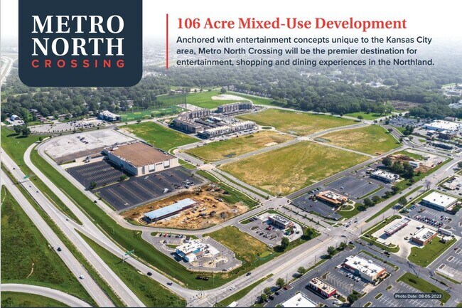
Metro North
13-216-00-04-004.00
METRO NORTH W PT TR 7A BEG SW COR TR 7A N277, E404, S287, NLY404 TO POB (I-145.1) A/K/A PT TR 7 BEG NW COR TR 7, E804.83, S103.43, W26.45, S22.19, W106.01, S163.7, WLY ALNG NL NW BARRY RD 672.98, N270 TO POB
Commercialnec
Clay
X
Missouri
29095C0127G
3.17 AC
2024
I-35 Corridor
2025
Kansas City
021213
DEMOGRAPHICS near 500 Nw Barry Rd
1 Mile
3 Mile
5 Mile
2024 Total Population
8,043
68,476
159,668
2029 Population
8,588
72,472
170,299
Pop Growth 2024-2029
+ 6.78%
+ 5.84%
+ 6.66%
Average Age
37
39
39
2024 Total Households
3,584
28,426
66,036
HH Growth 2024-2029
+ 6.75%
+ 5.87%
+ 6.74%
Median Household Inc
$64,478
$73,792
$75,646
Avg Household Size
2.20
2.30
2.30
2024 Avg HH Vehicles
2.00
2.00
2.00
Median Home Value
$177,543
$234,972
$246,955
Median Year Built
1983
1988
1988
Nearby Places
Map Layers
Map Styles
 Street
 Aerial
- Restaurants
- Banks
- Shops
- Fitness
- Groceries
PUBLIC TRANSPORTATION
AIRPORT
Kansas City International
DRIVE
WALK
Distance
Kansas City International
17 min
11.1 mi
Freight Ports
Tulsa Port Of Catoosa
DRIVE
WALK
Distance
Tulsa Port Of Catoosa
281 min
249.7 mi
SALE & LEASE HISTORY
LISTING DATE
SALE/LEASE

May 24, 2023
For Sale
Jun 02, 2023
For Lease
Nearby Properties
Address
Land Use
TOTAL SIZE
Lot Size
Zoning
Address
Land Use
TOTAL SIZE
Lot Size
Zoning
820 SF
5.19 AC
Address
Land Use
TOTAL SIZE
Lot Size
Zoning
1.90 AC
Address
Land Use
TOTAL SIZE
Lot Size
Zoning
11.07 AC
Address
Land Use
TOTAL SIZE
Lot Size
Zoning
Address
Land Use
TOTAL SIZE
Lot Size
Zoning
195.27 AC
Address
Land Use
TOTAL SIZE
Lot Size
Zoning
56.76 AC
Address
Land Use
TOTAL SIZE
Lot Size
Zoning
68.42 AC
Address
Land Use
TOTAL SIZE
Lot Size
Zoning
Address
Land Use
TOTAL SIZE
Lot Size
Zoning
50.67 AC
Address
Land Use
TOTAL SIZE
Lot Size
Zoning
20.34 AC
Address
Land Use
TOTAL SIZE
Lot Size
Zoning
417,393 SF
22.13 AC
Address
Land Use
TOTAL SIZE
Lot Size
Zoning
Address
Land Use
TOTAL SIZE
Lot Size
Zoning
349,586 SF
29.58 AC
Address
Land Use
TOTAL SIZE
Lot Size
Zoning
42.55 AC
Address
Land Use
TOTAL SIZE
Lot Size
Zoning
22.13 AC
Address
Land Use
TOTAL SIZE
Lot Size
Zoning
16.71 AC
Address
Land Use
TOTAL SIZE
Lot Size
Zoning
14.01 AC
Address
Land Use
TOTAL SIZE
Lot Size
Zoning
13.25 AC
Address
Land Use
TOTAL SIZE
Lot Size
Zoning
20.09 AC
Address
Land Use
TOTAL SIZE
Lot Size
Zoning
1,763 SF
10.06 AC
Address
Land Use
TOTAL SIZE
Lot Size
Zoning
4.84 AC
Address
Land Use
TOTAL SIZE
Lot Size
Zoning
Address
Land Use
TOTAL SIZE
Lot Size
Zoning
491,028 SF
16.35 AC
Address
Land Use
TOTAL SIZE
Lot Size
Zoning
5.69 AC
Address
Land Use
TOTAL SIZE
Lot Size
Zoning
235,392 SF
21.32 AC
Address
Land Use
TOTAL SIZE
Lot Size
Zoning
4.15 AC
Address
Land Use
TOTAL SIZE
Lot Size
Zoning
Address
Land Use
TOTAL SIZE
Lot Size
Zoning
255,096 SF
24.86 AC
Address
Land Use
TOTAL SIZE
Lot Size
Zoning
Address
Land Use
TOTAL SIZE
Lot Size
Zoning
13.01 AC
The World's #1 Commercial Real Estate Marketplace
Connect with us
© 2026 CoStar Group
The information above has been obtained from sources believed reliable. While we do not doubt its accuracy we have not verified it and make no guarantee, warranty or representation about it. It is your responsibility to independently confirm its accuracy and completeness. Any projections, opinions, assumptions, or estimates used are for example only and do not represent the current or future performance of the property. The value of this transaction to you depends on tax and other factors which should be evaluated by your tax, financial, and legal advisors. You and your advisors should conduct a careful, independent investigation of the property to determine to your satisfaction the suitability of the property for your needs.