Property Record
400 Rella Blvd, Suffern, NY 10901
Current Lease Availabilities
NEARBY LISTINGS FOR SALE OR LEASE
Property Detail
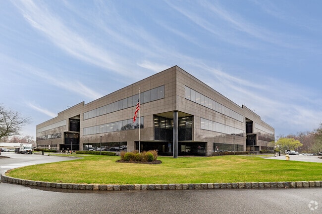
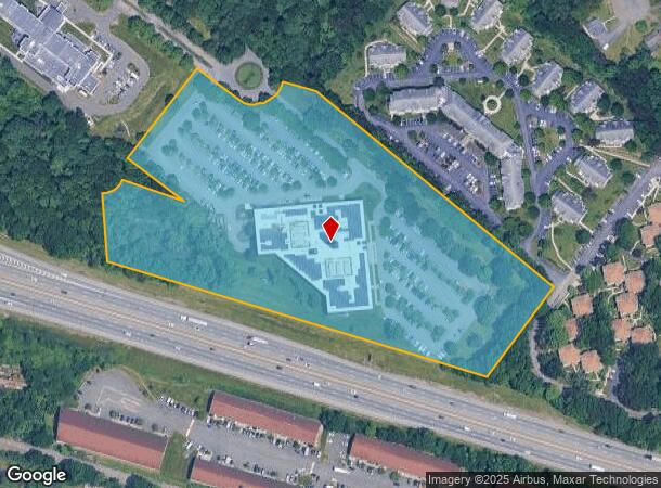
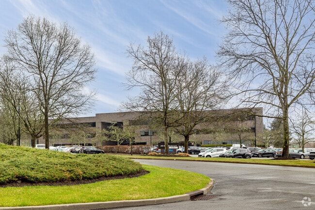
400 Rella Blvd
392617-055-008-0001-008-000-0000
Ramapo Corp Cntr Sub
Officebuilding
Rockland
X
New York
34003C0076H
8.0
2023
12.99 AC
2024
Ramapo
011602
Northern New Jersey
227,607 SF
New York-Jersey City-White Plains, NY-NJ
DEMOGRAPHICS near 400 Rella Blvd
1 Mile
3 Mile
5 Mile
2024 Total Population
7,193
104,970
209,137
2029 Population
7,234
104,585
208,495
Pop Growth 2024-2029
+ 0.57%
(0.37%)
(0.31%)
Average Age
40
32
35
2024 Total Households
2,233
28,455
59,774
HH Growth 2024-2029
+ 0.58%
(0.31%)
(0.24%)
Median Household Inc
$91,421
$84,539
$95,109
Avg Household Size
2.90
3.50
3.30
2024 Avg HH Vehicles
2.00
2.00
2.00
Median Home Value
$752,781
$629,388
$612,895
Median Year Built
1989
1975
1975
Nearby Places
- Restaurants
- Banks
- Shops
- Fitness
- Groceries
PUBLIC TRANSPORTATION
COMMUTER RAIL
Suffern (Bergen County/Port Jervis Line - NJ Transit Commuter Rail (NJ Transit), Main/Port Jervis Line - NJ Transit Commuter Rail (NJ Transit))
DRIVE
WALK
Distance
Suffern (Bergen County/Port Jervis Line - NJ Transit Commuter Rail (NJ Transit), Main/Port Jervis Line - NJ Transit Commuter Rail (NJ Transit))
8 min
3.2 mi
Mahwah (Bergen County/Port Jervis Line - NJ Transit Commuter Rail (NJ Transit), Main/Port Jervis Line - NJ Transit Commuter Rail (NJ Transit))
DRIVE
WALK
Distance
Mahwah (Bergen County/Port Jervis Line - NJ Transit Commuter Rail (NJ Transit), Main/Port Jervis Line - NJ Transit Commuter Rail (NJ Transit))
10 min
4.3 mi
AIRPORT
Westchester County
DRIVE
WALK
Distance
Westchester County
42 min
28.9 mi
LaGuardia
DRIVE
WALK
Distance
LaGuardia
54 min
36.6 mi
New York Stewart International
DRIVE
WALK
Distance
New York Stewart International
51 min
37.8 mi
Freight Ports
Maher Terminal
DRIVE
WALK
Distance
Maher Terminal
55 min
39.4 mi
Nearby Properties
Address
Land Use
TOTAL SIZE
Lot Size
Zoning
Address
Land Use
TOTAL SIZE
Lot Size
Zoning
1,056 SF
99.35 AC
OP200
Address
Land Use
TOTAL SIZE
Lot Size
Zoning
23.32 AC
Address
Land Use
TOTAL SIZE
Lot Size
Zoning
14.09 AC
B200
Address
Land Use
TOTAL SIZE
Lot Size
Zoning
Address
Land Use
TOTAL SIZE
Lot Size
Zoning
68.78 AC
OP20
Address
Land Use
TOTAL SIZE
Lot Size
Zoning
609,540 SF
174.09 AC
R-50
Address
Land Use
TOTAL SIZE
Lot Size
Zoning
19.60 AC
OP200
Address
Land Use
TOTAL SIZE
Lot Size
Zoning
539,911 SF
38.80 AC
05
Address
Land Use
TOTAL SIZE
Lot Size
Zoning
33.50 AC
GI80
Address
Land Use
TOTAL SIZE
Lot Size
Zoning
219,765 SF
29.88 AC
07
Address
Land Use
TOTAL SIZE
Lot Size
Zoning
5.30 AC
GA200
Address
Land Use
TOTAL SIZE
Lot Size
Zoning
0.44 AC
OP20
Address
Land Use
TOTAL SIZE
Lot Size
Zoning
5.31 AC
GA200
Address
Land Use
TOTAL SIZE
Lot Size
Zoning
3.65 AC
Address
Land Use
TOTAL SIZE
Lot Size
Zoning
4.71 AC
GA200
Address
Land Use
TOTAL SIZE
Lot Size
Zoning
58,473 SF
0.70 AC
HCS
Address
Land Use
TOTAL SIZE
Lot Size
Zoning
4.97 AC
GI80
Address
Land Use
TOTAL SIZE
Lot Size
Zoning
5.02 AC
B12
Address
Land Use
TOTAL SIZE
Lot Size
Zoning
76,083 SF
0.96 AC
05
Address
Land Use
TOTAL SIZE
Lot Size
Zoning
290,428 SF
35.56 AC
R35
Address
Land Use
TOTAL SIZE
Lot Size
Zoning
2.18 AC
B12
Address
Land Use
TOTAL SIZE
Lot Size
Zoning
859,490 SF
49.12 AC
PI
Address
Land Use
TOTAL SIZE
Lot Size
Zoning
5.56 AC
Address
Land Use
TOTAL SIZE
Lot Size
Zoning
70,527 SF
10.20 AC
RSH
Address
Land Use
TOTAL SIZE
Lot Size
Zoning
335,851 SF
9.96 AC
07
Address
Land Use
TOTAL SIZE
Lot Size
Zoning
2.50 AC
GA200
Address
Land Use
TOTAL SIZE
Lot Size
Zoning
275,724 SF
40 AC
R1
Address
Land Use
TOTAL SIZE
Lot Size
Zoning
18,820 SF
2.40 AC
LO
Address
Land Use
TOTAL SIZE
Lot Size
Zoning
38,056 SF
21.21 AC
R-15C
Address
Land Use
TOTAL SIZE
Lot Size
Zoning
8 AC
POS
The World's #1 Commercial Real Estate Marketplace
Connect with us
© 2025 CoStar Group
The information above has been obtained from sources believed reliable. While we do not doubt its accuracy we have not verified it and make no guarantee, warranty or representation about it. It is your responsibility to independently confirm its accuracy and completeness. Any projections, opinions, assumptions, or estimates used are for example only and do not represent the current or future performance of the property. The value of this transaction to you depends on tax and other factors which should be evaluated by your tax, financial, and legal advisors. You and your advisors should conduct a careful, independent investigation of the property to determine to your satisfaction the suitability of the property for your needs.