Property Record
400 Ridgefield Ct, Asheville, NC 28806


NEARBY LISTINGS FOR SALE OR LEASE
Property Detail
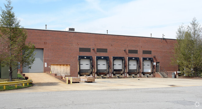
400 Ridgefield Ct
9636-03-1970-00000
LOT: 1 PLAT: 0057-0190
Hospitalpublic
Buncombe
X
North Carolina
3700963600J
1
2024
23.44 AC
2025
Buncombe County
002306
Asheville
219,474 SF
Asheville, NC
DEMOGRAPHICS near 400 Ridgefield Ct
1 Mile
3 Mile
5 Mile
2024 Total Population
1,648
9,172
73,348
2029 Population
1,678
9,477
76,151
Pop Growth 2024-2029
+ 1.82%
+ 3.33%
+ 3.82%
Average Age
41
43
42
2024 Total Households
737
4,064
32,339
HH Growth 2024-2029
+ 1.22%
+ 2.73%
+ 3.26%
Median Household Inc
$67,882
$76,001
$69,461
Avg Household Size
2.20
2.20
2.20
2024 Avg HH Vehicles
2.00
2.00
2.00
Median Home Value
$294,530
$377,696
$369,014
Median Year Built
1987
1995
1989
Nearby Places
Map Layers
Map Styles
 Street
 Aerial
- Restaurants
- Banks
- Shops
- Fitness
- Groceries
PUBLIC TRANSPORTATION
AIRPORT
Asheville Regional
DRIVE
WALK
Distance
Asheville Regional
17 min
9.5 mi
Nearby Properties
Address
Land Use
TOTAL SIZE
Lot Size
Zoning
Address
Land Use
TOTAL SIZE
Lot Size
Zoning
1,204,424 SF
100 AC
EMP
Address
Land Use
TOTAL SIZE
Lot Size
Zoning
13,459 SF
3.07 AC
CR
Address
Land Use
TOTAL SIZE
Lot Size
Zoning
166,747 SF
2,480.61 AC
CR
Address
Land Use
TOTAL SIZE
Lot Size
Zoning
398,787 SF
45.56 AC
RB
Address
Land Use
TOTAL SIZE
Lot Size
Zoning
118,357 SF
24.67 AC
EMP
Address
Land Use
TOTAL SIZE
Lot Size
Zoning
100,712 SF
24.65 AC
CS
Address
Land Use
TOTAL SIZE
Lot Size
Zoning
98,232 SF
23.24 AC
EMP
Address
Land Use
TOTAL SIZE
Lot Size
Zoning
46,724 SF
2,480.61 AC
CR
Address
Land Use
TOTAL SIZE
Lot Size
Zoning
85,997 SF
29.25 AC
R-3
Address
Land Use
TOTAL SIZE
Lot Size
Zoning
50,672 SF
21.21 AC
R-2
Address
Land Use
TOTAL SIZE
Lot Size
Zoning
81,621 SF
19.62 AC
PS
Address
Land Use
TOTAL SIZE
Lot Size
Zoning
3,161 SF
1,161.20 AC
CR
Address
Land Use
TOTAL SIZE
Lot Size
Zoning
62,425 SF
10.38 AC
CS
Address
Land Use
TOTAL SIZE
Lot Size
Zoning
111,000 SF
21.97 AC
PS
Address
Land Use
TOTAL SIZE
Lot Size
Zoning
2,171 SF
36.73 AC
PS
Address
Land Use
TOTAL SIZE
Lot Size
Zoning
345.09 AC
EMP
Address
Land Use
TOTAL SIZE
Lot Size
Zoning
52,316 SF
13.68 AC
INST
Address
Land Use
TOTAL SIZE
Lot Size
Zoning
35,952 SF
9.30 AC
RM16
Address
Land Use
TOTAL SIZE
Lot Size
Zoning
13,347 SF
2.50 AC
RB
Address
Land Use
TOTAL SIZE
Lot Size
Zoning
50,389 SF
29.67 AC
CS
Address
Land Use
TOTAL SIZE
Lot Size
Zoning
94,254 SF
43.17 AC
PS
Address
Land Use
TOTAL SIZE
Lot Size
Zoning
106,000 SF
10.91 AC
HB
Address
Land Use
TOTAL SIZE
Lot Size
Zoning
13,232 SF
2.05 AC
CBII
Address
Land Use
TOTAL SIZE
Lot Size
Zoning
117,560 SF
2,480.97 AC
CR
Address
Land Use
TOTAL SIZE
Lot Size
Zoning
23,727 SF
1.68 AC
RB
Address
Land Use
TOTAL SIZE
Lot Size
Zoning
17,090 SF
2.97 AC
HB
Address
Land Use
TOTAL SIZE
Lot Size
Zoning
76,453 SF
8.07 AC
RB
Address
Land Use
TOTAL SIZE
Lot Size
Zoning
3,006 SF
119 AC
EMP
Address
Land Use
TOTAL SIZE
Lot Size
Zoning
12,771 SF
3.15 AC
RB
The World's #1 Commercial Real Estate Marketplace
Connect with us
© 2025 CoStar Group
The information above has been obtained from sources believed reliable. While we do not doubt its accuracy we have not verified it and make no guarantee, warranty or representation about it. It is your responsibility to independently confirm its accuracy and completeness. Any projections, opinions, assumptions, or estimates used are for example only and do not represent the current or future performance of the property. The value of this transaction to you depends on tax and other factors which should be evaluated by your tax, financial, and legal advisors. You and your advisors should conduct a careful, independent investigation of the property to determine to your satisfaction the suitability of the property for your needs.