Property Record
400 Royer Rd, Westminster, MD 21157
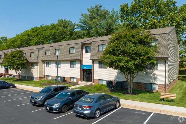

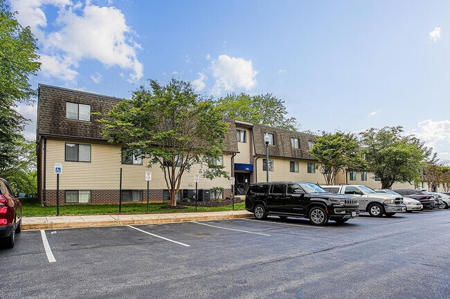
Property Detail
400 Royer Rd
07-080573
PAR 2 - 9.83 ACS 400 ROYER RD 24-104 APTS AT THE GREENS
Apartment
CARROLL
R-100
Maryland
AE The base floodplain where base flood elevations are provided. AE Zones are now used on new format FIRMs instead of A1-A30 Zones.
2
2025
9.83 AC
2025
Outlying Carroll County
507802
Baltimore
34,200 SF
Baltimore-Columbia-Towson, MD
NEARBY LISTINGS FOR SALE OR LEASE
DEMOGRAPHICS near 400 Royer Rd
1 mile
3 mile
5 mile
2025 Total Population
7,742
30,789
45,796
2030 Population
7,901
31,464
46,880
Pop Growth 2025-2030
+ 2.05%
+ 2.19%
+ 2.37%
Average Age
37
40
41
2025 Total Households
2,609
11,552
17,138
HH Growth 2025-2030
+ 2.07%
+ 2.28%
+ 2.44%
Median Household Inc
$113,318
$92,904
$102,517
Avg Household Size
2.80
2.50
2.50
2025 Avg HH Vehicles
2.00
2.00
2.00
Median Home Value
$357,210
$362,689
$383,062
Median Year Built
1990
1980
1980
Nearby Places
Map Layers
Map Styles
 Street
 Aerial
Transit
 Traffic
 Biking
Places
Listings with unknown addresses are not visible on the map
- Restaurants
- Banks
- Shops
- Fitness
- Groceries
PUBLIC TRANSPORTATION
AIRPORT
Baltimore/Washington International Thurgood Marshall
Drive
Walk
Distance
Baltimore/Washington International Thurgood Marshall
57 min
38.2 mi
Freight Ports
Port of Baltimore
Drive
Walk
Distance
Port of Baltimore
57 min
38.5 mi
Nearby Properties
Address
Land Use
TOTAL SIZE
Lot Size
Zoning
Address
Land Use
TOTAL SIZE
Lot Size
Zoning
2,739 SF
40.49 AC
R-200
Address
Land Use
TOTAL SIZE
Lot Size
Zoning
28,080 SF
88.80 AC
R-100
Address
Land Use
TOTAL SIZE
Lot Size
Zoning
204,161 SF
56.03 AC
R-100
Address
Land Use
TOTAL SIZE
Lot Size
Zoning
190,395 SF
45.81 AC
I-2
Address
Land Use
TOTAL SIZE
Lot Size
Zoning
84,991 SF
24.06 AC
CONSE
Address
Land Use
TOTAL SIZE
Lot Size
Zoning
60,930 SF
18.85 AC
PLANN
Address
Land Use
TOTAL SIZE
Lot Size
Zoning
73,746 SF
27.73 AC
R-200
Address
Land Use
TOTAL SIZE
Lot Size
Zoning
4,520 SF
10.84 AC
BUSIN
Address
Land Use
TOTAL SIZE
Lot Size
Zoning
42,834 SF
12.05 AC
BUSIN
Address
Land Use
TOTAL SIZE
Lot Size
Zoning
8,372 SF
29.54 AC
R-750
Address
Land Use
TOTAL SIZE
Lot Size
Zoning
235,200 SF
24.39 AC
PLANN
Address
Land Use
TOTAL SIZE
Lot Size
Zoning
27,040 SF
9.39 AC
BUSIN
Address
Land Use
TOTAL SIZE
Lot Size
Zoning
136,562 SF
25.60 AC
CONSE
Address
Land Use
TOTAL SIZE
Lot Size
Zoning
94,474 SF
5.57 AC
R-200
Address
Land Use
TOTAL SIZE
Lot Size
Zoning
17,245 SF
9.67 AC
BUSIN
Address
Land Use
TOTAL SIZE
Lot Size
Zoning
66,880 SF
1.24 AC
Address
Land Use
TOTAL SIZE
Lot Size
Zoning
125,518 SF
4.76 AC
R-200
Address
Land Use
TOTAL SIZE
Lot Size
Zoning
53,134 SF
2.84 AC
INDUS
Address
Land Use
TOTAL SIZE
Lot Size
Zoning
4,938 SF
7.76 AC
BUSIN
Address
Land Use
TOTAL SIZE
Lot Size
Zoning
64,886 SF
52.54 AC
AGRIC
Address
Land Use
TOTAL SIZE
Lot Size
Zoning
78,120 SF
1.31 AC
R-750
Address
Land Use
TOTAL SIZE
Lot Size
Zoning
74,145 SF
8.39 AC
BUSIN
Address
Land Use
TOTAL SIZE
Lot Size
Zoning
1,288 SF
6.44 AC
C-3
Address
Land Use
TOTAL SIZE
Lot Size
Zoning
62,562 SF
1.52 AC
BUSIN
Address
Land Use
TOTAL SIZE
Lot Size
Zoning
40,300 SF
17.81 AC
AGRIC
Address
Land Use
TOTAL SIZE
Lot Size
Zoning
31,900 SF
17.67 AC
I-2
Address
Land Use
TOTAL SIZE
Lot Size
Zoning
41,911 SF
1.57 AC
BUSIN
Address
Land Use
TOTAL SIZE
Lot Size
Zoning
44,800 SF
2.43 AC
NC
Address
Land Use
TOTAL SIZE
Lot Size
Zoning
7,700 SF
4.57 AC
C-2
The World's #1 Commercial Real Estate Marketplace
Connect with us
© 2026 CoStar Group
The information above has been obtained from sources believed reliable. While we do not doubt its accuracy we have not verified it and make no guarantee, warranty or representation about it. It is your responsibility to independently confirm its accuracy and completeness. Any projections, opinions, assumptions, or estimates used are for example only and do not represent the current or future performance of the property. The value of this transaction to you depends on tax and other factors which should be evaluated by your tax, financial, and legal advisors. You and your advisors should conduct a careful, independent investigation of the property to determine to your satisfaction the suitability of the property for your needs.