Property Record
400 S 10Th St, Atchison, KS 66002
NEARBY LISTINGS FOR SALE OR LEASE
-
-
View all Atchison listings for sale on LoopNet.com
Property Detail
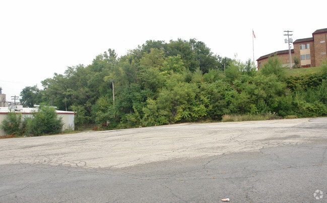
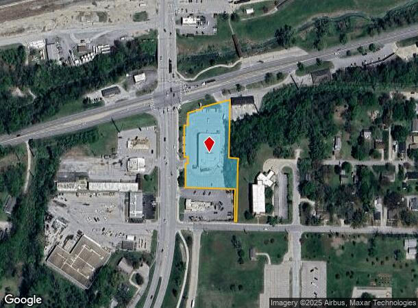
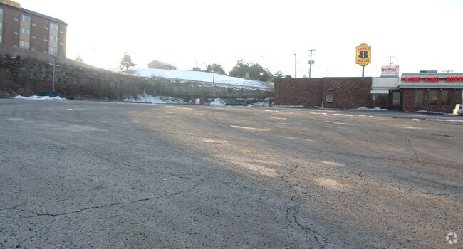
400 S 10Th St
Atchison, KS
Lc Challiss Addition
0030910101029004000
LC CHALLISS ADDITION, S01, T06, R20E, BLOCK 25, ACRES 1.75, BLOCK 25 & 26 LESS HWY ROW. BLOCK 25: PT LTS 8-12, PT LT 15, LTS
Storebuilding
Atchison
AE
Kansas
20005C0217C
7-12
2024
1.75 AC
2025
Atchison
081800
Kansas City
13,016 SF
DEMOGRAPHICS near 400 S 10Th St
1 mile
3 mile
5 mile
2024 Total Population
6,481
11,861
12,757
2029 Population
6,434
11,714
12,585
Pop Growth 2024-2029
(0.73%)
(1.24%)
(1.35%)
Average Age
40
38
38
2024 Total Households
2,653
4,288
4,642
HH Growth 2024-2029
(0.79%)
(1.28%)
(1.42%)
Median Household Inc
$43,518
$49,708
$51,131
Avg Household Size
2.20
2.30
2.30
2024 Avg HH Vehicles
2.00
2.00
2.00
Median Home Value
$97,739
$120,243
$123,222
Median Year Built
1948
1960
1961
Nearby Places
Map Layers
Map Styles
 Street
 Aerial
Transit
 Traffic
 Biking
Places
Listings with unknown addresses are not visible on the map
- Restaurants
- Banks
- Shops
- Fitness
- Groceries
PUBLIC TRANSPORTATION
AIRPORT
Kansas City International
Drive
Walk
Distance
Kansas City International
47 min
32.9 mi
Nearby Properties
Address
Land Use
TOTAL SIZE
Lot Size
Zoning
Address
Land Use
TOTAL SIZE
Lot Size
Zoning
94,286 SF
26.64 AC
Address
Land Use
TOTAL SIZE
Lot Size
Zoning
88,048 SF
0.97 AC
Address
Land Use
TOTAL SIZE
Lot Size
Zoning
53,291 SF
2.62 AC
Address
Land Use
TOTAL SIZE
Lot Size
Zoning
57,069 SF
4.51 AC
Address
Land Use
TOTAL SIZE
Lot Size
Zoning
22,642 SF
4.44 AC
Address
Land Use
TOTAL SIZE
Lot Size
Zoning
33,306 SF
24.51 AC
Address
Land Use
TOTAL SIZE
Lot Size
Zoning
98,471 SF
30 AC
Address
Land Use
TOTAL SIZE
Lot Size
Zoning
115,556 SF
24.60 AC
Address
Land Use
TOTAL SIZE
Lot Size
Zoning
198,647 SF
51.95 AC
Address
Land Use
TOTAL SIZE
Lot Size
Zoning
28,908 SF
2.61 AC
Address
Land Use
TOTAL SIZE
Lot Size
Zoning
93,616 SF
0.81 AC
Address
Land Use
TOTAL SIZE
Lot Size
Zoning
19,807 SF
2.50 AC
Address
Land Use
TOTAL SIZE
Lot Size
Zoning
129,107 SF
19 AC
Address
Land Use
TOTAL SIZE
Lot Size
Zoning
113,542 SF
3.94 AC
Address
Land Use
TOTAL SIZE
Lot Size
Zoning
30,016 SF
1.08 AC
Address
Land Use
TOTAL SIZE
Lot Size
Zoning
44,618 SF
1.08 AC
Address
Land Use
TOTAL SIZE
Lot Size
Zoning
36,531 SF
4 AC
Address
Land Use
TOTAL SIZE
Lot Size
Zoning
5,571 SF
1.49 AC
Address
Land Use
TOTAL SIZE
Lot Size
Zoning
38,102 SF
12.60 AC
Address
Land Use
TOTAL SIZE
Lot Size
Zoning
16,426 SF
14.90 AC
Address
Land Use
TOTAL SIZE
Lot Size
Zoning
51,848 SF
19.54 AC
Address
Land Use
TOTAL SIZE
Lot Size
Zoning
22,507 SF
74 AC
Address
Land Use
TOTAL SIZE
Lot Size
Zoning
37,620 SF
0.61 AC
Address
Land Use
TOTAL SIZE
Lot Size
Zoning
1,887 SF
20.08 AC
Address
Land Use
TOTAL SIZE
Lot Size
Zoning
581.90 AC
Address
Land Use
TOTAL SIZE
Lot Size
Zoning
38,430 SF
0.97 AC
Address
Land Use
TOTAL SIZE
Lot Size
Zoning
1,114 SF
2.31 AC
Address
Land Use
TOTAL SIZE
Lot Size
Zoning
18,240 SF
1.12 AC
Address
Land Use
TOTAL SIZE
Lot Size
Zoning
156,789 SF
17.88 AC
Address
Land Use
TOTAL SIZE
Lot Size
Zoning
28,411 SF
2.12 AC
The World's #1 Commercial Real Estate Marketplace
Connect with us
© 2026 CoStar Group
The information above has been obtained from sources believed reliable. While we do not doubt its accuracy we have not verified it and make no guarantee, warranty or representation about it. It is your responsibility to independently confirm its accuracy and completeness. Any projections, opinions, assumptions, or estimates used are for example only and do not represent the current or future performance of the property. The value of this transaction to you depends on tax and other factors which should be evaluated by your tax, financial, and legal advisors. You and your advisors should conduct a careful, independent investigation of the property to determine to your satisfaction the suitability of the property for your needs.