Property Record
400 Shire Way, Lexington, MA 02421
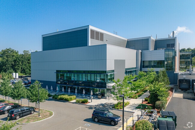


Property Detail
400 Shire Way
LEXI-000018-000000-000015G
MIDDLESEX
Industrialgeneral
Massachusetts
CD
15g
B and X Area of moderate flood hazard, usually the area between the limits of the 100-year and 500-year floods.
17.46 AC
2025
Lexington/Arlington
2025
Boston
358300
Boston-Cambridge-Newton, MA-NH
190,308 SF
NEARBY LISTINGS FOR SALE OR LEASE
DEMOGRAPHICS near 400 Shire Way
1 mile
3 mile
5 mile
2025 Total Population
4,804
53,258
201,894
2030 Population
5,025
55,658
209,693
Pop Growth 2025-2030
+ 4.60%
+ 4.51%
+ 3.86%
Average Age
43
43
42
2025 Total Households
1,617
19,536
77,092
HH Growth 2025-2030
+ 4.76%
+ 4.56%
+ 3.98%
Median Household Inc
$214,368
$174,209
$146,880
Avg Household Size
2.90
2.60
2.50
2025 Avg HH Vehicles
2.00
2.00
2.00
Median Home Value
$1,061,002
$984,430
$916,035
Median Year Built
1968
1968
1958
Nearby Places
Map Layers
Map Styles
 Street
 Aerial
Layers
 Traffic
 Biking
Places
Listings with unknown addresses are not visible on the map
- Restaurants
- Banks
- Shops
- Fitness
- Groceries
Nearby Properties
Address
Land Use
TOTAL SIZE
Lot Size
Zoning
Address
Land Use
TOTAL SIZE
Lot Size
Zoning
776,099 SF
35.70 AC
Address
Land Use
TOTAL SIZE
Lot Size
Zoning
561,437 SF
33.53 AC
Address
Land Use
TOTAL SIZE
Lot Size
Zoning
472,329 SF
22.11 AC
CD
Address
Land Use
TOTAL SIZE
Lot Size
Zoning
198,051 SF
11.56 AC
CR
Address
Land Use
TOTAL SIZE
Lot Size
Zoning
336,306 SF
7.54 AC
Address
Land Use
TOTAL SIZE
Lot Size
Zoning
25,000 SF
25.73 AC
RD
Address
Land Use
TOTAL SIZE
Lot Size
Zoning
79.60 AC
SD
Address
Land Use
TOTAL SIZE
Lot Size
Zoning
293,084 SF
5.01 AC
1
Address
Land Use
TOTAL SIZE
Lot Size
Zoning
238,065 SF
1.79 AC
Address
Land Use
TOTAL SIZE
Lot Size
Zoning
272,445 SF
6.40 AC
Address
Land Use
TOTAL SIZE
Lot Size
Zoning
282,014 SF
15.57 AC
Address
Land Use
TOTAL SIZE
Lot Size
Zoning
269,692 SF
15.37 AC
Address
Land Use
TOTAL SIZE
Lot Size
Zoning
344,469 SF
54.49 AC
Address
Land Use
TOTAL SIZE
Lot Size
Zoning
442,743 SF
27.11 AC
Address
Land Use
TOTAL SIZE
Lot Size
Zoning
164,072 SF
43.80 AC
Address
Land Use
TOTAL SIZE
Lot Size
Zoning
212,684 SF
54.49 AC
Address
Land Use
TOTAL SIZE
Lot Size
Zoning
30.69 AC
Address
Land Use
TOTAL SIZE
Lot Size
Zoning
342,677 SF
56.46 AC
ND
Address
Land Use
TOTAL SIZE
Lot Size
Zoning
21.99 AC
Address
Land Use
TOTAL SIZE
Lot Size
Zoning
11.25 AC
PD-6
Address
Land Use
TOTAL SIZE
Lot Size
Zoning
124,950 SF
1.69 AC
Address
Land Use
TOTAL SIZE
Lot Size
Zoning
224,892 SF
20.52 AC
Address
Land Use
TOTAL SIZE
Lot Size
Zoning
286,462 SF
15.94 AC
Address
Land Use
TOTAL SIZE
Lot Size
Zoning
210,423 SF
26.39 AC
Address
Land Use
TOTAL SIZE
Lot Size
Zoning
197,400 SF
4.29 AC
Address
Land Use
TOTAL SIZE
Lot Size
Zoning
288,975 SF
5 AC
Address
Land Use
TOTAL SIZE
Lot Size
Zoning
618.53 AC
Address
Land Use
TOTAL SIZE
Lot Size
Zoning
278,150 SF
16.84 AC
Address
Land Use
TOTAL SIZE
Lot Size
Zoning
120,704 SF
15.03 AC
CD
The World's #1 Commercial Real Estate Marketplace
Connect with us
© 2026 CoStar Group
The information above has been obtained from sources believed reliable. While we do not doubt its accuracy we have not verified it and make no guarantee, warranty or representation about it. It is your responsibility to independently confirm its accuracy and completeness. Any projections, opinions, assumptions, or estimates used are for example only and do not represent the current or future performance of the property. The value of this transaction to you depends on tax and other factors which should be evaluated by your tax, financial, and legal advisors. You and your advisors should conduct a careful, independent investigation of the property to determine to your satisfaction the suitability of the property for your needs.