Property Record
400 Springtree Ln, West Linn, OR 97068
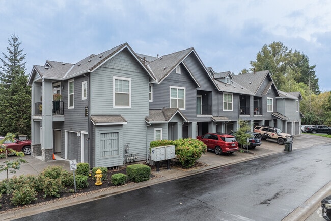


Property Detail
400 Springtree Ln
Portland-Vancouver-Hillsboro, OR-WA
SECTION 35 TOWNSHIP 2S RANGE 1E QUARTER BC TAX LOT 04000
05018340
CLACKAMAS
Multifamilydwelling
Oregon
R2.1
4000
B and X Area of moderate flood hazard, usually the area between the limits of the 100-year and 500-year floods.
6.14 AC
2025
Willamette
2025
Portland
020506
NEARBY LISTINGS FOR SALE OR LEASE
-
-
View all West Linn listings for sale on LoopNet.com
DEMOGRAPHICS near 400 Springtree Ln
1 mile
3 mile
5 mile
2025 Total Population
9,414
45,680
142,532
2030 Population
9,386
45,522
142,508
Pop Growth 2025-2030
(0.30%)
(0.35%)
(0.02%)
Average Age
42
43
43
2025 Total Households
3,530
16,950
54,657
HH Growth 2025-2030
(0.45%)
(0.42%)
(0.08%)
Median Household Inc
$138,473
$127,208
$112,042
Avg Household Size
2.60
2.60
2.50
2025 Avg HH Vehicles
2.00
2.00
2.00
Median Home Value
$751,536
$725,006
$698,303
Median Year Built
1993
1984
1980
Nearby Places
Map Layers
Map Styles
 Street
 Aerial
Transit
 Traffic
 Biking
Places
Listings with unknown addresses are not visible on the map
- Restaurants
- Banks
- Shops
- Fitness
- Groceries
PUBLIC TRANSPORTATION
COMMUTER RAIL
Oregon City Amtrak (Amtrak Cascades - Amtrak)
Drive
Walk
Distance
Oregon City Amtrak (Amtrak Cascades - Amtrak)
9 min
4.4 mi
Tualatin (Westside Express Service - Tri-County Metropolitan Transportation District of Oregon Rail (TriMet Rail))
Drive
Walk
Distance
Tualatin (Westside Express Service - Tri-County Metropolitan Transportation District of Oregon Rail (TriMet Rail))
11 min
8.0 mi
AIRPORT
Portland International
Drive
Walk
Distance
Portland International
33 min
21.5 mi
Freight Ports
Port of Portland
Drive
Walk
Distance
Port of Portland
31 min
21.6 mi
Nearby Properties
Address
Land Use
TOTAL SIZE
Lot Size
Zoning
Address
Land Use
TOTAL SIZE
Lot Size
Zoning
3.11 AC
GC
Address
Land Use
TOTAL SIZE
Lot Size
Zoning
1,008 SF
10 AC
R3
Address
Land Use
TOTAL SIZE
Lot Size
Zoning
6 AC
OBC
Address
Land Use
TOTAL SIZE
Lot Size
Zoning
9.21 AC
R3
Address
Land Use
TOTAL SIZE
Lot Size
Zoning
980 SF
6.19 AC
GC
Address
Land Use
TOTAL SIZE
Lot Size
Zoning
6.16 AC
GC
Address
Land Use
TOTAL SIZE
Lot Size
Zoning
1,202 SF
3 AC
OBC
Address
Land Use
TOTAL SIZE
Lot Size
Zoning
0.94 AC
MUD
Address
Land Use
TOTAL SIZE
Lot Size
Zoning
1,838 SF
4 AC
R3
Address
Land Use
TOTAL SIZE
Lot Size
Zoning
1,114 SF
3.11 AC
R2
Address
Land Use
TOTAL SIZE
Lot Size
Zoning
4.63 AC
GC
Address
Land Use
TOTAL SIZE
Lot Size
Zoning
2 AC
GC
Address
Land Use
TOTAL SIZE
Lot Size
Zoning
4.53 AC
R2.1
Address
Land Use
TOTAL SIZE
Lot Size
Zoning
Address
Land Use
TOTAL SIZE
Lot Size
Zoning
3.01 AC
GC
Address
Land Use
TOTAL SIZE
Lot Size
Zoning
2.33 AC
R4.5
Address
Land Use
TOTAL SIZE
Lot Size
Zoning
2,686 SF
1.17 AC
R10
Address
Land Use
TOTAL SIZE
Lot Size
Zoning
0.64 AC
GC
Address
Land Use
TOTAL SIZE
Lot Size
Zoning
0.97 AC
GC
Address
Land Use
TOTAL SIZE
Lot Size
Zoning
Address
Land Use
TOTAL SIZE
Lot Size
Zoning
4 AC
R2.1
Address
Land Use
TOTAL SIZE
Lot Size
Zoning
1,215 SF
1.98 AC
GC
Address
Land Use
TOTAL SIZE
Lot Size
Zoning
0.34 AC
GC
Address
Land Use
TOTAL SIZE
Lot Size
Zoning
3 AC
GC
Address
Land Use
TOTAL SIZE
Lot Size
Zoning
0.94 AC
GC
Address
Land Use
TOTAL SIZE
Lot Size
Zoning
64 AC
R10
Address
Land Use
TOTAL SIZE
Lot Size
Zoning
9,745 SF
1 AC
OBC
Address
Land Use
TOTAL SIZE
Lot Size
Zoning
2.25 AC
R2.1
Address
Land Use
TOTAL SIZE
Lot Size
Zoning
2.92 AC
R3.5
The World's #1 Commercial Real Estate Marketplace
Connect with us
© 2026 CoStar Group
The information above has been obtained from sources believed reliable. While we do not doubt its accuracy we have not verified it and make no guarantee, warranty or representation about it. It is your responsibility to independently confirm its accuracy and completeness. Any projections, opinions, assumptions, or estimates used are for example only and do not represent the current or future performance of the property. The value of this transaction to you depends on tax and other factors which should be evaluated by your tax, financial, and legal advisors. You and your advisors should conduct a careful, independent investigation of the property to determine to your satisfaction the suitability of the property for your needs.