Property Record
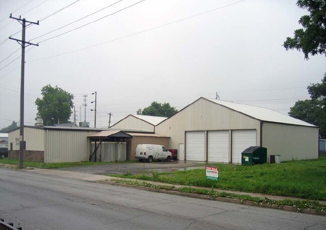
400 State St, Madison, IL 62060

Property Detail
400 State St
St. Louis
MADISON PROPER LOT 42 43 62.5X140.8 IRR
St. Louis, MO-IL
MADISON
21-2-19-25-14-301-024
Illinois
Municipalproperty
42
0
0.20 AC
2024
Illinois
400600
NEARBY LISTINGS FOR SALE OR LEASE
DEMOGRAPHICS near 400 State St
1 mile
3 mile
5 mile
2025 Total Population
5,853
26,291
111,929
2030 Population
6,027
26,859
111,827
Pop Growth 2025-2030
+ 2.97%
+ 2.16%
(0.09%)
Average Age
40
40
41
2025 Total Households
2,424
10,975
49,590
HH Growth 2025-2030
+ 2.89%
+ 2.05%
(0.52%)
Median Household Inc
$42,126
$45,437
$43,102
Avg Household Size
2.30
2.30
2.10
2025 Avg HH Vehicles
1.00
1.00
1.00
Median Home Value
$76,113
$70,004
$81,702
Median Year Built
1960
1949
1951
Nearby Places
Map Layers
Map Styles
 Street
 Aerial
Transit
 Traffic
 Biking
Places
Listings with unknown addresses are not visible on the map
- Restaurants
- Banks
- Shops
- Fitness
- Groceries
PUBLIC TRANSPORTATION
COMMUTER RAIL
Arch-Laclede's Landing (Lambert Airport Shiloh-Scott - St. Louis MetroLink (MetroLink), Shrewsbury-Lansdowne I-44 Emerson Park - St. Louis MetroLink (MetroLink))
Drive
Walk
Distance
Arch-Laclede's Landing (Lambert Airport Shiloh-Scott - St. Louis MetroLink (MetroLink), Shrewsbury-Lansdowne I-44 Emerson Park - St. Louis MetroLink (MetroLink))
9 min
5.6 mi
East Riverfront (Lambert Airport Shiloh-Scott - St. Louis MetroLink (MetroLink), Shrewsbury-Lansdowne I-44 Emerson Park - St. Louis MetroLink (MetroLink))
Drive
Walk
Distance
East Riverfront (Lambert Airport Shiloh-Scott - St. Louis MetroLink (MetroLink), Shrewsbury-Lansdowne I-44 Emerson Park - St. Louis MetroLink (MetroLink))
10 min
6.1 mi
AIRPORT
St Louis Lambert International
Drive
Walk
Distance
St Louis Lambert International
23 min
14.6 mi
Scott AFB/Midamerica St Louis
Drive
Walk
Distance
Scott AFB/Midamerica St Louis
41 min
26.4 mi
Freight Ports
Port Milwaukee
Drive
Walk
Distance
Port Milwaukee
416 min
368.7 mi
Nearby Properties
Address
Land Use
TOTAL SIZE
Lot Size
Zoning
Address
Land Use
TOTAL SIZE
Lot Size
Zoning
33.55 AC
Address
Land Use
TOTAL SIZE
Lot Size
Zoning
Address
Land Use
TOTAL SIZE
Lot Size
Zoning
1,925 SF
79.42 AC
Address
Land Use
TOTAL SIZE
Lot Size
Zoning
3.46 AC
Address
Land Use
TOTAL SIZE
Lot Size
Zoning
3.26 AC
Address
Land Use
TOTAL SIZE
Lot Size
Zoning
71,730 SF
3.23 AC
Address
Land Use
TOTAL SIZE
Lot Size
Zoning
165.04 AC
Address
Land Use
TOTAL SIZE
Lot Size
Zoning
54.74 AC
K
Address
Land Use
TOTAL SIZE
Lot Size
Zoning
Address
Land Use
TOTAL SIZE
Lot Size
Zoning
353,312 SF
17.84 AC
K
Address
Land Use
TOTAL SIZE
Lot Size
Zoning
429,181 SF
23.56 AC
K
Address
Land Use
TOTAL SIZE
Lot Size
Zoning
102,355 SF
9.31 AC
Address
Land Use
TOTAL SIZE
Lot Size
Zoning
42.52 AC
Address
Land Use
TOTAL SIZE
Lot Size
Zoning
6,240 SF
4.50 AC
Address
Land Use
TOTAL SIZE
Lot Size
Zoning
8,510 SF
27.51 AC
Address
Land Use
TOTAL SIZE
Lot Size
Zoning
11,541 SF
11.82 AC
Address
Land Use
TOTAL SIZE
Lot Size
Zoning
107,814 SF
5.89 AC
K
Address
Land Use
TOTAL SIZE
Lot Size
Zoning
5,610 SF
50.66 AC
Address
Land Use
TOTAL SIZE
Lot Size
Zoning
9,031 SF
11.89 AC
Address
Land Use
TOTAL SIZE
Lot Size
Zoning
47,556 SF
1.62 AC
Address
Land Use
TOTAL SIZE
Lot Size
Zoning
20.80 AC
Address
Land Use
TOTAL SIZE
Lot Size
Zoning
118,410 SF
2.25 AC
D
Address
Land Use
TOTAL SIZE
Lot Size
Zoning
309,129 SF
29.47 AC
Address
Land Use
TOTAL SIZE
Lot Size
Zoning
30,906 SF
1.68 AC
Address
Land Use
TOTAL SIZE
Lot Size
Zoning
87,419 SF
3.72 AC
D
Address
Land Use
TOTAL SIZE
Lot Size
Zoning
Address
Land Use
TOTAL SIZE
Lot Size
Zoning
88,800 SF
1.20 AC
A
Address
Land Use
TOTAL SIZE
Lot Size
Zoning
45,888 SF
14.62 AC
Address
Land Use
TOTAL SIZE
Lot Size
Zoning
22,500 SF
22.21 AC
Address
Land Use
TOTAL SIZE
Lot Size
Zoning
249,623 SF
6.20 AC
K
The World's #1 Commercial Real Estate Marketplace
Connect with us
© 2026 CoStar Group
The information above has been obtained from sources believed reliable. While we do not doubt its accuracy we have not verified it and make no guarantee, warranty or representation about it. It is your responsibility to independently confirm its accuracy and completeness. Any projections, opinions, assumptions, or estimates used are for example only and do not represent the current or future performance of the property. The value of this transaction to you depends on tax and other factors which should be evaluated by your tax, financial, and legal advisors. You and your advisors should conduct a careful, independent investigation of the property to determine to your satisfaction the suitability of the property for your needs.