Property Record
400 Stephen F Austin Dr, Conroe, TX 77302

Save to a Folder
{{folder.Name}}
{{folder.ListingIds.length}} Properties
{{folder.ListingIds.length}} Property
Create a New Folder
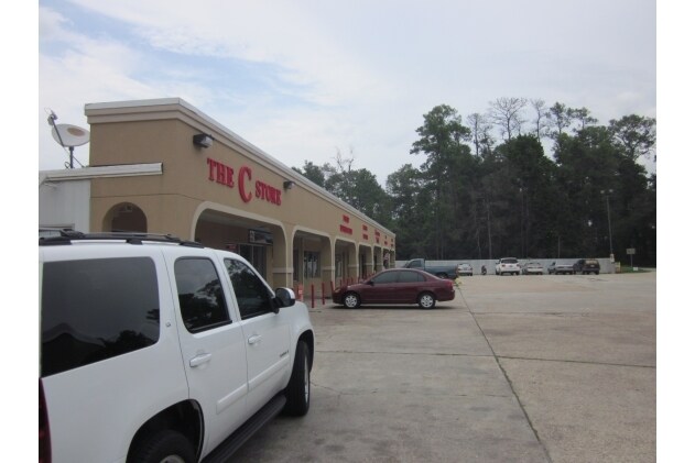
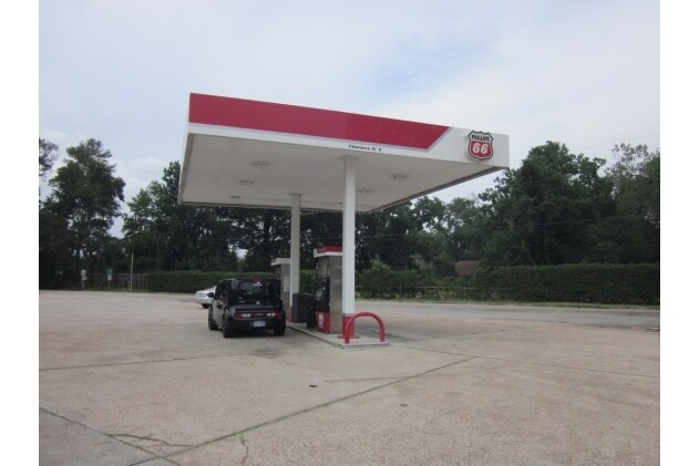
Property Detail
400 Stephen F Austin Dr
8063-01-08600
PLANTATION EST 01 RES A F#8851675, ACRES 0.970
Commercialnec
Montgomery
1
Texas
B and X Area of moderate flood hazard, usually the area between the limits of the 100-year and 500-year floods.
0.97 AC
2024
Montgomery County
2025
Houston
693202
Houston-Pasadena-The Woodlands, TX
7,200 SF
NEARBY LISTINGS FOR SALE OR LEASE
DEMOGRAPHICS near 400 Stephen F Austin Dr
1 mile
3 mile
5 mile
2025 Total Population
4,225
34,588
109,087
2030 Population
4,933
41,061
128,333
Pop Growth 2025-2030
+ 16.76%
+ 18.71%
+ 17.64%
Average Age
42
38
37
2025 Total Households
1,506
12,308
38,750
HH Growth 2025-2030
+ 17.26%
+ 19.32%
+ 18.51%
Median Household Inc
$116,019
$84,094
$83,762
Avg Household Size
2.80
2.80
2.70
2025 Avg HH Vehicles
2.00
2.00
2.00
Median Home Value
$347,050
$332,555
$317,322
Median Year Built
2000
2008
2008
Nearby Places
Map Layers
Map Styles
 Street
 Aerial
Layers
 Traffic
 Biking
Places
Listings with unknown addresses are not visible on the map
- Restaurants
- Banks
- Shops
- Fitness
- Groceries
PUBLIC TRANSPORTATION
AIRPORT
George Bush Intcntl/Houston
Drive
Walk
Distance
George Bush Intcntl/Houston
38 min
29.6 mi
Freight Ports
Port of Houston
Drive
Walk
Distance
Port of Houston
61 min
45.3 mi
Nearby Properties
Address
Land Use
TOTAL SIZE
Lot Size
Zoning
Address
Land Use
TOTAL SIZE
Lot Size
Zoning
535,690 SF
15.89 AC
Address
Land Use
TOTAL SIZE
Lot Size
Zoning
109,842 SF
25.58 AC
Address
Land Use
TOTAL SIZE
Lot Size
Zoning
470,259 SF
27.98 AC
1
Address
Land Use
TOTAL SIZE
Lot Size
Zoning
353,247 SF
14.38 AC
Address
Land Use
TOTAL SIZE
Lot Size
Zoning
292,274 SF
7.55 AC
Address
Land Use
TOTAL SIZE
Lot Size
Zoning
441,092 SF
29.09 AC
Address
Land Use
TOTAL SIZE
Lot Size
Zoning
304,482 SF
12.15 AC
Address
Land Use
TOTAL SIZE
Lot Size
Zoning
274,494 SF
28.96 AC
Address
Land Use
TOTAL SIZE
Lot Size
Zoning
291,173 SF
17.77 AC
6
Address
Land Use
TOTAL SIZE
Lot Size
Zoning
284,451 SF
13.66 AC
1
Address
Land Use
TOTAL SIZE
Lot Size
Zoning
326,478 SF
20.22 AC
Address
Land Use
TOTAL SIZE
Lot Size
Zoning
159,144 SF
32.27 AC
Address
Land Use
TOTAL SIZE
Lot Size
Zoning
195,956 SF
1.76 AC
1
Address
Land Use
TOTAL SIZE
Lot Size
Zoning
100,800 SF
8.60 AC
Address
Land Use
TOTAL SIZE
Lot Size
Zoning
85,560 SF
8.55 AC
Address
Land Use
TOTAL SIZE
Lot Size
Zoning
70,010 SF
8.89 AC
Address
Land Use
TOTAL SIZE
Lot Size
Zoning
148,906 SF
7.05 AC
1
Address
Land Use
TOTAL SIZE
Lot Size
Zoning
171,550 SF
25.36 AC
1
Address
Land Use
TOTAL SIZE
Lot Size
Zoning
89,736 SF
26.85 AC
1
Address
Land Use
TOTAL SIZE
Lot Size
Zoning
222,647 SF
11.25 AC
Address
Land Use
TOTAL SIZE
Lot Size
Zoning
11.25 AC
Address
Land Use
TOTAL SIZE
Lot Size
Zoning
72,648 SF
5.55 AC
Address
Land Use
TOTAL SIZE
Lot Size
Zoning
45,171 SF
7.76 AC
1
Address
Land Use
TOTAL SIZE
Lot Size
Zoning
141,600 SF
15.02 AC
1
Address
Land Use
TOTAL SIZE
Lot Size
Zoning
209,151 SF
12.97 AC
1
Address
Land Use
TOTAL SIZE
Lot Size
Zoning
66,894 SF
0.63 AC
1
Address
Land Use
TOTAL SIZE
Lot Size
Zoning
35,077 SF
5.28 AC
Address
Land Use
TOTAL SIZE
Lot Size
Zoning
64,236 SF
9.16 AC
1
Address
Land Use
TOTAL SIZE
Lot Size
Zoning
159,185 SF
18.45 AC
1
The World's #1 Commercial Real Estate Marketplace
Connect with us
© 2026 CoStar Group
The information above has been obtained from sources believed reliable. While we do not doubt its accuracy we have not verified it and make no guarantee, warranty or representation about it. It is your responsibility to independently confirm its accuracy and completeness. Any projections, opinions, assumptions, or estimates used are for example only and do not represent the current or future performance of the property. The value of this transaction to you depends on tax and other factors which should be evaluated by your tax, financial, and legal advisors. You and your advisors should conduct a careful, independent investigation of the property to determine to your satisfaction the suitability of the property for your needs.