Property Record
400 Steward Rd, Rochelle, IL 61068

NEARBY LISTINGS FOR SALE OR LEASE
Property Detail
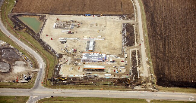
400 Steward Rd
24-36-100-026
PT W2 SEC 26 LYG S I-88 AND N STEWARD RD SEC 36-40-1 17.06AC
Commercialnec
Ogle
X
Illinois
17103C0150G
17.06 AC
2024
I-39 Corridor/Ogle County
2024
Chicago
961600
Rochelle, IL
10,260 SF
DEMOGRAPHICS near 400 Steward Rd
1 Mile
3 Mile
5 Mile
2024 Total Population
1,312
9,985
13,869
2029 Population
1,307
10,002
13,810
Pop Growth 2024-2029
(0.38%)
+ 0.17%
(0.43%)
Average Age
37
39
39
2024 Total Households
499
4,046
5,444
HH Growth 2024-2029
(0.40%)
+ 0.07%
(0.46%)
Median Household Inc
$39,999
$54,414
$59,601
Avg Household Size
2.50
2.40
2.50
2024 Avg HH Vehicles
2.00
2.00
2.00
Median Home Value
$131,169
$151,810
$155,682
Median Year Built
1974
1970
1972
Nearby Places
Map Layers
Map Styles
 Street
 Aerial
- Restaurants
- Banks
- Shops
- Fitness
- Groceries
PUBLIC TRANSPORTATION
AIRPORT
Chicago/Rockford International
DRIVE
WALK
Distance
Chicago/Rockford International
36 min
22.0 mi
Freight Ports
Port Milwaukee
DRIVE
WALK
Distance
Port Milwaukee
138 min
119.3 mi
Nearby Properties
Address
Land Use
TOTAL SIZE
Lot Size
Zoning
Address
Land Use
TOTAL SIZE
Lot Size
Zoning
24.14 AC
Address
Land Use
TOTAL SIZE
Lot Size
Zoning
39.59 AC
Address
Land Use
TOTAL SIZE
Lot Size
Zoning
45.20 AC
Address
Land Use
TOTAL SIZE
Lot Size
Zoning
47.91 AC
Address
Land Use
TOTAL SIZE
Lot Size
Zoning
26.63 AC
Address
Land Use
TOTAL SIZE
Lot Size
Zoning
20.21 AC
Address
Land Use
TOTAL SIZE
Lot Size
Zoning
28.48 AC
Address
Land Use
TOTAL SIZE
Lot Size
Zoning
22.16 AC
Address
Land Use
TOTAL SIZE
Lot Size
Zoning
18.14 AC
Address
Land Use
TOTAL SIZE
Lot Size
Zoning
14.66 AC
Address
Land Use
TOTAL SIZE
Lot Size
Zoning
14.33 AC
Address
Land Use
TOTAL SIZE
Lot Size
Zoning
34.90 AC
Address
Land Use
TOTAL SIZE
Lot Size
Zoning
20,000 SF
12 AC
Address
Land Use
TOTAL SIZE
Lot Size
Zoning
55.67 AC
Address
Land Use
TOTAL SIZE
Lot Size
Zoning
20,200 SF
5.10 AC
Address
Land Use
TOTAL SIZE
Lot Size
Zoning
23.94 AC
Address
Land Use
TOTAL SIZE
Lot Size
Zoning
41.28 AC
Address
Land Use
TOTAL SIZE
Lot Size
Zoning
9.55 AC
Address
Land Use
TOTAL SIZE
Lot Size
Zoning
176,200 SF
15.72 AC
Address
Land Use
TOTAL SIZE
Lot Size
Zoning
14.90 AC
Address
Land Use
TOTAL SIZE
Lot Size
Zoning
21,000 SF
4.81 AC
Address
Land Use
TOTAL SIZE
Lot Size
Zoning
55,200 SF
1.74 AC
Address
Land Use
TOTAL SIZE
Lot Size
Zoning
1.27 AC
Address
Land Use
TOTAL SIZE
Lot Size
Zoning
1.15 AC
Address
Land Use
TOTAL SIZE
Lot Size
Zoning
13.94 AC
Address
Land Use
TOTAL SIZE
Lot Size
Zoning
58,473 SF
2.13 AC
Address
Land Use
TOTAL SIZE
Lot Size
Zoning
22.70 AC
Address
Land Use
TOTAL SIZE
Lot Size
Zoning
17,868 SF
4.01 AC
The World's #1 Commercial Real Estate Marketplace
Connect with us
© 2025 CoStar Group
The information above has been obtained from sources believed reliable. While we do not doubt its accuracy we have not verified it and make no guarantee, warranty or representation about it. It is your responsibility to independently confirm its accuracy and completeness. Any projections, opinions, assumptions, or estimates used are for example only and do not represent the current or future performance of the property. The value of this transaction to you depends on tax and other factors which should be evaluated by your tax, financial, and legal advisors. You and your advisors should conduct a careful, independent investigation of the property to determine to your satisfaction the suitability of the property for your needs.