Property Record
400 W Carson St, Carson, CA 90745
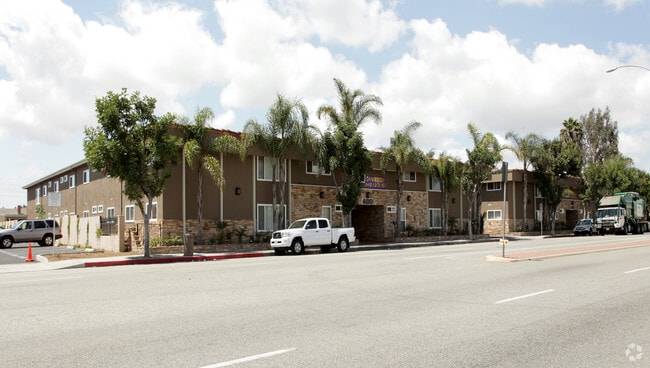


Property Detail
400 W Carson St
7343-017-028
TRACT NO 3612 E 136 FT OF W 254 FT (EX OF ST) OF LOT 38
Multifamilydwelling
Los Angeles
CAMU&CS*
California
B and X Area of moderate flood hazard, usually the area between the limits of the 100-year and 500-year floods.
38
2024
0.81 AC
2025
Carson
543501
Los Angeles
22,708 SF
Los Angeles-Long Beach-Glendale, CA
NEARBY LISTINGS FOR SALE OR LEASE
DEMOGRAPHICS near 400 W Carson St
1 mile
3 mile
5 mile
2024 Total Population
35,755
188,971
485,218
2029 Population
35,567
187,162
480,710
Pop Growth 2024-2029
(0.53%)
(0.96%)
(0.93%)
Average Age
44
42
41
2024 Total Households
10,222
59,704
158,043
HH Growth 2024-2029
(0.70%)
(1.13%)
(1.09%)
Median Household Inc
$105,623
$99,740
$94,033
Avg Household Size
3.10
3.00
2.90
2024 Avg HH Vehicles
2.00
2.00
2.00
Median Home Value
$695,912
$737,433
$772,768
Median Year Built
1968
1965
1964
Nearby Places
Map Layers
Map Styles
 Street
 Aerial
Transit
 Traffic
 Biking
Places
Listings with unknown addresses are not visible on the map
- Restaurants
- Banks
- Shops
- Fitness
- Groceries
PUBLIC TRANSPORTATION
AIRPORT
Long Beach (Daugherty Field)
Drive
Walk
Distance
Long Beach (Daugherty Field)
14 min
7.7 mi
Los Angeles International
Drive
Walk
Distance
Los Angeles International
21 min
13.9 mi
Bob Hope
Drive
Walk
Distance
Bob Hope
42 min
33.0 mi
Freight Ports
Port of Long Beach
Drive
Walk
Distance
Port of Long Beach
16 min
9.6 mi
Nearby Properties
Address
Land Use
TOTAL SIZE
Lot Size
Zoning
Address
Land Use
TOTAL SIZE
Lot Size
Zoning
997,143 SF
98.35 AC
TOMI-BP
Address
Land Use
TOTAL SIZE
Lot Size
Zoning
236,582 SF
425.41 AC
CAMH*
Address
Land Use
TOTAL SIZE
Lot Size
Zoning
64,456 SF
11.71 AC
CASP-10*
Address
Land Use
TOTAL SIZE
Lot Size
Zoning
10,152 SF
140.14 AC
TOMI-HVY
Address
Land Use
TOTAL SIZE
Lot Size
Zoning
422,640 SF
LAM3
Address
Land Use
TOTAL SIZE
Lot Size
Zoning
506,189 SF
20.33 AC
LAM2
Address
Land Use
TOTAL SIZE
Lot Size
Zoning
3,585,714 SF
67.35 AC
LAM3
Address
Land Use
TOTAL SIZE
Lot Size
Zoning
409,522 SF
11.41 AC
LAM3
Address
Land Use
TOTAL SIZE
Lot Size
Zoning
246,981 SF
11.95 AC
LARD2
Address
Land Use
TOTAL SIZE
Lot Size
Zoning
184,300 SF
8.14 AC
LAM3
Address
Land Use
TOTAL SIZE
Lot Size
Zoning
285,314 SF
14.28 AC
CAMH*
Address
Land Use
TOTAL SIZE
Lot Size
Zoning
84,365 SF
7.62 AC
LARAS3
Address
Land Use
TOTAL SIZE
Lot Size
Zoning
260,766 SF
10.70 AC
LAM3
Address
Land Use
TOTAL SIZE
Lot Size
Zoning
429,141 SF
3.29 AC
LCM1*
Address
Land Use
TOTAL SIZE
Lot Size
Zoning
282,280 SF
Address
Land Use
TOTAL SIZE
Lot Size
Zoning
670,305 SF
28.08 AC
TOMI-BP
Address
Land Use
TOTAL SIZE
Lot Size
Zoning
198,502 SF
LCM2 *
Address
Land Use
TOTAL SIZE
Lot Size
Zoning
365,701 SF
2.45 AC
TOMI-BP
Address
Land Use
TOTAL SIZE
Lot Size
Zoning
125,849 SF
6.08 AC
LAM2
Address
Land Use
TOTAL SIZE
Lot Size
Zoning
10.30 AC
TOM2*
Address
Land Use
TOTAL SIZE
Lot Size
Zoning
24,060 SF
LAM2
Address
Land Use
TOTAL SIZE
Lot Size
Zoning
178,323 SF
12.23 AC
CACR&D&MUR
Address
Land Use
TOTAL SIZE
Lot Size
Zoning
546,606 SF
17.58 AC
LAM3
Address
Land Use
TOTAL SIZE
Lot Size
Zoning
1,005,037 SF
23.98 AC
TOMI-LT
Address
Land Use
TOTAL SIZE
Lot Size
Zoning
169,576 SF
8.40 AC
TOMI-BP
Address
Land Use
TOTAL SIZE
Lot Size
Zoning
499,562 SF
6.50 AC
LAM3
Address
Land Use
TOTAL SIZE
Lot Size
Zoning
536,092 SF
3.79 AC
LAM3
Address
Land Use
TOTAL SIZE
Lot Size
Zoning
533,879 SF
10.02 AC
LAM2
Address
Land Use
TOTAL SIZE
Lot Size
Zoning
496,472 SF
21.57 AC
CAMH*
Address
Land Use
TOTAL SIZE
Lot Size
Zoning
519,144 SF
3.49 AC
LAM3
The World's #1 Commercial Real Estate Marketplace
Connect with us
© 2026 CoStar Group
The information above has been obtained from sources believed reliable. While we do not doubt its accuracy we have not verified it and make no guarantee, warranty or representation about it. It is your responsibility to independently confirm its accuracy and completeness. Any projections, opinions, assumptions, or estimates used are for example only and do not represent the current or future performance of the property. The value of this transaction to you depends on tax and other factors which should be evaluated by your tax, financial, and legal advisors. You and your advisors should conduct a careful, independent investigation of the property to determine to your satisfaction the suitability of the property for your needs.