Property Record
400 W Markham St, Little Rock, AR 72201


NEARBY LISTINGS FOR SALE OR LEASE
-
-
View all Little Rock listings for sale on LoopNet.com
Property Detail
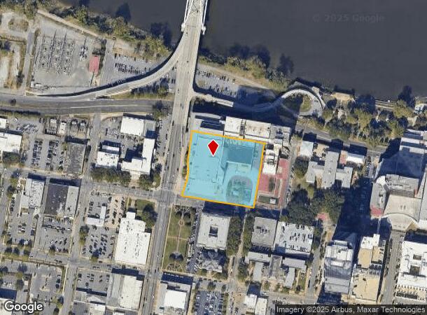
400 W Markham St
Little Rock-North Little Rock-Conway, AR
City Of Lr L5
34L-020-05-088-00
LOTS 1-12 BLK 100 TOGETHER WITH 60 FORMER SPRING ST LYING BETWEEN BLKS 99 &100 & LOTS 7, 8 & 9 BLK 99 BELOW THE 305 MEAN SEA LEVEL EXC THAT PLATTED AS VINSON PLAZA & EXC 5,066 SQ FT FOR R/W PER 2014-035454 3 1N 12W
Taxexempt
Pulaski
X
Arkansas
05119C0457G
1-12
2025
2.26 AC
2025
Downtown
004400
Little Rock/N Little Rock
12,562 SF
DEMOGRAPHICS near 400 W Markham St
1 Mile
3 Mile
5 Mile
2024 Total Population
5,714
54,874
123,602
2029 Population
5,838
56,221
125,110
Pop Growth 2024-2029
+ 2.17%
+ 2.45%
+ 1.22%
Average Age
42
40
40
2024 Total Households
3,765
26,058
56,603
HH Growth 2024-2029
+ 2.10%
+ 2.36%
+ 1.26%
Median Household Inc
$53,504
$41,096
$44,431
Avg Household Size
1.50
1.90
2.00
2024 Avg HH Vehicles
1.00
1.00
1.00
Median Home Value
$238,746
$146,849
$154,297
Median Year Built
1983
1962
1966
Nearby Places
Map Layers
Map Styles
 Street
 Aerial
- Restaurants
- Banks
- Shops
- Fitness
- Groceries
PUBLIC TRANSPORTATION
AIRPORT
Bill and Hillary Clinton Ntl/Adams Field
DRIVE
WALK
Distance
Bill and Hillary Clinton Ntl/Adams Field
12 min
7.6 mi
Freight Ports
Port of Shreveport
DRIVE
WALK
Distance
Port of Shreveport
1 min
182.7 mi
Nearby Properties
Address
Land Use
TOTAL SIZE
Lot Size
Zoning
Address
Land Use
TOTAL SIZE
Lot Size
Zoning
1.80 AC
Address
Land Use
TOTAL SIZE
Lot Size
Zoning
4,400,000 SF
27.97 AC
Address
Land Use
TOTAL SIZE
Lot Size
Zoning
0.90 AC
Address
Land Use
TOTAL SIZE
Lot Size
Zoning
0.45 AC
Address
Land Use
TOTAL SIZE
Lot Size
Zoning
802,734 SF
22.99 AC
Address
Land Use
TOTAL SIZE
Lot Size
Zoning
1,000,000 SF
9.38 AC
Address
Land Use
TOTAL SIZE
Lot Size
Zoning
333,096 SF
11.62 AC
Address
Land Use
TOTAL SIZE
Lot Size
Zoning
956,566 SF
70.39 AC
Address
Land Use
TOTAL SIZE
Lot Size
Zoning
475,613 SF
10.14 AC
Address
Land Use
TOTAL SIZE
Lot Size
Zoning
237,144 SF
1.26 AC
Address
Land Use
TOTAL SIZE
Lot Size
Zoning
526,829 SF
33.78 AC
Address
Land Use
TOTAL SIZE
Lot Size
Zoning
180,616 SF
0.91 AC
Address
Land Use
TOTAL SIZE
Lot Size
Zoning
603,434 SF
10.21 AC
Address
Land Use
TOTAL SIZE
Lot Size
Zoning
412,597 SF
Address
Land Use
TOTAL SIZE
Lot Size
Zoning
297,814 SF
86.09 AC
Address
Land Use
TOTAL SIZE
Lot Size
Zoning
22,017 SF
2.06 AC
Address
Land Use
TOTAL SIZE
Lot Size
Zoning
305,882 SF
7.82 AC
Address
Land Use
TOTAL SIZE
Lot Size
Zoning
761,810 SF
75.61 AC
Address
Land Use
TOTAL SIZE
Lot Size
Zoning
576 SF
62.63 AC
Address
Land Use
TOTAL SIZE
Lot Size
Zoning
2,636 SF
0.67 AC
Address
Land Use
TOTAL SIZE
Lot Size
Zoning
267,152 SF
Address
Land Use
TOTAL SIZE
Lot Size
Zoning
137,538 SF
31.58 AC
Address
Land Use
TOTAL SIZE
Lot Size
Zoning
260,000 SF
5.80 AC
Address
Land Use
TOTAL SIZE
Lot Size
Zoning
143,553 SF
12.76 AC
Address
Land Use
TOTAL SIZE
Lot Size
Zoning
130,742 SF
15.71 AC
Address
Land Use
TOTAL SIZE
Lot Size
Zoning
95,719 SF
32.76 AC
Address
Land Use
TOTAL SIZE
Lot Size
Zoning
346,974 SF
Address
Land Use
TOTAL SIZE
Lot Size
Zoning
138,352 SF
2.95 AC
Address
Land Use
TOTAL SIZE
Lot Size
Zoning
61,225 SF
5.66 AC
The World's #1 Commercial Real Estate Marketplace
Connect with us
© 2025 CoStar Group
The information above has been obtained from sources believed reliable. While we do not doubt its accuracy we have not verified it and make no guarantee, warranty or representation about it. It is your responsibility to independently confirm its accuracy and completeness. Any projections, opinions, assumptions, or estimates used are for example only and do not represent the current or future performance of the property. The value of this transaction to you depends on tax and other factors which should be evaluated by your tax, financial, and legal advisors. You and your advisors should conduct a careful, independent investigation of the property to determine to your satisfaction the suitability of the property for your needs.