Property Record
400 W Padonia Rd, Lutherville Timonium, MD 21093

Property Detail
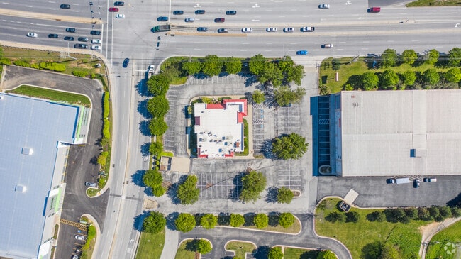
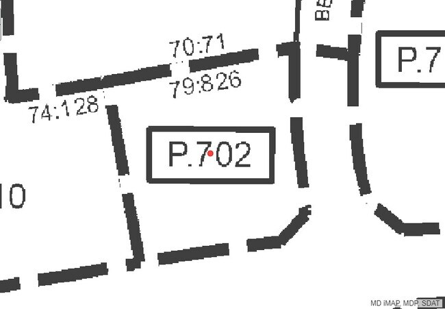
400 W Padonia Rd
08-2200028448
1.481 AC
Warehouse
Baltimore
BMCCC
Maryland
B and X Area of moderate flood hazard, usually the area between the limits of the 100-year and 500-year floods.
1
2024
1.48 AC
2025
Route 83 Corridor North
408400
Baltimore
2,004 SF
Baltimore-Columbia-Towson, MD
NEARBY LISTINGS FOR SALE OR LEASE
DEMOGRAPHICS near 400 W Padonia Rd
1 mile
3 mile
5 mile
2025 Total Population
9,707
58,428
111,949
2030 Population
9,668
58,445
112,673
Pop Growth 2025-2030
(0.40%)
+ 0.03%
+ 0.65%
Average Age
42
43
42
2025 Total Households
4,281
24,014
45,063
HH Growth 2025-2030
(0.49%)
+ 0.01%
+ 0.76%
Median Household Inc
$93,126
$106,999
$106,275
Avg Household Size
2.20
2.40
2.30
2025 Avg HH Vehicles
2.00
2.00
2.00
Median Home Value
$415,712
$469,028
$493,764
Median Year Built
1982
1976
1977
Nearby Places
Map Layers
Map Styles
 Street
 Aerial
Layers
 Traffic
 Biking
Places
Listings with unknown addresses are not visible on the map
- Restaurants
- Banks
- Shops
- Fitness
- Groceries
PUBLIC TRANSPORTATION
TRANSIT/SUBWAY
Timonium (Hunt Valley & BWI Marshall - Maryland Transit Administration Light Rail (Baltimore Light Rail), Timonium & Cromwell - Maryland Transit Administration Light Rail (Baltimore Light Rail))
Drive
Walk
Distance
Timonium (Hunt Valley & BWI Marshall - Maryland Transit Administration Light Rail (Baltimore Light Rail), Timonium & Cromwell - Maryland Transit Administration Light Rail (Baltimore Light Rail))
5 min
15 min
0.8 mi
AIRPORT
Baltimore/Washington International Thurgood Marshall
Drive
Walk
Distance
Baltimore/Washington International Thurgood Marshall
40 min
26.3 mi
Freight Ports
Port of Baltimore
Drive
Walk
Distance
Port of Baltimore
26 min
15.2 mi
SALE & LEASE HISTORY
LISTING DATE
SALE/LEASE

Oct 20, 2017
For Lease
Jan 12, 2021
For Lease
Aug 03, 2018
For Sale
Nearby Properties
Address
Land Use
TOTAL SIZE
Lot Size
Zoning
Address
Land Use
TOTAL SIZE
Lot Size
Zoning
217,147 SF
5.08 AC
MLIM
Address
Land Use
TOTAL SIZE
Lot Size
Zoning
513,056 SF
55.49 AC
BM
Address
Land Use
TOTAL SIZE
Lot Size
Zoning
343,606 SF
19.65 AC
Address
Land Use
TOTAL SIZE
Lot Size
Zoning
720,989 SF
32.65 AC
Address
Land Use
TOTAL SIZE
Lot Size
Zoning
595,100 SF
5.73 AC
Address
Land Use
TOTAL SIZE
Lot Size
Zoning
38.89 AC
DR16
Address
Land Use
TOTAL SIZE
Lot Size
Zoning
13,468 SF
32.08 AC
DR16
Address
Land Use
TOTAL SIZE
Lot Size
Zoning
28.74 AC
DR16
Address
Land Use
TOTAL SIZE
Lot Size
Zoning
362,686 SF
88.84 AC
MR
Address
Land Use
TOTAL SIZE
Lot Size
Zoning
330,145 SF
16.20 AC
Address
Land Use
TOTAL SIZE
Lot Size
Zoning
26.73 AC
DR16
Address
Land Use
TOTAL SIZE
Lot Size
Zoning
330,802 SF
14.81 AC
ML-IM
Address
Land Use
TOTAL SIZE
Lot Size
Zoning
4.94 AC
DR16
Address
Land Use
TOTAL SIZE
Lot Size
Zoning
178,200 SF
5.58 AC
BR-CR
Address
Land Use
TOTAL SIZE
Lot Size
Zoning
176,584 SF
31 AC
Address
Land Use
TOTAL SIZE
Lot Size
Zoning
125,398 SF
15.13 AC
BM
Address
Land Use
TOTAL SIZE
Lot Size
Zoning
73,186 SF
34 AC
Address
Land Use
TOTAL SIZE
Lot Size
Zoning
44.76 AC
DR3.5
Address
Land Use
TOTAL SIZE
Lot Size
Zoning
138,000 SF
3.09 AC
Address
Land Use
TOTAL SIZE
Lot Size
Zoning
172,782 SF
5.35 AC
ML-IM
Address
Land Use
TOTAL SIZE
Lot Size
Zoning
14.49 AC
DR16
Address
Land Use
TOTAL SIZE
Lot Size
Zoning
94,534 SF
15.68 AC
BLCCC
Address
Land Use
TOTAL SIZE
Lot Size
Zoning
18.07 AC
DR3.5
Address
Land Use
TOTAL SIZE
Lot Size
Zoning
13.46 AC
DR16
Address
Land Use
TOTAL SIZE
Lot Size
Zoning
326,069 SF
9.28 AC
ML-IM
Address
Land Use
TOTAL SIZE
Lot Size
Zoning
18.68 AC
DR3.5
Address
Land Use
TOTAL SIZE
Lot Size
Zoning
204,329 SF
25.45 AC
ML
Address
Land Use
TOTAL SIZE
Lot Size
Zoning
143,260 SF
7.31 AC
ML
Address
Land Use
TOTAL SIZE
Lot Size
Zoning
4,000 SF
23.97 AC
DR3.5
Address
Land Use
TOTAL SIZE
Lot Size
Zoning
106,612 SF
12.49 AC
BLRBR
The World's #1 Commercial Real Estate Marketplace
Connect with us
© 2026 CoStar Group
The information above has been obtained from sources believed reliable. While we do not doubt its accuracy we have not verified it and make no guarantee, warranty or representation about it. It is your responsibility to independently confirm its accuracy and completeness. Any projections, opinions, assumptions, or estimates used are for example only and do not represent the current or future performance of the property. The value of this transaction to you depends on tax and other factors which should be evaluated by your tax, financial, and legal advisors. You and your advisors should conduct a careful, independent investigation of the property to determine to your satisfaction the suitability of the property for your needs.