Property Record
400 Westmont Dr, San Pedro, CA 90731


NEARBY LISTINGS FOR SALE OR LEASE
Property Detail
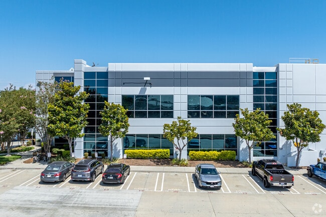
400 Westmont Dr
Los Angeles-Long Beach-Glendale, CA
52831
7412-026-017
TR=52831 LOT 2
Warehouse
Los Angeles
X
California
06037C1943G
2
2024
20.65 AC
2025
San Pedro
295103
Los Angeles
512,700 SF
DEMOGRAPHICS near 400 Westmont Dr
1 Mile
3 Mile
5 Mile
2024 Total Population
7,118
165,440
327,650
2029 Population
6,958
160,267
317,572
Pop Growth 2024-2029
(2.25%)
(3.13%)
(3.08%)
Average Age
38
40
41
2024 Total Households
2,226
56,067
109,787
HH Growth 2024-2029
(2.61%)
(3.32%)
(3.26%)
Median Household Inc
$81,444
$73,543
$84,151
Avg Household Size
3.00
2.80
2.80
2024 Avg HH Vehicles
2.00
2.00
2.00
Median Home Value
$724,391
$741,278
$769,760
Median Year Built
1972
1965
1965
Nearby Places
Map Layers
Map Styles
 Street
 Aerial
- Restaurants
- Banks
- Shops
- Fitness
- Groceries
PUBLIC TRANSPORTATION
AIRPORT
Long Beach (Daugherty Field)
DRIVE
WALK
Distance
Long Beach (Daugherty Field)
22 min
12.1 mi
Los Angeles International
DRIVE
WALK
Distance
Los Angeles International
29 min
18.1 mi
John Wayne/Orange County
DRIVE
WALK
Distance
John Wayne/Orange County
44 min
32.3 mi
Freight Ports
Port of Los Angeles
DRIVE
WALK
Distance
Port of Los Angeles
14 min
5.6 mi
Nearby Properties
Address
Land Use
TOTAL SIZE
Lot Size
Zoning
Address
Land Use
TOTAL SIZE
Lot Size
Zoning
671,091 SF
18 AC
LAC1
Address
Land Use
TOTAL SIZE
Lot Size
Zoning
414,189 SF
2.45 AC
LAC2
Address
Land Use
TOTAL SIZE
Lot Size
Zoning
56,300 SF
116.80 AC
LAM3
Address
Land Use
TOTAL SIZE
Lot Size
Zoning
5,086 SF
255.48 AC
LAM3
Address
Land Use
TOTAL SIZE
Lot Size
Zoning
286,186 SF
8.20 AC
LAMR1
Address
Land Use
TOTAL SIZE
Lot Size
Zoning
119,356 SF
3.86 AC
LAM2
Address
Land Use
TOTAL SIZE
Lot Size
Zoning
246,981 SF
11.95 AC
LARD2
Address
Land Use
TOTAL SIZE
Lot Size
Zoning
84,365 SF
7.62 AC
LARAS3
Address
Land Use
TOTAL SIZE
Lot Size
Zoning
426,285 SF
LAC2
Address
Land Use
TOTAL SIZE
Lot Size
Zoning
170,000 SF
7.61 AC
LARD1.5
Address
Land Use
TOTAL SIZE
Lot Size
Zoning
759,851 SF
33.72 AC
LAM3
Address
Land Use
TOTAL SIZE
Lot Size
Zoning
191,424 SF
7.71 AC
LARD1.5
Address
Land Use
TOTAL SIZE
Lot Size
Zoning
174,910 SF
131.43 AC
LAM3
Address
Land Use
TOTAL SIZE
Lot Size
Zoning
269,859 SF
11.14 AC
RPRS-4*
Address
Land Use
TOTAL SIZE
Lot Size
Zoning
10.30 AC
TOM2*
Address
Land Use
TOTAL SIZE
Lot Size
Zoning
131,529 SF
9.83 AC
LAM1
Address
Land Use
TOTAL SIZE
Lot Size
Zoning
173,135 SF
2.05 AC
LAC2
Address
Land Use
TOTAL SIZE
Lot Size
Zoning
169,947 SF
1.81 AC
LAC2
Address
Land Use
TOTAL SIZE
Lot Size
Zoning
340,659 SF
15.14 AC
LAM3
Address
Land Use
TOTAL SIZE
Lot Size
Zoning
225,314 SF
10.02 AC
CAML&D
Address
Land Use
TOTAL SIZE
Lot Size
Zoning
233.72 AC
LAM3
Address
Land Use
TOTAL SIZE
Lot Size
Zoning
120,148 SF
5.49 AC
LAMR1
Address
Land Use
TOTAL SIZE
Lot Size
Zoning
488,488 SF
1.65 AC
LAC2
Address
Land Use
TOTAL SIZE
Lot Size
Zoning
133,613 SF
5.70 AC
LAM2
Address
Land Use
TOTAL SIZE
Lot Size
Zoning
42,313 SF
27.33 AC
LAR1
Address
Land Use
TOTAL SIZE
Lot Size
Zoning
1,676,000 SF
38.49 AC
LAM3
Address
Land Use
TOTAL SIZE
Lot Size
Zoning
14,827 SF
9.43 AC
LAMR2
Address
Land Use
TOTAL SIZE
Lot Size
Zoning
202,027 SF
4.85 AC
LAP
The World's #1 Commercial Real Estate Marketplace
Connect with us
© 2025 CoStar Group
The information above has been obtained from sources believed reliable. While we do not doubt its accuracy we have not verified it and make no guarantee, warranty or representation about it. It is your responsibility to independently confirm its accuracy and completeness. Any projections, opinions, assumptions, or estimates used are for example only and do not represent the current or future performance of the property. The value of this transaction to you depends on tax and other factors which should be evaluated by your tax, financial, and legal advisors. You and your advisors should conduct a careful, independent investigation of the property to determine to your satisfaction the suitability of the property for your needs.