Property Record
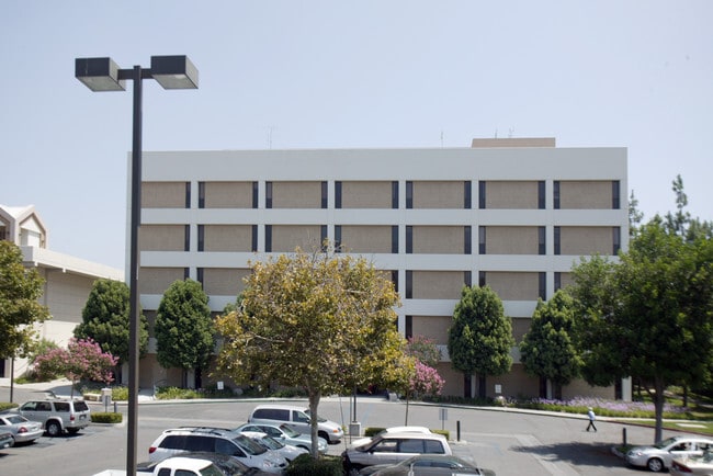
4000 14Th St, Riverside, CA 92501


Property Detail
4000 14Th St
Riverside-San Bernardino-Ontario, CA
.39 ACRES M/L IN POR LOT A MB 004/087 FINCH B S SUB AND POR LOT 6 MB 007/003 SB SOUTHERN CALIFORNIA COLONY ASSOCIATION
217-300-009
RIVERSIDE
Hospitalpublic
California
B and X Area of moderate flood hazard, usually the area between the limits of the 100-year and 500-year floods.
a
2024
0.39 AC
2025
Riverside
030300
Inland Empire (California)
87,600 SF
NEARBY LISTINGS FOR SALE OR LEASE
DEMOGRAPHICS near 4000 14Th St
1 mile
3 mile
5 mile
2025 Total Population
16,508
120,331
252,054
2030 Population
17,048
122,937
257,694
Pop Growth 2025-2030
+ 3.27%
+ 2.17%
+ 2.24%
Average Age
37
36
36
2025 Total Households
5,704
36,872
74,642
HH Growth 2025-2030
+ 3.00%
+ 1.76%
+ 1.86%
Median Household Inc
$77,741
$82,385
$89,757
Avg Household Size
2.50
3.00
3.10
2025 Avg HH Vehicles
2.00
2.00
2.00
Median Home Value
$681,745
$600,062
$623,786
Median Year Built
1949
1967
1974
Nearby Places
Map Layers
Map Styles
 Street
 Aerial
Layers
 Traffic
 Biking
Places
Listings with unknown addresses are not visible on the map
- Restaurants
- Banks
- Shops
- Fitness
- Groceries
PUBLIC TRANSPORTATION
COMMUTER RAIL
Riverside-Downtown (91 Line - Southern California Regional Rail Authority (Metrolink), Inland Empire-Orange County Line - Southern California Regional Rail Authority (Metrolink), Riverside Line - Southern California Regional Rail Authority (Metrolink))
Drive
Walk
Distance
Riverside-Downtown (91 Line - Southern California Regional Rail Authority (Metrolink), Inland Empire-Orange County Line - Southern California Regional Rail Authority (Metrolink), Riverside Line - Southern California Regional Rail Authority (Metrolink))
5 min
1.3 mi
Drive
Walk
Distance
7 min
4.2 mi
AIRPORT
Ontario International
Drive
Walk
Distance
Ontario International
25 min
18.1 mi
John Wayne/Orange County
Drive
Walk
Distance
John Wayne/Orange County
52 min
42.5 mi
Nearby Properties
Address
Land Use
TOTAL SIZE
Lot Size
Zoning
Address
Land Use
TOTAL SIZE
Lot Size
Zoning
412,950 SF
23.16 AC
C2
Address
Land Use
TOTAL SIZE
Lot Size
Zoning
247,416 SF
10.17 AC
Address
Land Use
TOTAL SIZE
Lot Size
Zoning
350,278 SF
1.21 AC
Address
Land Use
TOTAL SIZE
Lot Size
Zoning
26,879 SF
16.27 AC
R3
Address
Land Use
TOTAL SIZE
Lot Size
Zoning
217,036 SF
1.66 AC
C2
Address
Land Use
TOTAL SIZE
Lot Size
Zoning
156,241 SF
2.55 AC
Address
Land Use
TOTAL SIZE
Lot Size
Zoning
139,454 SF
0.97 AC
DSP
Address
Land Use
TOTAL SIZE
Lot Size
Zoning
37,729 SF
3.23 AC
Address
Land Use
TOTAL SIZE
Lot Size
Zoning
36,010 SF
11.76 AC
R3
Address
Land Use
TOTAL SIZE
Lot Size
Zoning
244,495 SF
17.53 AC
MH
Address
Land Use
TOTAL SIZE
Lot Size
Zoning
134,944 SF
2.52 AC
Address
Land Use
TOTAL SIZE
Lot Size
Zoning
415,990 SF
5.16 AC
Address
Land Use
TOTAL SIZE
Lot Size
Zoning
122,023 SF
6.83 AC
Address
Land Use
TOTAL SIZE
Lot Size
Zoning
129,739 SF
5.08 AC
Address
Land Use
TOTAL SIZE
Lot Size
Zoning
272,472 SF
24.49 AC
N2
Address
Land Use
TOTAL SIZE
Lot Size
Zoning
69,660 SF
0.62 AC
C3
Address
Land Use
TOTAL SIZE
Lot Size
Zoning
108,930 SF
4.89 AC
Address
Land Use
TOTAL SIZE
Lot Size
Zoning
446,832 SF
5.03 AC
Address
Land Use
TOTAL SIZE
Lot Size
Zoning
Address
Land Use
TOTAL SIZE
Lot Size
Zoning
156,998 SF
11.90 AC
MP
Address
Land Use
TOTAL SIZE
Lot Size
Zoning
83,572 SF
2.93 AC
Address
Land Use
TOTAL SIZE
Lot Size
Zoning
8.81 AC
R3S3
Address
Land Use
TOTAL SIZE
Lot Size
Zoning
17,542 SF
8.27 AC
R1
Address
Land Use
TOTAL SIZE
Lot Size
Zoning
156,688 SF
6.09 AC
BMP
Address
Land Use
TOTAL SIZE
Lot Size
Zoning
306,278 SF
2.50 AC
C3
The World's #1 Commercial Real Estate Marketplace
Connect with us
© 2026 CoStar Group
The information above has been obtained from sources believed reliable. While we do not doubt its accuracy we have not verified it and make no guarantee, warranty or representation about it. It is your responsibility to independently confirm its accuracy and completeness. Any projections, opinions, assumptions, or estimates used are for example only and do not represent the current or future performance of the property. The value of this transaction to you depends on tax and other factors which should be evaluated by your tax, financial, and legal advisors. You and your advisors should conduct a careful, independent investigation of the property to determine to your satisfaction the suitability of the property for your needs.