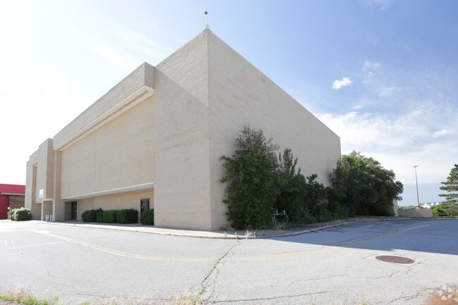
Property Record
4000 Crossroads Mall, Oklahoma City, OK 73149


NEARBY LISTINGS FOR SALE OR LEASE
Property Detail
4000 Crossroads Mall
132164080
Unpltd Pt Sec 26 11N 3W
Taxexempt
UNPLTD PT SEC 26 11N 3W 000 000 PT OF NW4 & SW4 SEC 26 11N 3W BEG 2458.522FT E & 812.522FT N & 28.507FT NELY & 544.471FT NELY LEFT ON CURVE & 340.020FT NW & 199.368FT LEFT ON CURVE NW & 281.906FT NW OF SW/C SW4 TH NW502.726FT LEFT ON CURVE NWLY237.68
X
Oklahoma
40109C0315H
Oklahoma
0
14 AC
2024
South
107302
Oklahoma City
152,302 SF
Oklahoma City, OK
DEMOGRAPHICS near 4000 Crossroads Mall
1 Mile
3 Mile
5 Mile
2024 Total Population
3,641
71,984
236,582
2029 Population
3,745
74,207
244,396
Pop Growth 2024-2029
+ 2.86%
+ 3.09%
+ 3.30%
Average Age
35
35
36
2024 Total Households
1,230
26,956
87,732
HH Growth 2024-2029
+ 3.01%
+ 3.18%
+ 3.40%
Median Household Inc
$43,481
$45,447
$51,763
Avg Household Size
2.80
2.60
2.60
2024 Avg HH Vehicles
2.00
2.00
2.00
Median Home Value
$78,381
$115,144
$130,860
Median Year Built
1963
1974
1974
Nearby Places
Map Layers
Map Styles
 Street
 Aerial
- Restaurants
- Banks
- Shops
- Fitness
- Groceries
PUBLIC TRANSPORTATION
COMMUTER RAIL
Oklahoma City (Heartland Flyer - Amtrak)
DRIVE
WALK
Distance
Oklahoma City (Heartland Flyer - Amtrak)
10 min
6.4 mi
AIRPORT
Will Rogers World
DRIVE
WALK
Distance
Will Rogers World
19 min
9.2 mi
Freight Ports
Tulsa Port Of Catoosa
DRIVE
WALK
Distance
Tulsa Port Of Catoosa
140 min
127.7 mi
Nearby Properties
Address
Land Use
TOTAL SIZE
Lot Size
Zoning
Address
Land Use
TOTAL SIZE
Lot Size
Zoning
50.08 AC
Address
Land Use
TOTAL SIZE
Lot Size
Zoning
2,123 SF
53.41 AC
C3
Address
Land Use
TOTAL SIZE
Lot Size
Zoning
155.94 AC
Address
Land Use
TOTAL SIZE
Lot Size
Zoning
57,536 SF
66.21 AC
R4
Address
Land Use
TOTAL SIZE
Lot Size
Zoning
Address
Land Use
TOTAL SIZE
Lot Size
Zoning
64,658 SF
1.86 AC
SPUD
Address
Land Use
TOTAL SIZE
Lot Size
Zoning
Address
Land Use
TOTAL SIZE
Lot Size
Zoning
Address
Land Use
TOTAL SIZE
Lot Size
Zoning
347,050 SF
18.56 AC
Address
Land Use
TOTAL SIZE
Lot Size
Zoning
40.90 AC
Address
Land Use
TOTAL SIZE
Lot Size
Zoning
998,813 SF
167.96 AC
I-2
Address
Land Use
TOTAL SIZE
Lot Size
Zoning
70.01 AC
Address
Land Use
TOTAL SIZE
Lot Size
Zoning
232,037 SF
18.80 AC
C-3
Address
Land Use
TOTAL SIZE
Lot Size
Zoning
403,745 SF
26.03 AC
I-3
Address
Land Use
TOTAL SIZE
Lot Size
Zoning
2.55 AC
Address
Land Use
TOTAL SIZE
Lot Size
Zoning
35.11 AC
Address
Land Use
TOTAL SIZE
Lot Size
Zoning
296,429 SF
33.05 AC
I-2
Address
Land Use
TOTAL SIZE
Lot Size
Zoning
303,996 SF
14.90 AC
Address
Land Use
TOTAL SIZE
Lot Size
Zoning
312,675 SF
25.01 AC
Address
Land Use
TOTAL SIZE
Lot Size
Zoning
10,110 SF
10 AC
Address
Land Use
TOTAL SIZE
Lot Size
Zoning
81,929 SF
8.65 AC
PUD
Address
Land Use
TOTAL SIZE
Lot Size
Zoning
0.34 AC
Address
Land Use
TOTAL SIZE
Lot Size
Zoning
512,046 SF
41.53 AC
I-2
Address
Land Use
TOTAL SIZE
Lot Size
Zoning
392,100 SF
7.87 AC
I-2
Address
Land Use
TOTAL SIZE
Lot Size
Zoning
18,999 SF
2.92 AC
Address
Land Use
TOTAL SIZE
Lot Size
Zoning
296,700 SF
9.17 AC
I-2
Address
Land Use
TOTAL SIZE
Lot Size
Zoning
501,811 SF
29.33 AC
I-2
Address
Land Use
TOTAL SIZE
Lot Size
Zoning
2,245 SF
6.08 AC
Address
Land Use
TOTAL SIZE
Lot Size
Zoning
211,642 SF
15.17 AC
I-2
The World's #1 Commercial Real Estate Marketplace
Connect with us
© 2026 CoStar Group
The information above has been obtained from sources believed reliable. While we do not doubt its accuracy we have not verified it and make no guarantee, warranty or representation about it. It is your responsibility to independently confirm its accuracy and completeness. Any projections, opinions, assumptions, or estimates used are for example only and do not represent the current or future performance of the property. The value of this transaction to you depends on tax and other factors which should be evaluated by your tax, financial, and legal advisors. You and your advisors should conduct a careful, independent investigation of the property to determine to your satisfaction the suitability of the property for your needs.