Property Record
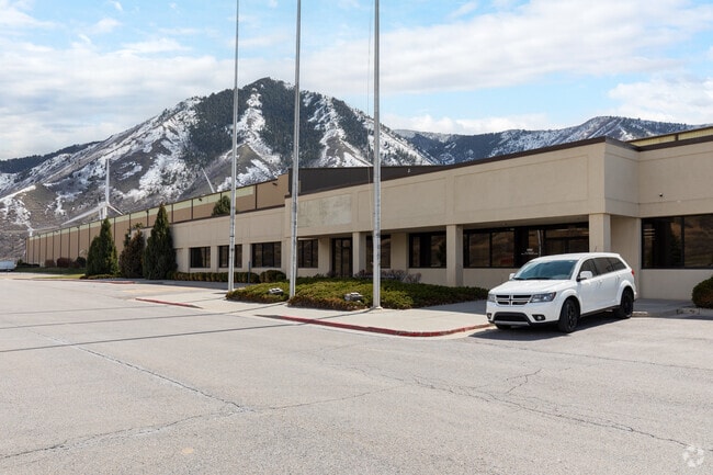
4000 E Highway 6, Spanish Fork, UT 84660


Current Lease Availabilities
Property Detail
4000 E Highway 6
Provo-Orem-Lehi, UT
LOT 4, PLAT A, MOARK JUNCTION SUBDV. AREA 69.933 AC.
46-680-0004
Utah
Commercialnec
Utah
RA5
4
2024
69.93 AC
2025
Utah County
010406
Salt Lake City
10,479 SF
NEARBY LISTINGS FOR SALE OR LEASE
-
-
View all Spanish Fork listings for lease on LoopNet.com
DEMOGRAPHICS near 4000 E Highway 6
1 mile
3 mile
5 mile
2025 Total Population
898
23,998
74,145
2030 Population
989
26,533
82,011
Pop Growth 2025-2030
+ 10.13%
+ 10.56%
+ 10.61%
Average Age
35
32
33
2025 Total Households
242
6,022
19,992
HH Growth 2025-2030
+ 11.16%
+ 11.41%
+ 11.29%
Median Household Inc
$113,306
$126,253
$112,176
Avg Household Size
3.70
4.00
3.70
2025 Avg HH Vehicles
3.00
3.00
3.00
Median Home Value
$643,442
$645,567
$613,758
Median Year Built
2001
2006
2003
Nearby Places
Map Layers
Map Styles
 Street
 Aerial
Layers
 Traffic
 Biking
Places
Listings with unknown addresses are not visible on the map
- Restaurants
- Banks
- Shops
- Fitness
- Groceries
PUBLIC TRANSPORTATION
AIRPORT
Provo Municipal
Drive
Walk
Distance
Provo Municipal
24 min
14.2 mi
Freight Ports
Port of Stockton
Drive
Walk
Distance
Port of Stockton
773 min
750.8 mi
Nearby Properties
Address
Land Use
TOTAL SIZE
Lot Size
Zoning
Address
Land Use
TOTAL SIZE
Lot Size
Zoning
49,436 SF
6.30 AC
Address
Land Use
TOTAL SIZE
Lot Size
Zoning
88,763 SF
5.89 AC
Address
Land Use
TOTAL SIZE
Lot Size
Zoning
54,208 SF
20.51 AC
Address
Land Use
TOTAL SIZE
Lot Size
Zoning
36,021 SF
1.54 AC
Address
Land Use
TOTAL SIZE
Lot Size
Zoning
75,796 SF
3.07 AC
Address
Land Use
TOTAL SIZE
Lot Size
Zoning
5,758 SF
3.08 AC
Address
Land Use
TOTAL SIZE
Lot Size
Zoning
11,487 SF
1.30 AC
Address
Land Use
TOTAL SIZE
Lot Size
Zoning
4,540 SF
1.48 AC
Address
Land Use
TOTAL SIZE
Lot Size
Zoning
15.97 AC
Address
Land Use
TOTAL SIZE
Lot Size
Zoning
16.07 AC
Address
Land Use
TOTAL SIZE
Lot Size
Zoning
17,864 SF
1.54 AC
Address
Land Use
TOTAL SIZE
Lot Size
Zoning
10 AC
RA5
Address
Land Use
TOTAL SIZE
Lot Size
Zoning
8,734 SF
0.99 AC
Address
Land Use
TOTAL SIZE
Lot Size
Zoning
21,323 SF
1.70 AC
Address
Land Use
TOTAL SIZE
Lot Size
Zoning
3,837 SF
1.14 AC
Address
Land Use
TOTAL SIZE
Lot Size
Zoning
9,218 SF
8.64 AC
RA5
Address
Land Use
TOTAL SIZE
Lot Size
Zoning
5,048 SF
3.65 AC
RA5
Address
Land Use
TOTAL SIZE
Lot Size
Zoning
Address
Land Use
TOTAL SIZE
Lot Size
Zoning
2,731 SF
0.69 AC
Address
Land Use
TOTAL SIZE
Lot Size
Zoning
Address
Land Use
TOTAL SIZE
Lot Size
Zoning
Address
Land Use
TOTAL SIZE
Lot Size
Zoning
3,740 SF
1.01 AC
Address
Land Use
TOTAL SIZE
Lot Size
Zoning
11.75 AC
Address
Land Use
TOTAL SIZE
Lot Size
Zoning
4,090 SF
0.56 AC
Address
Land Use
TOTAL SIZE
Lot Size
Zoning
4.50 AC
Address
Land Use
TOTAL SIZE
Lot Size
Zoning
3,990 SF
0.66 AC
Address
Land Use
TOTAL SIZE
Lot Size
Zoning
13,175 SF
7.35 AC
RA5
Address
Land Use
TOTAL SIZE
Lot Size
Zoning
The World's #1 Commercial Real Estate Marketplace
Connect with us
© 2026 CoStar Group
The information above has been obtained from sources believed reliable. While we do not doubt its accuracy we have not verified it and make no guarantee, warranty or representation about it. It is your responsibility to independently confirm its accuracy and completeness. Any projections, opinions, assumptions, or estimates used are for example only and do not represent the current or future performance of the property. The value of this transaction to you depends on tax and other factors which should be evaluated by your tax, financial, and legal advisors. You and your advisors should conduct a careful, independent investigation of the property to determine to your satisfaction the suitability of the property for your needs.