Property Record
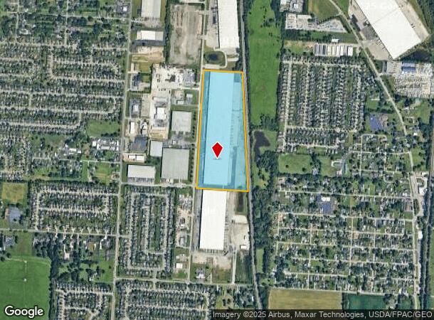
4000 Lockbourne Ind Pw Pkwy, Columbus Grove, OH 45830
NEARBY LISTINGS FOR SALE OR LEASE
Property Detail
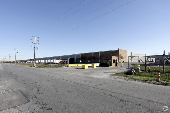
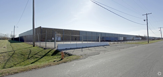
4000 Lockbourne Ind Pw Pkwy
510-212189
Lockbourne Industrial Park
Industrialgeneral
LOCKBOURNE PKWY LOCKBOURNE INDUST PK RES A 35.067 ACRES
X
Franklin
39049C0339K
Ohio
2024
35.07 AC
2024
Southeast
030500
Columbus
761,098 SF
Columbus, OH
DEMOGRAPHICS near 4000 Lockbourne Ind Pw Pkwy
1 Mile
3 Mile
5 Mile
2024 Total Population
7,090
37,826
127,687
2029 Population
7,059
37,843
128,712
Pop Growth 2024-2029
(0.44%)
+ 0.04%
+ 0.80%
Average Age
38
40
39
2024 Total Households
2,449
14,390
52,398
HH Growth 2024-2029
(0.45%)
(0.01%)
+ 0.78%
Median Household Inc
$71,082
$58,679
$58,754
Avg Household Size
2.80
2.60
2.30
2024 Avg HH Vehicles
2.00
2.00
2.00
Median Home Value
$154,473
$153,385
$184,408
Median Year Built
1972
1971
1966
Nearby Places
Map Layers
Map Styles
 Street
 Aerial
- Restaurants
- Banks
- Shops
- Fitness
- Groceries
PUBLIC TRANSPORTATION
AIRPORT
Rickenbacker International
DRIVE
WALK
Distance
Rickenbacker International
14 min
6.2 mi
John Glenn Columbus International
DRIVE
WALK
Distance
John Glenn Columbus International
23 min
12.6 mi
Freight Ports
Port of Toledo
DRIVE
WALK
Distance
Port of Toledo
196 min
152.2 mi
SALE & LEASE HISTORY
LISTING DATE
SALE/LEASE

Sep 25, 2016
For Lease
Sep 23, 2016
For Sale
May 12, 2021
For Lease
Nearby Properties
Address
Land Use
TOTAL SIZE
Lot Size
Zoning
Address
Land Use
TOTAL SIZE
Lot Size
Zoning
587,462 SF
480.43 AC
Address
Land Use
TOTAL SIZE
Lot Size
Zoning
859,800 SF
68.91 AC
Address
Land Use
TOTAL SIZE
Lot Size
Zoning
1,054,500 SF
59.77 AC
Address
Land Use
TOTAL SIZE
Lot Size
Zoning
1,021,020 SF
68.44 AC
Address
Land Use
TOTAL SIZE
Lot Size
Zoning
785,854 SF
30.85 AC
Address
Land Use
TOTAL SIZE
Lot Size
Zoning
541,910 SF
36.84 AC
Address
Land Use
TOTAL SIZE
Lot Size
Zoning
130,865 SF
9.97 AC
Address
Land Use
TOTAL SIZE
Lot Size
Zoning
767,697 SF
39.49 AC
Address
Land Use
TOTAL SIZE
Lot Size
Zoning
655,288 SF
40.76 AC
Address
Land Use
TOTAL SIZE
Lot Size
Zoning
737,054 SF
37.15 AC
Address
Land Use
TOTAL SIZE
Lot Size
Zoning
614,138 SF
36.90 AC
Address
Land Use
TOTAL SIZE
Lot Size
Zoning
642,331 SF
25.16 AC
Address
Land Use
TOTAL SIZE
Lot Size
Zoning
478,544 SF
23.04 AC
Address
Land Use
TOTAL SIZE
Lot Size
Zoning
478,544 SF
24.25 AC
Address
Land Use
TOTAL SIZE
Lot Size
Zoning
462,840 SF
27.07 AC
Address
Land Use
TOTAL SIZE
Lot Size
Zoning
107,676 SF
14.15 AC
Address
Land Use
TOTAL SIZE
Lot Size
Zoning
352,500 SF
20.75 AC
Address
Land Use
TOTAL SIZE
Lot Size
Zoning
516,025 SF
24.18 AC
Address
Land Use
TOTAL SIZE
Lot Size
Zoning
389,476 SF
18.84 AC
Address
Land Use
TOTAL SIZE
Lot Size
Zoning
455,654 SF
24.55 AC
Address
Land Use
TOTAL SIZE
Lot Size
Zoning
323,376 SF
23.64 AC
Address
Land Use
TOTAL SIZE
Lot Size
Zoning
311,190 SF
21.90 AC
Address
Land Use
TOTAL SIZE
Lot Size
Zoning
276,284 SF
14.77 AC
Address
Land Use
TOTAL SIZE
Lot Size
Zoning
493,392 SF
28.93 AC
Address
Land Use
TOTAL SIZE
Lot Size
Zoning
257,400 SF
18.71 AC
Address
Land Use
TOTAL SIZE
Lot Size
Zoning
705,600 SF
43.41 AC
Address
Land Use
TOTAL SIZE
Lot Size
Zoning
235,600 SF
11.25 AC
Address
Land Use
TOTAL SIZE
Lot Size
Zoning
604,078 SF
50.18 AC
Address
Land Use
TOTAL SIZE
Lot Size
Zoning
386,400 SF
21.24 AC
Address
Land Use
TOTAL SIZE
Lot Size
Zoning
111,874 SF
21.97 AC
The World's #1 Commercial Real Estate Marketplace
Connect with us
© 2025 CoStar Group
The information above has been obtained from sources believed reliable. While we do not doubt its accuracy we have not verified it and make no guarantee, warranty or representation about it. It is your responsibility to independently confirm its accuracy and completeness. Any projections, opinions, assumptions, or estimates used are for example only and do not represent the current or future performance of the property. The value of this transaction to you depends on tax and other factors which should be evaluated by your tax, financial, and legal advisors. You and your advisors should conduct a careful, independent investigation of the property to determine to your satisfaction the suitability of the property for your needs.