Property Record
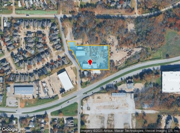
4000 N Tarrant Main St, Euless, TX 76040

NEARBY LISTINGS FOR SALE OR LEASE
Property Detail
4000 N Tarrant Main St
Dallas-Fort Worth-Arlington, TX
Threatt, Ray Subdivision Lot
41712773
THREATT, RAY SUBDIVISION LOT 1R PER PLAT D214080334
Commercialnec
Tarrant
X
Texas
48439C0230L
1r
2023
2.49 AC
2024
Upper Great Southwest
106523
Dallas/Ft Worth
10,000 SF
DEMOGRAPHICS near 4000 N Tarrant Main St
1 Mile
3 Mile
5 Mile
2024 Total Population
15,011
83,943
241,589
2029 Population
15,787
88,741
252,259
Pop Growth 2024-2029
+ 5.17%
+ 5.72%
+ 4.42%
Average Age
36
36
37
2024 Total Households
6,030
36,206
102,768
HH Growth 2024-2029
+ 5.19%
+ 5.56%
+ 4.50%
Median Household Inc
$57,665
$66,661
$64,393
Avg Household Size
2.40
2.30
2.30
2024 Avg HH Vehicles
2.00
2.00
2.00
Median Home Value
$264,636
$295,922
$288,520
Median Year Built
1988
1989
1986
Nearby Places
Map Layers
Map Styles
 Street
 Aerial
- Restaurants
- Banks
- Shops
- Fitness
- Groceries
PUBLIC TRANSPORTATION
COMMUTER RAIL
Centre Port/DFW (Trinity Railway Express - Dallas Area Rapid Transit (DART))
DRIVE
WALK
Distance
Centre Port/DFW (Trinity Railway Express - Dallas Area Rapid Transit (DART))
5 min
1.9 mi
DRIVE
WALK
Distance
11 min
3.7 mi
AIRPORT
Dallas-Fort Worth International
DRIVE
WALK
Distance
Dallas-Fort Worth International
14 min
8.1 mi
Dallas Love Field
DRIVE
WALK
Distance
Dallas Love Field
26 min
16.9 mi
Nearby Properties
Address
Land Use
TOTAL SIZE
Lot Size
Zoning
Address
Land Use
TOTAL SIZE
Lot Size
Zoning
3,204,300 SF
124.04 AC
Address
Land Use
TOTAL SIZE
Lot Size
Zoning
1,344,594 SF
44.86 AC
Address
Land Use
TOTAL SIZE
Lot Size
Zoning
1,447,078 SF
41.52 AC
Address
Land Use
TOTAL SIZE
Lot Size
Zoning
394,769 SF
20.36 AC
Address
Land Use
TOTAL SIZE
Lot Size
Zoning
468,250 SF
37.03 AC
Address
Land Use
TOTAL SIZE
Lot Size
Zoning
467,694 SF
24.03 AC
Address
Land Use
TOTAL SIZE
Lot Size
Zoning
332,952 SF
13.54 AC
Address
Land Use
TOTAL SIZE
Lot Size
Zoning
516,974 SF
23.81 AC
Address
Land Use
TOTAL SIZE
Lot Size
Zoning
485,911 SF
54.76 AC
Address
Land Use
TOTAL SIZE
Lot Size
Zoning
521,200 SF
7.99 AC
Address
Land Use
TOTAL SIZE
Lot Size
Zoning
548,095 SF
7.19 AC
Address
Land Use
TOTAL SIZE
Lot Size
Zoning
522,294 SF
18.35 AC
Address
Land Use
TOTAL SIZE
Lot Size
Zoning
501,933 SF
16.25 AC
Address
Land Use
TOTAL SIZE
Lot Size
Zoning
443,420 SF
10.96 AC
Address
Land Use
TOTAL SIZE
Lot Size
Zoning
363,849 SF
8.08 AC
Address
Land Use
TOTAL SIZE
Lot Size
Zoning
591,105 SF
46.67 AC
Address
Land Use
TOTAL SIZE
Lot Size
Zoning
290,680 SF
26.31 AC
Address
Land Use
TOTAL SIZE
Lot Size
Zoning
294,296 SF
12.08 AC
Address
Land Use
TOTAL SIZE
Lot Size
Zoning
348,842 SF
17.09 AC
Address
Land Use
TOTAL SIZE
Lot Size
Zoning
266,586 SF
11.47 AC
Address
Land Use
TOTAL SIZE
Lot Size
Zoning
342,583 SF
23.87 AC
Address
Land Use
TOTAL SIZE
Lot Size
Zoning
344,326 SF
15.25 AC
Address
Land Use
TOTAL SIZE
Lot Size
Zoning
339,965 SF
15.59 AC
Address
Land Use
TOTAL SIZE
Lot Size
Zoning
220,435 SF
14.97 AC
Address
Land Use
TOTAL SIZE
Lot Size
Zoning
300,915 SF
24.90 AC
Address
Land Use
TOTAL SIZE
Lot Size
Zoning
285,194 SF
15.91 AC
Address
Land Use
TOTAL SIZE
Lot Size
Zoning
293,822 SF
18.80 AC
Address
Land Use
TOTAL SIZE
Lot Size
Zoning
520,000 SF
28.92 AC
Z123
Address
Land Use
TOTAL SIZE
Lot Size
Zoning
345,216 SF
21.64 AC
Address
Land Use
TOTAL SIZE
Lot Size
Zoning
563,300 SF
27.40 AC
Z128
The World's #1 Commercial Real Estate Marketplace
Connect with us
© 2026 CoStar Group
The information above has been obtained from sources believed reliable. While we do not doubt its accuracy we have not verified it and make no guarantee, warranty or representation about it. It is your responsibility to independently confirm its accuracy and completeness. Any projections, opinions, assumptions, or estimates used are for example only and do not represent the current or future performance of the property. The value of this transaction to you depends on tax and other factors which should be evaluated by your tax, financial, and legal advisors. You and your advisors should conduct a careful, independent investigation of the property to determine to your satisfaction the suitability of the property for your needs.