Property Record
4000 Ne 164Th Ave, Vancouver, WA 98682


NEARBY LISTINGS FOR SALE OR LEASE
Property Detail
4000 Ne 164Th Ave
159328-000
Springbrook Ridge
Publicschool
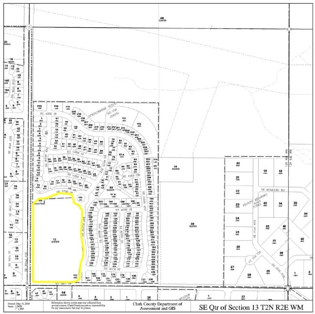
#12 OF SEC 13 T2N R2EWM 9.428A FOR ASSESSOR USE ONLY COMMENCING AT THE SOUTH QUARTER CORNER OF SAID SECTION 13, THENCE ALONG THE WEST LINE OF THE SOUTHEAST QUARTER OF SAID SECTION 13, NORTH 014219 EAST, FOR A DISTANCE OF 830.05 FEET; THENCE LEAVING S
X
Clark
53011C0394D
Washington
0
9.43 AC
2025
Camas/Washougal
041334
Portland
61,428 SF
Portland-Vancouver-Hillsboro, OR-WA
DEMOGRAPHICS near 4000 Ne 164Th Ave
1 Mile
3 Mile
5 Mile
2024 Total Population
13,028
103,706
226,548
2029 Population
14,032
112,146
244,934
Pop Growth 2024-2029
+ 7.71%
+ 8.14%
+ 8.12%
Average Age
39
38
39
2024 Total Households
4,171
37,572
84,204
HH Growth 2024-2029
+ 7.91%
+ 8.28%
+ 8.23%
Median Household Inc
$95,661
$81,457
$82,545
Avg Household Size
3.00
2.70
2.60
2024 Avg HH Vehicles
2.00
2.00
2.00
Median Home Value
$398,005
$392,242
$418,532
Median Year Built
1995
1995
1994
Nearby Places
Map Layers
Map Styles
 Street
 Aerial
- Restaurants
- Banks
- Shops
- Fitness
- Groceries
PUBLIC TRANSPORTATION
AIRPORT
Portland International
DRIVE
WALK
Distance
Portland International
21 min
11.1 mi
Freight Ports
Port of Vancouver
DRIVE
WALK
Distance
Port of Vancouver
22 min
11.7 mi
Nearby Properties
Address
Land Use
TOTAL SIZE
Lot Size
Zoning
Address
Land Use
TOTAL SIZE
Lot Size
Zoning
681,799 SF
36.22 AC
IL
Address
Land Use
TOTAL SIZE
Lot Size
Zoning
399,563 SF
12.98 AC
CC
Address
Land Use
TOTAL SIZE
Lot Size
Zoning
613,468 SF
45.44 AC
R1-6
Address
Land Use
TOTAL SIZE
Lot Size
Zoning
304,876 SF
11.34 AC
R-18
Address
Land Use
TOTAL SIZE
Lot Size
Zoning
340,500 SF
19.01 AC
R-22
Address
Land Use
TOTAL SIZE
Lot Size
Zoning
264,044 SF
11.16 AC
CC
Address
Land Use
TOTAL SIZE
Lot Size
Zoning
237,558 SF
15.48 AC
R-22
Address
Land Use
TOTAL SIZE
Lot Size
Zoning
49,124 SF
17.26 AC
R-18
Address
Land Use
TOTAL SIZE
Lot Size
Zoning
233,766 SF
5.34 AC
R-30
Address
Land Use
TOTAL SIZE
Lot Size
Zoning
104,279 SF
6.09 AC
MX
Address
Land Use
TOTAL SIZE
Lot Size
Zoning
282,460 SF
7.85 AC
R-18
Address
Land Use
TOTAL SIZE
Lot Size
Zoning
204,999 SF
5.71 AC
MX
Address
Land Use
TOTAL SIZE
Lot Size
Zoning
280,065 SF
14.80 AC
R-22
Address
Land Use
TOTAL SIZE
Lot Size
Zoning
247,598 SF
45.75 AC
CG
Address
Land Use
TOTAL SIZE
Lot Size
Zoning
253,976 SF
11.46 AC
MX
Address
Land Use
TOTAL SIZE
Lot Size
Zoning
201,471 SF
8.76 AC
CG
Address
Land Use
TOTAL SIZE
Lot Size
Zoning
212,641 SF
8.03 AC
R-22
Address
Land Use
TOTAL SIZE
Lot Size
Zoning
171,584 SF
6.26 AC
MX
Address
Land Use
TOTAL SIZE
Lot Size
Zoning
244,812 SF
16.33 AC
CC
Address
Land Use
TOTAL SIZE
Lot Size
Zoning
100,476 SF
5.51 AC
R-18
Address
Land Use
TOTAL SIZE
Lot Size
Zoning
301,864 SF
9.53 AC
R-22
Address
Land Use
TOTAL SIZE
Lot Size
Zoning
188,974 SF
7.19 AC
R-30
Address
Land Use
TOTAL SIZE
Lot Size
Zoning
220,905 SF
9.04 AC
R-22
Address
Land Use
TOTAL SIZE
Lot Size
Zoning
357,948 SF
8.03 AC
IL
Address
Land Use
TOTAL SIZE
Lot Size
Zoning
706,024 SF
16.41 AC
IL
Address
Land Use
TOTAL SIZE
Lot Size
Zoning
421,150 SF
9.50 AC
R-30
Address
Land Use
TOTAL SIZE
Lot Size
Zoning
164,030 SF
24.75 AC
R-6
Address
Land Use
TOTAL SIZE
Lot Size
Zoning
186,702 SF
34.20 AC
R-4
Address
Land Use
TOTAL SIZE
Lot Size
Zoning
199,550 SF
12.27 AC
R-30
The World's #1 Commercial Real Estate Marketplace
Connect with us
© 2026 CoStar Group
The information above has been obtained from sources believed reliable. While we do not doubt its accuracy we have not verified it and make no guarantee, warranty or representation about it. It is your responsibility to independently confirm its accuracy and completeness. Any projections, opinions, assumptions, or estimates used are for example only and do not represent the current or future performance of the property. The value of this transaction to you depends on tax and other factors which should be evaluated by your tax, financial, and legal advisors. You and your advisors should conduct a careful, independent investigation of the property to determine to your satisfaction the suitability of the property for your needs.