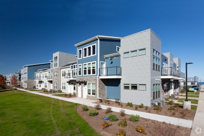
Property Record
4000 S Lake Dr, Saint Francis, WI 53235


NEARBY LISTINGS FOR SALE OR LEASE
Property Detail
4000 S Lake Dr
Milwaukee-Waukesha, WI
CERTIFIED SURVEY MAP NO. 9019, NW 1/4 SEC 22-6-22, LOT 1
543-9027-000
Milwaukee
Commercialnec
Wisconsin
X
1
55079C0176E
11.09 AC
2023
Southern Milwaukee County
2024
Milwaukee/Madison
185100
DEMOGRAPHICS near 4000 S Lake Dr
1 Mile
3 Mile
5 Mile
2024 Total Population
8,395
48,573
146,980
2029 Population
8,245
47,353
143,151
Pop Growth 2024-2029
(1.79%)
(2.51%)
(2.61%)
Average Age
43
42
38
2024 Total Households
4,189
23,086
61,131
HH Growth 2024-2029
(1.67%)
(2.56%)
(2.63%)
Median Household Inc
$60,016
$66,917
$58,082
Avg Household Size
2.00
2.10
2.30
2024 Avg HH Vehicles
1.00
2.00
2.00
Median Home Value
$196,535
$198,486
$182,093
Median Year Built
1957
1952
1950
Nearby Places
Map Layers
Map Styles
 Street
 Aerial
- Restaurants
- Banks
- Shops
- Fitness
- Groceries
PUBLIC TRANSPORTATION
COMMUTER RAIL
General Mitchell Intl. Airport Amtrak Station (Hiawatha Service - Amtrak)
DRIVE
WALK
Distance
General Mitchell Intl. Airport Amtrak Station (Hiawatha Service - Amtrak)
15 min
5.7 mi
Milwaukee (Empire Builder - Amtrak)
DRIVE
WALK
Distance
Milwaukee (Empire Builder - Amtrak)
14 min
7.0 mi
AIRPORT
General Mitchell International
DRIVE
WALK
Distance
General Mitchell International
13 min
5.1 mi
Freight Ports
Port Milwaukee
DRIVE
WALK
Distance
Port Milwaukee
10 min
3.8 mi
Nearby Properties
Address
Land Use
TOTAL SIZE
Lot Size
Zoning
Address
Land Use
TOTAL SIZE
Lot Size
Zoning
Address
Land Use
TOTAL SIZE
Lot Size
Zoning
0.43 AC
RT3
Address
Land Use
TOTAL SIZE
Lot Size
Zoning
Address
Land Use
TOTAL SIZE
Lot Size
Zoning
76.97 AC
IH
Address
Land Use
TOTAL SIZE
Lot Size
Zoning
94.05 AC
PK
Address
Land Use
TOTAL SIZE
Lot Size
Zoning
153,300 SF
7.39 AC
M-1PUD
Address
Land Use
TOTAL SIZE
Lot Size
Zoning
216,281 SF
5.99 AC
RESIDENTIA
Address
Land Use
TOTAL SIZE
Lot Size
Zoning
Address
Land Use
TOTAL SIZE
Lot Size
Zoning
Address
Land Use
TOTAL SIZE
Lot Size
Zoning
Address
Land Use
TOTAL SIZE
Lot Size
Zoning
Address
Land Use
TOTAL SIZE
Lot Size
Zoning
111,759 SF
9.31 AC
LB2
Address
Land Use
TOTAL SIZE
Lot Size
Zoning
153,000 SF
8.22 AC
M-1PUD
Address
Land Use
TOTAL SIZE
Lot Size
Zoning
149,489 SF
7.43 AC
M-1PUD
Address
Land Use
TOTAL SIZE
Lot Size
Zoning
142,210 SF
14.70 AC
M-1PUD
Address
Land Use
TOTAL SIZE
Lot Size
Zoning
405,764 SF
12.70 AC
M-2
Address
Land Use
TOTAL SIZE
Lot Size
Zoning
1.07 AC
LB2
Address
Land Use
TOTAL SIZE
Lot Size
Zoning
126,791 SF
8.81 AC
RESIDENTIA
Address
Land Use
TOTAL SIZE
Lot Size
Zoning
118,320 SF
6.29 AC
M-1PUD
Address
Land Use
TOTAL SIZE
Lot Size
Zoning
7.11 AC
TL
Address
Land Use
TOTAL SIZE
Lot Size
Zoning
Address
Land Use
TOTAL SIZE
Lot Size
Zoning
87,790 SF
7.97 AC
LB2
Address
Land Use
TOTAL SIZE
Lot Size
Zoning
96,096 SF
5.34 AC
RESIDENTIA
Address
Land Use
TOTAL SIZE
Lot Size
Zoning
84,345 SF
2.30 AC
RM4
Address
Land Use
TOTAL SIZE
Lot Size
Zoning
Address
Land Use
TOTAL SIZE
Lot Size
Zoning
150,000 SF
11.13 AC
M-1PUD
Address
Land Use
TOTAL SIZE
Lot Size
Zoning
48.34 AC
M-1C
Address
Land Use
TOTAL SIZE
Lot Size
Zoning
59.55 AC
M-2
Address
Land Use
TOTAL SIZE
Lot Size
Zoning
7.57 AC
RS5
The World's #1 Commercial Real Estate Marketplace
Connect with us
© 2026 CoStar Group
The information above has been obtained from sources believed reliable. While we do not doubt its accuracy we have not verified it and make no guarantee, warranty or representation about it. It is your responsibility to independently confirm its accuracy and completeness. Any projections, opinions, assumptions, or estimates used are for example only and do not represent the current or future performance of the property. The value of this transaction to you depends on tax and other factors which should be evaluated by your tax, financial, and legal advisors. You and your advisors should conduct a careful, independent investigation of the property to determine to your satisfaction the suitability of the property for your needs.