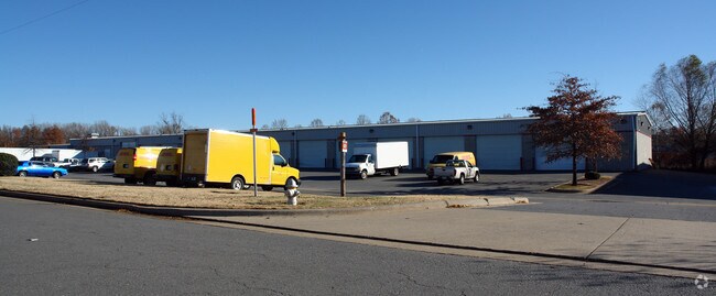
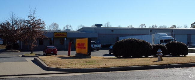
Property Record
4001 Pratt Remmel Rd, Little Rock, AR 72206

NEARBY LISTINGS FOR SALE OR LEASE
Property Detail
4001 Pratt Remmel Rd
24L-015-02-002-00
Pratt Cates Remmel Sub
Officebuilding
Pulaski
X
Arkansas
05119C0479G
2
2025
2.28 AC
2025
Outlying Pulaski County
004001
Little Rock/N Little Rock
3,600 SF
Little Rock-North Little Rock-Conway, AR
DEMOGRAPHICS near 4001 Pratt Remmel Rd
1 Mile
3 Mile
5 Mile
2024 Total Population
780
4,629
31,942
2029 Population
753
4,675
32,786
Pop Growth 2024-2029
(3.46%)
+ 0.99%
+ 2.64%
Average Age
42
41
41
2024 Total Households
337
1,933
15,083
HH Growth 2024-2029
(3.26%)
+ 1.03%
+ 2.61%
Median Household Inc
$60,165
$28,551
$33,001
Avg Household Size
2.30
2.30
2.00
2024 Avg HH Vehicles
2.00
1.00
1.00
Median Home Value
$122,124
$85,548
$98,539
Median Year Built
1990
1975
1967
Nearby Places
Map Layers
Map Styles
 Street
 Aerial
- Restaurants
- Banks
- Shops
- Fitness
- Groceries
PUBLIC TRANSPORTATION
COMMUTER RAIL
DRIVE
WALK
Distance
12 min
7.4 mi
AIRPORT
Bill and Hillary Clinton Ntl/Adams Field
DRIVE
WALK
Distance
Bill and Hillary Clinton Ntl/Adams Field
5 min
2.1 mi
SALE & LEASE HISTORY
LISTING DATE
SALE/LEASE

Nov 06, 2024
For Sale
Jul 21, 2023
For Lease
Nearby Properties
Address
Land Use
TOTAL SIZE
Lot Size
Zoning
Address
Land Use
TOTAL SIZE
Lot Size
Zoning
855,268 SF
82.05 AC
Address
Land Use
TOTAL SIZE
Lot Size
Zoning
379,157 SF
919.20 AC
Address
Land Use
TOTAL SIZE
Lot Size
Zoning
412,597 SF
Address
Land Use
TOTAL SIZE
Lot Size
Zoning
267,152 SF
Address
Land Use
TOTAL SIZE
Lot Size
Zoning
550,000 SF
39.66 AC
Address
Land Use
TOTAL SIZE
Lot Size
Zoning
142,944 SF
Address
Land Use
TOTAL SIZE
Lot Size
Zoning
5,949 SF
25.53 AC
Address
Land Use
TOTAL SIZE
Lot Size
Zoning
345,807 SF
69.54 AC
Address
Land Use
TOTAL SIZE
Lot Size
Zoning
112,500 SF
72.59 AC
Address
Land Use
TOTAL SIZE
Lot Size
Zoning
124,800 SF
23.82 AC
Address
Land Use
TOTAL SIZE
Lot Size
Zoning
31,810 SF
39.99 AC
Address
Land Use
TOTAL SIZE
Lot Size
Zoning
95,472 SF
44.21 AC
Address
Land Use
TOTAL SIZE
Lot Size
Zoning
76,733 SF
Address
Land Use
TOTAL SIZE
Lot Size
Zoning
27,000 SF
9.99 AC
Address
Land Use
TOTAL SIZE
Lot Size
Zoning
272,446 SF
21.74 AC
Address
Land Use
TOTAL SIZE
Lot Size
Zoning
57,648 SF
389.29 AC
Address
Land Use
TOTAL SIZE
Lot Size
Zoning
131,025 SF
176.44 AC
Address
Land Use
TOTAL SIZE
Lot Size
Zoning
1,380 SF
514.53 AC
Address
Land Use
TOTAL SIZE
Lot Size
Zoning
29,792 SF
26.14 AC
Address
Land Use
TOTAL SIZE
Lot Size
Zoning
7,393 SF
38.01 AC
Address
Land Use
TOTAL SIZE
Lot Size
Zoning
Address
Land Use
TOTAL SIZE
Lot Size
Zoning
8,972 SF
15.89 AC
Address
Land Use
TOTAL SIZE
Lot Size
Zoning
30,400 SF
Address
Land Use
TOTAL SIZE
Lot Size
Zoning
7,216 SF
16.01 AC
Address
Land Use
TOTAL SIZE
Lot Size
Zoning
184,524 SF
10.43 AC
Address
Land Use
TOTAL SIZE
Lot Size
Zoning
23,205 SF
9.14 AC
Address
Land Use
TOTAL SIZE
Lot Size
Zoning
25,125 SF
26.87 AC
Address
Land Use
TOTAL SIZE
Lot Size
Zoning
2,460 SF
13.33 AC
Address
Land Use
TOTAL SIZE
Lot Size
Zoning
30,400 SF
Address
Land Use
TOTAL SIZE
Lot Size
Zoning
59,117 SF
4.59 AC
The World's #1 Commercial Real Estate Marketplace
Connect with us
© 2026 CoStar Group
The information above has been obtained from sources believed reliable. While we do not doubt its accuracy we have not verified it and make no guarantee, warranty or representation about it. It is your responsibility to independently confirm its accuracy and completeness. Any projections, opinions, assumptions, or estimates used are for example only and do not represent the current or future performance of the property. The value of this transaction to you depends on tax and other factors which should be evaluated by your tax, financial, and legal advisors. You and your advisors should conduct a careful, independent investigation of the property to determine to your satisfaction the suitability of the property for your needs.