Property Record
4001 Rice St, Saint Paul, MN 55126


NEARBY LISTINGS FOR SALE OR LEASE
Property Detail
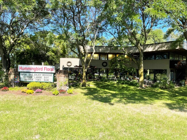
4001 Rice St
25-30-23-11-0002
Section 25 Town 30 Range 23
Storebuilding
SECTION 25 TOWN 30 RANGE 23 SUBJ TO ROW ESMT DOC NO 4984426 & SUBJ ...NE 1/4 OF SD SEC 25 TN 30 RN 23
X
Ramsey
27003C0450E
Minnesota
2024
0.74 AC
2025
Suburban St Paul
040709
Minneapolis/St Paul
5,783 SF
Minneapolis-St. Paul-Bloomington, MN-WI
DEMOGRAPHICS near 4001 Rice St
1 Mile
3 Mile
5 Mile
2024 Total Population
3,915
48,371
137,997
2029 Population
3,810
47,241
134,691
Pop Growth 2024-2029
(2.68%)
(2.34%)
(2.40%)
Average Age
42
43
42
2024 Total Households
1,425
20,118
56,430
HH Growth 2024-2029
(3.02%)
(2.55%)
(2.60%)
Median Household Inc
$152,181
$90,817
$86,401
Avg Household Size
2.60
2.30
2.40
2024 Avg HH Vehicles
2.00
2.00
2.00
Median Home Value
$434,946
$359,354
$330,807
Median Year Built
1982
1980
1978
Nearby Places
Map Layers
Map Styles
 Street
 Aerial
- Restaurants
- Banks
- Shops
- Fitness
- Groceries
PUBLIC TRANSPORTATION
COMMUTER RAIL
DRIVE
WALK
Distance
14 min
8.7 mi
Fridley Station (Northstar Corridor - Northstar Commuter Rail)
DRIVE
WALK
Distance
Fridley Station (Northstar Corridor - Northstar Commuter Rail)
15 min
9.8 mi
AIRPORT
Minneapolis-St Paul International/Wold-Chamberlain
DRIVE
WALK
Distance
Minneapolis-St Paul International/Wold-Chamberlain
28 min
17.3 mi
SALE & LEASE HISTORY
LISTING DATE
SALE/LEASE

Nov 16, 2021
For Sale
Nearby Properties
Address
Land Use
TOTAL SIZE
Lot Size
Zoning
Address
Land Use
TOTAL SIZE
Lot Size
Zoning
70,115 SF
191.32 AC
Address
Land Use
TOTAL SIZE
Lot Size
Zoning
Address
Land Use
TOTAL SIZE
Lot Size
Zoning
9,320 SF
77.38 AC
Address
Land Use
TOTAL SIZE
Lot Size
Zoning
4.18 AC
Address
Land Use
TOTAL SIZE
Lot Size
Zoning
2.39 AC
Address
Land Use
TOTAL SIZE
Lot Size
Zoning
Address
Land Use
TOTAL SIZE
Lot Size
Zoning
13.44 AC
Address
Land Use
TOTAL SIZE
Lot Size
Zoning
4,800 SF
20.36 AC
Address
Land Use
TOTAL SIZE
Lot Size
Zoning
106,400 SF
18.29 AC
Address
Land Use
TOTAL SIZE
Lot Size
Zoning
212,663 SF
3.50 AC
Address
Land Use
TOTAL SIZE
Lot Size
Zoning
159.37 AC
Address
Land Use
TOTAL SIZE
Lot Size
Zoning
150,034 SF
48.48 AC
Address
Land Use
TOTAL SIZE
Lot Size
Zoning
91,679 SF
35.89 AC
Address
Land Use
TOTAL SIZE
Lot Size
Zoning
Address
Land Use
TOTAL SIZE
Lot Size
Zoning
1.77 AC
Address
Land Use
TOTAL SIZE
Lot Size
Zoning
213,177 SF
17.86 AC
Address
Land Use
TOTAL SIZE
Lot Size
Zoning
129,278 SF
4.53 AC
Address
Land Use
TOTAL SIZE
Lot Size
Zoning
126,852 SF
11.86 AC
Address
Land Use
TOTAL SIZE
Lot Size
Zoning
67,693 SF
7.30 AC
Address
Land Use
TOTAL SIZE
Lot Size
Zoning
284,650 SF
16.60 AC
Address
Land Use
TOTAL SIZE
Lot Size
Zoning
209,830 SF
10.06 AC
Address
Land Use
TOTAL SIZE
Lot Size
Zoning
Address
Land Use
TOTAL SIZE
Lot Size
Zoning
138,655 SF
4.70 AC
Address
Land Use
TOTAL SIZE
Lot Size
Zoning
167,134 SF
6.70 AC
Address
Land Use
TOTAL SIZE
Lot Size
Zoning
123,360 SF
14.50 AC
Address
Land Use
TOTAL SIZE
Lot Size
Zoning
26,109 SF
167.19 AC
Address
Land Use
TOTAL SIZE
Lot Size
Zoning
230,592 SF
9.44 AC
Address
Land Use
TOTAL SIZE
Lot Size
Zoning
113,378 SF
13.36 AC
Address
Land Use
TOTAL SIZE
Lot Size
Zoning
147,019 SF
4.02 AC
Address
Land Use
TOTAL SIZE
Lot Size
Zoning
The World's #1 Commercial Real Estate Marketplace
Connect with us
© 2026 CoStar Group
The information above has been obtained from sources believed reliable. While we do not doubt its accuracy we have not verified it and make no guarantee, warranty or representation about it. It is your responsibility to independently confirm its accuracy and completeness. Any projections, opinions, assumptions, or estimates used are for example only and do not represent the current or future performance of the property. The value of this transaction to you depends on tax and other factors which should be evaluated by your tax, financial, and legal advisors. You and your advisors should conduct a careful, independent investigation of the property to determine to your satisfaction the suitability of the property for your needs.