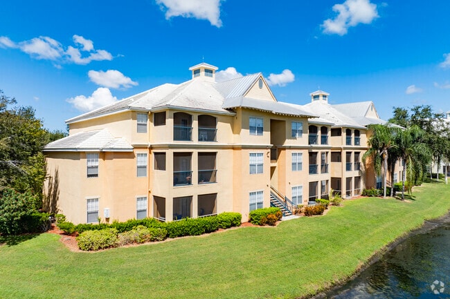
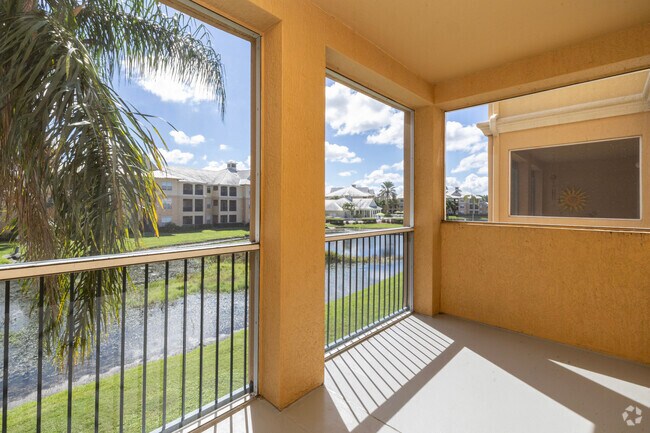
Property Record
4001 Taggart Cay N, Sarasota, FL 34233
NEARBY LISTINGS FOR SALE OR LEASE
Property Detail
4001 Taggart Cay N
North Port-Sarasota-Bradenton, FL
Bee Ridge Farms Sub
0070-08-0001
LOTS 2 & 11, BLK 1, LESS E 19 FT FOR R/W, LESS ADDITIONAL R/W FOR MCINTOSH RD AS DESC IN ORI 2005082373, SUBJ TO 20023 C-SF DRAINAGE ESMT TO SARASOTA COUNTY DESC IN ORI 2001123960, SUBJ TO
Multifamilydwelling
Sarasota
AE
Florida
12115C0161G
2,11
2024
18.88 AC
2025
South Sarasota
001508
Tampa/St Petersburg
263,961 SF
DEMOGRAPHICS near 4001 Taggart Cay N
1 Mile
3 Mile
5 Mile
2024 Total Population
12,512
85,162
185,871
2029 Population
14,166
96,859
213,791
Pop Growth 2024-2029
+ 13.22%
+ 13.73%
+ 15.02%
Average Age
45
46
48
2024 Total Households
5,345
37,292
84,245
HH Growth 2024-2029
+ 13.17%
+ 13.71%
+ 15.17%
Median Household Inc
$73,683
$69,346
$73,143
Avg Household Size
2.20
2.20
2.10
2024 Avg HH Vehicles
2.00
2.00
2.00
Median Home Value
$296,365
$319,621
$355,402
Median Year Built
1977
1979
1981
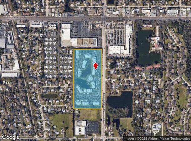
Nearby Places
Map Layers
Map Styles
 Street
 Aerial
- Restaurants
- Banks
- Shops
- Fitness
- Groceries
PUBLIC TRANSPORTATION
AIRPORT
Sarasota/Bradenton International
DRIVE
WALK
Distance
Sarasota/Bradenton International
22 min
11.3 mi
Freight Ports
Port Manatee
DRIVE
WALK
Distance
Port Manatee
40 min
29.5 mi
Nearby Properties
Address
Land Use
TOTAL SIZE
Lot Size
Zoning
Address
Land Use
TOTAL SIZE
Lot Size
Zoning
588,839 SF
42.33 AC
GU
Address
Land Use
TOTAL SIZE
Lot Size
Zoning
409,467 SF
36.72 AC
RMF2
Address
Land Use
TOTAL SIZE
Lot Size
Zoning
19,761 SF
119.20 AC
RMH
Address
Land Use
TOTAL SIZE
Lot Size
Zoning
912,253 SF
43.46 AC
PID
Address
Land Use
TOTAL SIZE
Lot Size
Zoning
370,367 SF
27.32 AC
OPI
Address
Land Use
TOTAL SIZE
Lot Size
Zoning
366,256 SF
32.53 AC
RMF3
Address
Land Use
TOTAL SIZE
Lot Size
Zoning
432,668 SF
72.05 AC
GU
Address
Land Use
TOTAL SIZE
Lot Size
Zoning
15,614 SF
104.95 AC
RMH
Address
Land Use
TOTAL SIZE
Lot Size
Zoning
318,350 SF
14.30 AC
ILW
Address
Land Use
TOTAL SIZE
Lot Size
Zoning
415,689 SF
37.52 AC
OPI
Address
Land Use
TOTAL SIZE
Lot Size
Zoning
258,994 SF
20.03 AC
PCD
Address
Land Use
TOTAL SIZE
Lot Size
Zoning
94,981 SF
6 AC
PCD
Address
Land Use
TOTAL SIZE
Lot Size
Zoning
206,788 SF
122.30 AC
GU
Address
Land Use
TOTAL SIZE
Lot Size
Zoning
150,433 SF
10.55 AC
RMF4
Address
Land Use
TOTAL SIZE
Lot Size
Zoning
170,631 SF
23.70 AC
RMF2
Address
Land Use
TOTAL SIZE
Lot Size
Zoning
157,854 SF
8.32 AC
OPI
Address
Land Use
TOTAL SIZE
Lot Size
Zoning
223,929 SF
28.24 AC
RMF1
Address
Land Use
TOTAL SIZE
Lot Size
Zoning
87,816 SF
24.83 AC
ILW
Address
Land Use
TOTAL SIZE
Lot Size
Zoning
109,470 SF
17.23 AC
RSF2
Address
Land Use
TOTAL SIZE
Lot Size
Zoning
118,713 SF
31.70 AC
MCI
Address
Land Use
TOTAL SIZE
Lot Size
Zoning
373,288 SF
53.07 AC
PID
Address
Land Use
TOTAL SIZE
Lot Size
Zoning
233,075 SF
19.49 AC
RMF2
Address
Land Use
TOTAL SIZE
Lot Size
Zoning
80,038 SF
28.10 AC
ILW
Address
Land Use
TOTAL SIZE
Lot Size
Zoning
133,430 SF
19.60 AC
GU
Address
Land Use
TOTAL SIZE
Lot Size
Zoning
89,418 SF
7.86 AC
GU
Address
Land Use
TOTAL SIZE
Lot Size
Zoning
205,136 SF
17.32 AC
RMF2
Address
Land Use
TOTAL SIZE
Lot Size
Zoning
177,957 SF
19.36 AC
G
Address
Land Use
TOTAL SIZE
Lot Size
Zoning
166,310 SF
40.38 AC
GU
Address
Land Use
TOTAL SIZE
Lot Size
Zoning
140,372 SF
14.31 AC
CG
The World's #1 Commercial Real Estate Marketplace
Connect with us
© 2026 CoStar Group
The information above has been obtained from sources believed reliable. While we do not doubt its accuracy we have not verified it and make no guarantee, warranty or representation about it. It is your responsibility to independently confirm its accuracy and completeness. Any projections, opinions, assumptions, or estimates used are for example only and do not represent the current or future performance of the property. The value of this transaction to you depends on tax and other factors which should be evaluated by your tax, financial, and legal advisors. You and your advisors should conduct a careful, independent investigation of the property to determine to your satisfaction the suitability of the property for your needs.