Property Record
4001 W Algonquin Rd, Algonquin, IL 60102
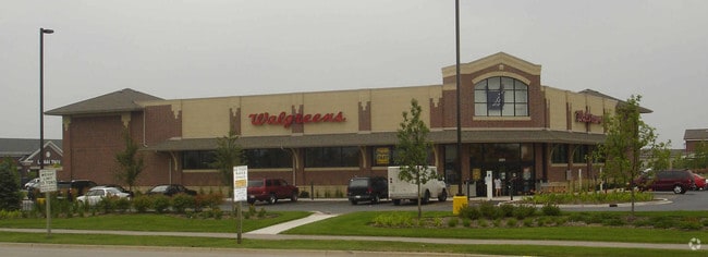

Property Detail
4001 W Algonquin Rd
Chicago-Naperville-Elgin, IL-IN
DOC 2025R0000391 LT 3 SQUARE BARN COMMERCIAL CENTER
18-25-301-052
McHenry
Commercialnec
Illinois
B and X Area of moderate flood hazard, usually the area between the limits of the 100-year and 500-year floods.
3
2024
1.81 AC
2024
Far Northwest
871111
Chicago
14,851 SF
NEARBY LISTINGS FOR SALE OR LEASE
DEMOGRAPHICS near 4001 W Algonquin Rd
1 mile
3 mile
5 mile
2025 Total Population
8,030
67,769
130,565
2030 Population
8,224
68,517
132,247
Pop Growth 2025-2030
+ 2.42%
+ 1.10%
+ 1.29%
Average Age
40
39
41
2025 Total Households
2,661
22,760
46,438
HH Growth 2025-2030
+ 2.48%
+ 1.16%
+ 1.33%
Median Household Inc
$142,092
$122,212
$111,946
Avg Household Size
3.00
2.90
2.80
2025 Avg HH Vehicles
2.00
2.00
2.00
Median Home Value
$403,385
$341,538
$333,163
Median Year Built
1999
1996
1995
Nearby Places
Map Layers
Map Styles
 Street
 Aerial
Layers
 Traffic
 Biking
Places
Listings with unknown addresses are not visible on the map
- Restaurants
- Banks
- Shops
- Fitness
- Groceries
PUBLIC TRANSPORTATION
COMMUTER RAIL
Crystal Lake Station (Union Pacific Northwest Line - Northeast Illinois Regional Commuter Railroad (Metra))
Drive
Walk
Distance
Crystal Lake Station (Union Pacific Northwest Line - Northeast Illinois Regional Commuter Railroad (Metra))
15 min
7.6 mi
Pingree Road Station (Union Pacific Northwest Line - Northeast Illinois Regional Commuter Railroad (Metra))
Drive
Walk
Distance
Pingree Road Station (Union Pacific Northwest Line - Northeast Illinois Regional Commuter Railroad (Metra))
16 min
7.9 mi
AIRPORT
Chicago O'Hare International
Drive
Walk
Distance
Chicago O'Hare International
47 min
35.8 mi
Nearby Properties
Address
Land Use
TOTAL SIZE
Lot Size
Zoning
Address
Land Use
TOTAL SIZE
Lot Size
Zoning
0.90 AC
Address
Land Use
TOTAL SIZE
Lot Size
Zoning
Address
Land Use
TOTAL SIZE
Lot Size
Zoning
Address
Land Use
TOTAL SIZE
Lot Size
Zoning
54,472 SF
21 AC
Address
Land Use
TOTAL SIZE
Lot Size
Zoning
147,496 SF
11.81 AC
Address
Land Use
TOTAL SIZE
Lot Size
Zoning
Address
Land Use
TOTAL SIZE
Lot Size
Zoning
11.91 AC
Address
Land Use
TOTAL SIZE
Lot Size
Zoning
11.86 AC
Address
Land Use
TOTAL SIZE
Lot Size
Zoning
28.69 AC
Address
Land Use
TOTAL SIZE
Lot Size
Zoning
195,564 SF
18.76 AC
Address
Land Use
TOTAL SIZE
Lot Size
Zoning
8.32 AC
Address
Land Use
TOTAL SIZE
Lot Size
Zoning
175,185 SF
13 AC
Address
Land Use
TOTAL SIZE
Lot Size
Zoning
Address
Land Use
TOTAL SIZE
Lot Size
Zoning
106,309 SF
12.96 AC
Address
Land Use
TOTAL SIZE
Lot Size
Zoning
Address
Land Use
TOTAL SIZE
Lot Size
Zoning
3.50 AC
Address
Land Use
TOTAL SIZE
Lot Size
Zoning
85,319 SF
12.04 AC
Address
Land Use
TOTAL SIZE
Lot Size
Zoning
Address
Land Use
TOTAL SIZE
Lot Size
Zoning
Address
Land Use
TOTAL SIZE
Lot Size
Zoning
0.71 AC
Address
Land Use
TOTAL SIZE
Lot Size
Zoning
7.95 AC
Address
Land Use
TOTAL SIZE
Lot Size
Zoning
136,739 SF
15.07 AC
Address
Land Use
TOTAL SIZE
Lot Size
Zoning
134,523 SF
15.27 AC
Address
Land Use
TOTAL SIZE
Lot Size
Zoning
81,873 SF
9.38 AC
Address
Land Use
TOTAL SIZE
Lot Size
Zoning
Address
Land Use
TOTAL SIZE
Lot Size
Zoning
Address
Land Use
TOTAL SIZE
Lot Size
Zoning
8.23 AC
Address
Land Use
TOTAL SIZE
Lot Size
Zoning
94,825 SF
0.50 AC
The World's #1 Commercial Real Estate Marketplace
Connect with us
© 2026 CoStar Group
The information above has been obtained from sources believed reliable. While we do not doubt its accuracy we have not verified it and make no guarantee, warranty or representation about it. It is your responsibility to independently confirm its accuracy and completeness. Any projections, opinions, assumptions, or estimates used are for example only and do not represent the current or future performance of the property. The value of this transaction to you depends on tax and other factors which should be evaluated by your tax, financial, and legal advisors. You and your advisors should conduct a careful, independent investigation of the property to determine to your satisfaction the suitability of the property for your needs.