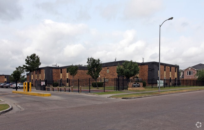
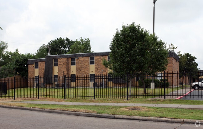
Property Record
4002 Corder St, Houston, TX 77021

Property Detail
4002 Corder St
1193300000001
BLDGS 1 THRU 21 FOURTH MISSIONARY VLG 236 R/P
Governmentalpublicusegeneral
HARRIS
B and X Area of moderate flood hazard, usually the area between the limits of the 100-year and 500-year floods.
Texas
2024
8.52 AC
2025
OST-South Union
313600
Houston
155,977 SF
Houston-Pasadena-The Woodlands, TX
NEARBY LISTINGS FOR SALE OR LEASE
DEMOGRAPHICS near 4002 Corder St
1 mile
3 mile
5 mile
2024 Total Population
17,272
139,586
401,340
2029 Population
17,906
144,336
415,107
Pop Growth 2024-2029
+ 3.67%
+ 3.40%
+ 3.43%
Average Age
37
36
37
2024 Total Households
6,335
53,573
168,140
HH Growth 2024-2029
+ 3.66%
+ 3.69%
+ 3.61%
Median Household Inc
$27,185
$43,676
$57,708
Avg Household Size
2.60
2.30
2.20
2024 Avg HH Vehicles
1.00
1.00
1.00
Median Home Value
$133,793
$159,502
$264,838
Median Year Built
1963
1977
1983
Nearby Places
Map Layers
Map Styles
 Street
 Aerial
Transit
 Traffic
 Biking
Places
Listings with unknown addresses are not visible on the map
- Restaurants
- Banks
- Shops
- Fitness
- Groceries
PUBLIC TRANSPORTATION
COMMUTER RAIL
Houston (Sunset Limited - Amtrak)
Drive
Walk
Distance
Houston (Sunset Limited - Amtrak)
14 min
7.3 mi
AIRPORT
William P Hobby
Drive
Walk
Distance
William P Hobby
22 min
10.1 mi
George Bush Intcntl/Houston
Drive
Walk
Distance
George Bush Intcntl/Houston
35 min
25.1 mi
Freight Ports
Port of Houston
Drive
Walk
Distance
Port of Houston
19 min
10.4 mi
Nearby Properties
Address
Land Use
TOTAL SIZE
Lot Size
Zoning
Address
Land Use
TOTAL SIZE
Lot Size
Zoning
519,409 SF
1.52 AC
Address
Land Use
TOTAL SIZE
Lot Size
Zoning
1,359,194 SF
Address
Land Use
TOTAL SIZE
Lot Size
Zoning
402,467 SF
28.30 AC
Address
Land Use
TOTAL SIZE
Lot Size
Zoning
577,327 SF
28.80 AC
Address
Land Use
TOTAL SIZE
Lot Size
Zoning
396,888 SF
2.02 AC
Address
Land Use
TOTAL SIZE
Lot Size
Zoning
486,076 SF
3.79 AC
Address
Land Use
TOTAL SIZE
Lot Size
Zoning
453,987 SF
4.33 AC
Address
Land Use
TOTAL SIZE
Lot Size
Zoning
527,457 SF
6.21 AC
Address
Land Use
TOTAL SIZE
Lot Size
Zoning
706,892 SF
5.86 AC
Address
Land Use
TOTAL SIZE
Lot Size
Zoning
356,610 SF
2.26 AC
Address
Land Use
TOTAL SIZE
Lot Size
Zoning
557,397 SF
5.58 AC
Address
Land Use
TOTAL SIZE
Lot Size
Zoning
353,738 SF
2.04 AC
Address
Land Use
TOTAL SIZE
Lot Size
Zoning
651,551 SF
52.18 AC
Address
Land Use
TOTAL SIZE
Lot Size
Zoning
372,028 SF
26.56 AC
Address
Land Use
TOTAL SIZE
Lot Size
Zoning
643,698 SF
6.57 AC
Address
Land Use
TOTAL SIZE
Lot Size
Zoning
365,485 SF
13.94 AC
Address
Land Use
TOTAL SIZE
Lot Size
Zoning
397,924 SF
3.64 AC
Address
Land Use
TOTAL SIZE
Lot Size
Zoning
380,761 SF
0.92 AC
Address
Land Use
TOTAL SIZE
Lot Size
Zoning
257,963 SF
6.39 AC
Address
Land Use
TOTAL SIZE
Lot Size
Zoning
518,025 SF
18.09 AC
Address
Land Use
TOTAL SIZE
Lot Size
Zoning
53,600 SF
21.34 AC
Address
Land Use
TOTAL SIZE
Lot Size
Zoning
474,970 SF
6.95 AC
Address
Land Use
TOTAL SIZE
Lot Size
Zoning
460,438 SF
3.37 AC
Address
Land Use
TOTAL SIZE
Lot Size
Zoning
593,742 SF
15.79 AC
Address
Land Use
TOTAL SIZE
Lot Size
Zoning
542,367 SF
18.58 AC
Address
Land Use
TOTAL SIZE
Lot Size
Zoning
164,549 SF
0.34 AC
Address
Land Use
TOTAL SIZE
Lot Size
Zoning
181,517 SF
0.66 AC
Address
Land Use
TOTAL SIZE
Lot Size
Zoning
368,099 SF
9.05 AC
Address
Land Use
TOTAL SIZE
Lot Size
Zoning
476,754 SF
4.14 AC
Address
Land Use
TOTAL SIZE
Lot Size
Zoning
301,566 SF
0.54 AC
The World's #1 Commercial Real Estate Marketplace
Connect with us
© 2026 CoStar Group
The information above has been obtained from sources believed reliable. While we do not doubt its accuracy we have not verified it and make no guarantee, warranty or representation about it. It is your responsibility to independently confirm its accuracy and completeness. Any projections, opinions, assumptions, or estimates used are for example only and do not represent the current or future performance of the property. The value of this transaction to you depends on tax and other factors which should be evaluated by your tax, financial, and legal advisors. You and your advisors should conduct a careful, independent investigation of the property to determine to your satisfaction the suitability of the property for your needs.