Property Record
4003 W Post Rd Nw, Cedar Rapids, IA 52405

NEARBY LISTINGS FOR SALE OR LEASE
Property Detail
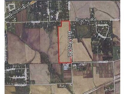
4003 W Post Rd Nw
20024-01002-00000
NE SE EX N400 STR/LB 2 82 8
Agriculturalland
Linn
X
Iowa
19113C0405F
26.20 AC
2024
Iowa City/Waterloo
2025
Other Market Areas
001101
Cedar Rapids, IA
DEMOGRAPHICS near 4003 W Post Rd Nw
1 Mile
3 Mile
5 Mile
2024 Total Population
4,171
33,884
72,639
2029 Population
4,209
33,822
72,700
Pop Growth 2024-2029
+ 0.91%
(0.18%)
+ 0.08%
Average Age
41
40
39
2024 Total Households
1,901
14,163
30,559
HH Growth 2024-2029
+ 0.68%
(0.14%)
+ 0.11%
Median Household Inc
$72,978
$66,108
$60,247
Avg Household Size
2.10
2.30
2.30
2024 Avg HH Vehicles
2.00
2.00
2.00
Median Home Value
$176,855
$175,849
$166,763
Median Year Built
2004
1986
1976
Nearby Places
Map Layers
Map Styles
 Street
 Aerial
- Restaurants
- Banks
- Shops
- Fitness
- Groceries
PUBLIC TRANSPORTATION
AIRPORT
The Eastern Iowa
DRIVE
WALK
Distance
The Eastern Iowa
10 min
5.0 mi
Freight Ports
Port Milwaukee
DRIVE
WALK
Distance
Port Milwaukee
303 min
255.1 mi
Nearby Properties
Address
Land Use
TOTAL SIZE
Lot Size
Zoning
Address
Land Use
TOTAL SIZE
Lot Size
Zoning
550,428 SF
78.91 AC
Address
Land Use
TOTAL SIZE
Lot Size
Zoning
427,700 SF
12.67 AC
Address
Land Use
TOTAL SIZE
Lot Size
Zoning
68,553 SF
7.70 AC
Address
Land Use
TOTAL SIZE
Lot Size
Zoning
42,449 SF
4.70 AC
Address
Land Use
TOTAL SIZE
Lot Size
Zoning
541,028 SF
76.36 AC
AG
Address
Land Use
TOTAL SIZE
Lot Size
Zoning
1,049,268 SF
79.35 AC
Address
Land Use
TOTAL SIZE
Lot Size
Zoning
59,467 SF
8.39 AC
Address
Land Use
TOTAL SIZE
Lot Size
Zoning
243,300 SF
22.44 AC
Address
Land Use
TOTAL SIZE
Lot Size
Zoning
66,922 SF
4.90 AC
Address
Land Use
TOTAL SIZE
Lot Size
Zoning
907,717 SF
152.19 AC
Address
Land Use
TOTAL SIZE
Lot Size
Zoning
315,459 SF
13.85 AC
Address
Land Use
TOTAL SIZE
Lot Size
Zoning
416,830 SF
18.06 AC
Address
Land Use
TOTAL SIZE
Lot Size
Zoning
88,849 SF
18.63 AC
Address
Land Use
TOTAL SIZE
Lot Size
Zoning
203,840 SF
18.22 AC
Address
Land Use
TOTAL SIZE
Lot Size
Zoning
212,316 SF
23.89 AC
Address
Land Use
TOTAL SIZE
Lot Size
Zoning
205,013 SF
16.44 AC
Address
Land Use
TOTAL SIZE
Lot Size
Zoning
189,188 SF
19.44 AC
Address
Land Use
TOTAL SIZE
Lot Size
Zoning
175,600 SF
15.91 AC
Address
Land Use
TOTAL SIZE
Lot Size
Zoning
44,754 SF
6 AC
Address
Land Use
TOTAL SIZE
Lot Size
Zoning
68,384 SF
17.90 AC
Address
Land Use
TOTAL SIZE
Lot Size
Zoning
70,918 SF
6.70 AC
Address
Land Use
TOTAL SIZE
Lot Size
Zoning
49,896 SF
3.80 AC
Address
Land Use
TOTAL SIZE
Lot Size
Zoning
274,433 SF
17.68 AC
Address
Land Use
TOTAL SIZE
Lot Size
Zoning
14,839 SF
1.82 AC
Address
Land Use
TOTAL SIZE
Lot Size
Zoning
232,750 SF
9.65 AC
Address
Land Use
TOTAL SIZE
Lot Size
Zoning
39,679 SF
28.85 AC
Address
Land Use
TOTAL SIZE
Lot Size
Zoning
15,196 SF
1.79 AC
Address
Land Use
TOTAL SIZE
Lot Size
Zoning
320 SF
414.34 AC
AGRICULTUR
Address
Land Use
TOTAL SIZE
Lot Size
Zoning
46,128 SF
20.84 AC
Address
Land Use
TOTAL SIZE
Lot Size
Zoning
43,037 SF
The World's #1 Commercial Real Estate Marketplace
Connect with us
© 2025 CoStar Group
The information above has been obtained from sources believed reliable. While we do not doubt its accuracy we have not verified it and make no guarantee, warranty or representation about it. It is your responsibility to independently confirm its accuracy and completeness. Any projections, opinions, assumptions, or estimates used are for example only and do not represent the current or future performance of the property. The value of this transaction to you depends on tax and other factors which should be evaluated by your tax, financial, and legal advisors. You and your advisors should conduct a careful, independent investigation of the property to determine to your satisfaction the suitability of the property for your needs.