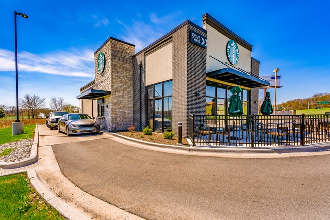
Property Record
4005 7Th St, East Moline, IL 61244


NEARBY LISTINGS FOR SALE OR LEASE
-
-
No Photo
-
-
-
View all East Moline listings for sale on LoopNet.com
Property Detail
4005 7Th St
Davenport-Moline-Rock Island, IA-IL
Hillview 3Rd Add
17-01-305-020
Rock Island
Singlefamilyresidentialassumed
Illinois
X
0.26 AC
17161C0330F
Greater Rock Island
1,590 SF
Davenport/Moline/Rock Island
DEMOGRAPHICS near 4005 7Th St
1 Mile
3 Mile
5 Mile
2024 Total Population
3,582
55,963
124,480
2029 Population
3,482
54,606
122,266
Pop Growth 2024-2029
(2.79%)
(2.42%)
(1.78%)
Average Age
44
41
40
2024 Total Households
1,636
23,557
53,516
HH Growth 2024-2029
(2.81%)
(2.49%)
(1.78%)
Median Household Inc
$70,106
$56,539
$54,042
Avg Household Size
2.20
2.20
2.20
2024 Avg HH Vehicles
2.00
2.00
2.00
Median Home Value
$147,217
$125,484
$136,478
Median Year Built
1959
1950
1955
Nearby Places
Map Layers
Map Styles
 Street
 Aerial
- Restaurants
- Banks
- Shops
- Fitness
- Groceries
PUBLIC TRANSPORTATION
AIRPORT
Quad Cities International
DRIVE
WALK
Distance
Quad Cities International
13 min
6.3 mi
Freight Ports
Port Milwaukee
DRIVE
WALK
Distance
Port Milwaukee
231 min
202.4 mi
SALE & LEASE HISTORY
LISTING DATE
SALE/LEASE

May 20, 2019
For Sale
Nearby Properties
Address
Land Use
TOTAL SIZE
Lot Size
Zoning
Address
Land Use
TOTAL SIZE
Lot Size
Zoning
9,000 SF
408.98 AC
Address
Land Use
TOTAL SIZE
Lot Size
Zoning
333.38 AC
B3
Address
Land Use
TOTAL SIZE
Lot Size
Zoning
3,384,969 SF
128 AC
EM
Address
Land Use
TOTAL SIZE
Lot Size
Zoning
197,382 SF
14.06 AC
EM
Address
Land Use
TOTAL SIZE
Lot Size
Zoning
112,000 SF
16.50 AC
EM
Address
Land Use
TOTAL SIZE
Lot Size
Zoning
166,102 SF
4.36 AC
SIL
Address
Land Use
TOTAL SIZE
Lot Size
Zoning
250,875 SF
11.92 AC
MOL
Address
Land Use
TOTAL SIZE
Lot Size
Zoning
333,348 SF
30.81 AC
EM
Address
Land Use
TOTAL SIZE
Lot Size
Zoning
600 SF
25.17 AC
Address
Land Use
TOTAL SIZE
Lot Size
Zoning
132,647 SF
13.76 AC
MOL
Address
Land Use
TOTAL SIZE
Lot Size
Zoning
196,305 SF
24.75 AC
SIL
Address
Land Use
TOTAL SIZE
Lot Size
Zoning
19.69 AC
MOL
Address
Land Use
TOTAL SIZE
Lot Size
Zoning
194,267 SF
23.16 AC
MOL
Address
Land Use
TOTAL SIZE
Lot Size
Zoning
Address
Land Use
TOTAL SIZE
Lot Size
Zoning
244,440 SF
13.25 AC
MOL
Address
Land Use
TOTAL SIZE
Lot Size
Zoning
10.75 AC
MOL
Address
Land Use
TOTAL SIZE
Lot Size
Zoning
46,917 SF
4.57 AC
SIL
Address
Land Use
TOTAL SIZE
Lot Size
Zoning
142,836 SF
14.60 AC
MOL
Address
Land Use
TOTAL SIZE
Lot Size
Zoning
203,904 SF
12.75 AC
MOL
Address
Land Use
TOTAL SIZE
Lot Size
Zoning
18.46 AC
EM
Address
Land Use
TOTAL SIZE
Lot Size
Zoning
47,578 SF
23.65 AC
MOL
Address
Land Use
TOTAL SIZE
Lot Size
Zoning
45,000 SF
2.52 AC
SIL
Address
Land Use
TOTAL SIZE
Lot Size
Zoning
134,142 SF
13.31 AC
EM
Address
Land Use
TOTAL SIZE
Lot Size
Zoning
9.18 AC
MOL
Address
Land Use
TOTAL SIZE
Lot Size
Zoning
3.12 AC
SIL
Address
Land Use
TOTAL SIZE
Lot Size
Zoning
144,306 SF
16.90 AC
EM
Address
Land Use
TOTAL SIZE
Lot Size
Zoning
162,924 SF
17.18 AC
MOL
Address
Land Use
TOTAL SIZE
Lot Size
Zoning
30,836 SF
4.91 AC
MOL
Address
Land Use
TOTAL SIZE
Lot Size
Zoning
433,640 SF
32.30 AC
EM
The World's #1 Commercial Real Estate Marketplace
Connect with us
© 2026 CoStar Group
The information above has been obtained from sources believed reliable. While we do not doubt its accuracy we have not verified it and make no guarantee, warranty or representation about it. It is your responsibility to independently confirm its accuracy and completeness. Any projections, opinions, assumptions, or estimates used are for example only and do not represent the current or future performance of the property. The value of this transaction to you depends on tax and other factors which should be evaluated by your tax, financial, and legal advisors. You and your advisors should conduct a careful, independent investigation of the property to determine to your satisfaction the suitability of the property for your needs.