Property Record
40051 N Il Route 59 Rd, Antioch, IL 60002
NEARBY LISTINGS FOR SALE OR LEASE
-
-
-
No Photo
-
View all Antioch listings for sale on LoopNet.com
Property Detail
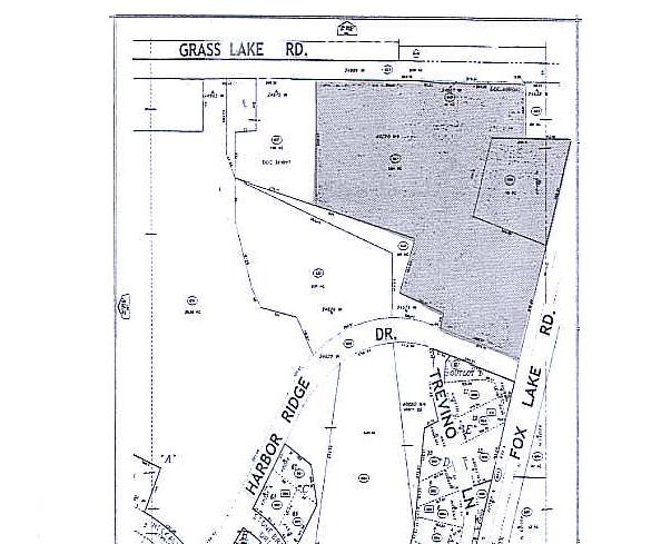
40051 N Il Route 59 Rd
02-19-300-004
TH PT S1/2 SW LYG SELY OF HWY (EX BEG ATX OF N LN & CEN LN R TE59, E465MOL TO W LN E60ACS,S416,W586.84MOL TO CEN HWY,N ELY ALG CEN HWY 434.2MOL TO POB)& (EX W34 S256.6)&(EX E60
Taxexempt
Lake
X
Illinois
17097C0028K
0.36 AC
0
Central Northwest
2024
Chicago
860809
Chicago-Naperville-Elgin, IL-IN-WI
DEMOGRAPHICS near 40051 N Il Route 59 Rd
1 Mile
3 Mile
5 Mile
2024 Total Population
2,384
23,818
85,680
2029 Population
2,386
23,792
85,258
Pop Growth 2024-2029
+ 0.08%
(0.11%)
(0.49%)
Average Age
45
42
41
2024 Total Households
1,013
9,529
32,309
HH Growth 2024-2029
0.00%
(0.16%)
(0.49%)
Median Household Inc
$94,980
$91,695
$91,141
Avg Household Size
2.30
2.50
2.60
2024 Avg HH Vehicles
2.00
2.00
2.00
Median Home Value
$289,807
$258,829
$237,918
Median Year Built
1982
1977
1981
Nearby Places
Map Layers
Map Styles
 Street
 Aerial
- Restaurants
- Banks
- Shops
- Fitness
- Groceries
PUBLIC TRANSPORTATION
COMMUTER RAIL
Antioch Station (North Central Service - Northeast Illinois Regional Commuter Railroad (Metra))
DRIVE
WALK
Distance
Antioch Station (North Central Service - Northeast Illinois Regional Commuter Railroad (Metra))
6 min
3.1 mi
Lake Villa Station (North Central Service - Northeast Illinois Regional Commuter Railroad (Metra))
DRIVE
WALK
Distance
Lake Villa Station (North Central Service - Northeast Illinois Regional Commuter Railroad (Metra))
7 min
3.5 mi
Freight Ports
Port Milwaukee
DRIVE
WALK
Distance
Port Milwaukee
61 min
49.5 mi
Nearby Properties
Address
Land Use
TOTAL SIZE
Lot Size
Zoning
Address
Land Use
TOTAL SIZE
Lot Size
Zoning
209,669 SF
28.20 AC
Address
Land Use
TOTAL SIZE
Lot Size
Zoning
854,280 SF
18.40 AC
Address
Land Use
TOTAL SIZE
Lot Size
Zoning
201,621 SF
16.17 AC
Address
Land Use
TOTAL SIZE
Lot Size
Zoning
46,512 SF
0.45 AC
Address
Land Use
TOTAL SIZE
Lot Size
Zoning
552,960 SF
5.90 AC
Address
Land Use
TOTAL SIZE
Lot Size
Zoning
71,406 SF
2.35 AC
Address
Land Use
TOTAL SIZE
Lot Size
Zoning
54,724 SF
3.89 AC
Address
Land Use
TOTAL SIZE
Lot Size
Zoning
335,145 SF
9.20 AC
Address
Land Use
TOTAL SIZE
Lot Size
Zoning
21,240 SF
3.19 AC
Address
Land Use
TOTAL SIZE
Lot Size
Zoning
58,442 SF
3.70 AC
Address
Land Use
TOTAL SIZE
Lot Size
Zoning
62,388 SF
8.05 AC
Address
Land Use
TOTAL SIZE
Lot Size
Zoning
9,374 SF
4.38 AC
Address
Land Use
TOTAL SIZE
Lot Size
Zoning
75,672 SF
7.18 AC
Address
Land Use
TOTAL SIZE
Lot Size
Zoning
91,081 SF
6.93 AC
Address
Land Use
TOTAL SIZE
Lot Size
Zoning
135,840 SF
5.40 AC
Address
Land Use
TOTAL SIZE
Lot Size
Zoning
18,900 SF
3.64 AC
Address
Land Use
TOTAL SIZE
Lot Size
Zoning
11,924 SF
3.97 AC
Address
Land Use
TOTAL SIZE
Lot Size
Zoning
88,128 SF
0.85 AC
Address
Land Use
TOTAL SIZE
Lot Size
Zoning
9,710 SF
1.71 AC
Address
Land Use
TOTAL SIZE
Lot Size
Zoning
20,509 SF
2.77 AC
Address
Land Use
TOTAL SIZE
Lot Size
Zoning
15,701 SF
2.46 AC
Address
Land Use
TOTAL SIZE
Lot Size
Zoning
25,280 SF
2.17 AC
Address
Land Use
TOTAL SIZE
Lot Size
Zoning
36,816 SF
0.80 AC
Address
Land Use
TOTAL SIZE
Lot Size
Zoning
57,920 SF
1.80 AC
Address
Land Use
TOTAL SIZE
Lot Size
Zoning
30,000 SF
1.57 AC
Address
Land Use
TOTAL SIZE
Lot Size
Zoning
47,130 SF
1.05 AC
Address
Land Use
TOTAL SIZE
Lot Size
Zoning
38,576 SF
3.86 AC
Address
Land Use
TOTAL SIZE
Lot Size
Zoning
50,090 SF
0.97 AC
Address
Land Use
TOTAL SIZE
Lot Size
Zoning
14,550 SF
5.22 AC
Address
Land Use
TOTAL SIZE
Lot Size
Zoning
39,725 SF
1.25 AC
The World's #1 Commercial Real Estate Marketplace
Connect with us
© 2025 CoStar Group
The information above has been obtained from sources believed reliable. While we do not doubt its accuracy we have not verified it and make no guarantee, warranty or representation about it. It is your responsibility to independently confirm its accuracy and completeness. Any projections, opinions, assumptions, or estimates used are for example only and do not represent the current or future performance of the property. The value of this transaction to you depends on tax and other factors which should be evaluated by your tax, financial, and legal advisors. You and your advisors should conduct a careful, independent investigation of the property to determine to your satisfaction the suitability of the property for your needs.