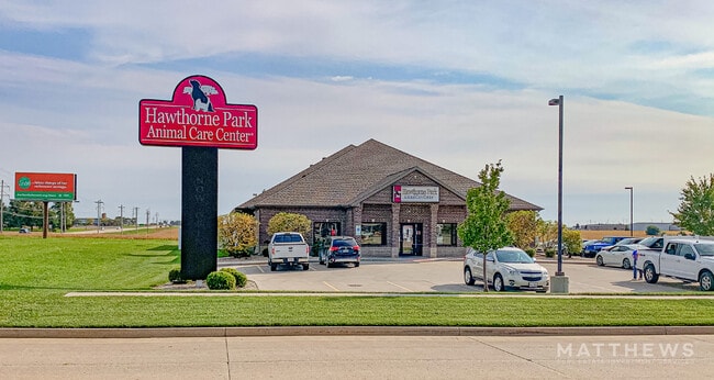
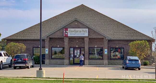
Property Record
4007 Pamela Dr, Bloomington, IL 61704


NEARBY LISTINGS FOR SALE OR LEASE
Property Detail
4007 Pamela Dr
Bloomington, IL
Hawthorne Commerical Sub
15-31-277-003
HAWTHORNE COMMERICAL SUB 6TH ADD LT 17
Commercialnec
Mclean
X
Illinois
17113C0510E
17
2022
0.91 AC
2024
Bloomington/Normal
005104
Other Market Areas
13,276 SF
DEMOGRAPHICS near 4007 Pamela Dr
1 Mile
3 Mile
5 Mile
2024 Total Population
5,913
37,454
92,329
2029 Population
5,917
37,300
92,300
Pop Growth 2024-2029
+ 0.07%
(0.41%)
(0.03%)
Average Age
37
38
37
2024 Total Households
2,232
14,554
37,143
HH Growth 2024-2029
+ 0.13%
(0.36%)
(0.02%)
Median Household Inc
$104,873
$103,466
$72,583
Avg Household Size
2.60
2.50
2.30
2024 Avg HH Vehicles
2.00
2.00
2.00
Median Home Value
$265,999
$239,133
$202,125
Median Year Built
2002
1993
1982
Nearby Places
Map Layers
Map Styles
 Street
 Aerial
- Restaurants
- Banks
- Shops
- Fitness
- Groceries
PUBLIC TRANSPORTATION
COMMUTER RAIL
Bloomington-Normal (Lincoln Service - Amtrak, Lincoln Service Missouri River Runner - Amtrak, Texas Eagle - Amtrak)
DRIVE
WALK
Distance
Bloomington-Normal (Lincoln Service - Amtrak, Lincoln Service Missouri River Runner - Amtrak, Texas Eagle - Amtrak)
11 min
5.3 mi
AIRPORT
Central Il Regional/Bloomington-Normal
DRIVE
WALK
Distance
Central Il Regional/Bloomington-Normal
7 min
2.3 mi
Freight Ports
Port Milwaukee
DRIVE
WALK
Distance
Port Milwaukee
240 min
203.6 mi
SALE & LEASE HISTORY
LISTING DATE
SALE/LEASE

Oct 21, 2020
For Sale
Nearby Properties
Address
Land Use
TOTAL SIZE
Lot Size
Zoning
Address
Land Use
TOTAL SIZE
Lot Size
Zoning
562,852 SF
48.94 AC
Address
Land Use
TOTAL SIZE
Lot Size
Zoning
445,676 SF
20.86 AC
Address
Land Use
TOTAL SIZE
Lot Size
Zoning
426,806 SF
20.93 AC
Address
Land Use
TOTAL SIZE
Lot Size
Zoning
1,624,618 SF
54.32 AC
Address
Land Use
TOTAL SIZE
Lot Size
Zoning
414,270 SF
13.50 AC
Address
Land Use
TOTAL SIZE
Lot Size
Zoning
177,365 SF
11.75 AC
Address
Land Use
TOTAL SIZE
Lot Size
Zoning
123,016 SF
18.52 AC
C-2
Address
Land Use
TOTAL SIZE
Lot Size
Zoning
136,382 SF
9.53 AC
Address
Land Use
TOTAL SIZE
Lot Size
Zoning
16.79 AC
Address
Land Use
TOTAL SIZE
Lot Size
Zoning
423,526 SF
25.35 AC
B-1
Address
Land Use
TOTAL SIZE
Lot Size
Zoning
208,876 SF
20.87 AC
B-1
Address
Land Use
TOTAL SIZE
Lot Size
Zoning
122,112 SF
7.16 AC
Address
Land Use
TOTAL SIZE
Lot Size
Zoning
276,695 SF
12.68 AC
Address
Land Use
TOTAL SIZE
Lot Size
Zoning
28,953 SF
1 AC
Address
Land Use
TOTAL SIZE
Lot Size
Zoning
231,077 SF
15.49 AC
Address
Land Use
TOTAL SIZE
Lot Size
Zoning
197,766 SF
13.86 AC
Address
Land Use
TOTAL SIZE
Lot Size
Zoning
295,802 SF
14.99 AC
Address
Land Use
TOTAL SIZE
Lot Size
Zoning
141,694 SF
5.75 AC
Address
Land Use
TOTAL SIZE
Lot Size
Zoning
139,324 SF
15.78 AC
B-1
Address
Land Use
TOTAL SIZE
Lot Size
Zoning
223,726 SF
10.15 AC
Address
Land Use
TOTAL SIZE
Lot Size
Zoning
180,144 SF
8.95 AC
Address
Land Use
TOTAL SIZE
Lot Size
Zoning
105,746 SF
8.17 AC
B-1
Address
Land Use
TOTAL SIZE
Lot Size
Zoning
166,922 SF
7.42 AC
Address
Land Use
TOTAL SIZE
Lot Size
Zoning
104,805 SF
3.77 AC
Address
Land Use
TOTAL SIZE
Lot Size
Zoning
134,416 SF
4.26 AC
Address
Land Use
TOTAL SIZE
Lot Size
Zoning
98,726 SF
3.97 AC
Address
Land Use
TOTAL SIZE
Lot Size
Zoning
336,536 SF
10.98 AC
Address
Land Use
TOTAL SIZE
Lot Size
Zoning
46,886 SF
2.06 AC
B1
Address
Land Use
TOTAL SIZE
Lot Size
Zoning
119,299 SF
8.91 AC
Address
Land Use
TOTAL SIZE
Lot Size
Zoning
75,574 SF
5.95 AC
B-1
The World's #1 Commercial Real Estate Marketplace
Connect with us
© 2025 CoStar Group
The information above has been obtained from sources believed reliable. While we do not doubt its accuracy we have not verified it and make no guarantee, warranty or representation about it. It is your responsibility to independently confirm its accuracy and completeness. Any projections, opinions, assumptions, or estimates used are for example only and do not represent the current or future performance of the property. The value of this transaction to you depends on tax and other factors which should be evaluated by your tax, financial, and legal advisors. You and your advisors should conduct a careful, independent investigation of the property to determine to your satisfaction the suitability of the property for your needs.