Property Record
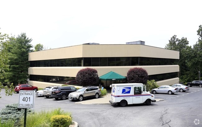
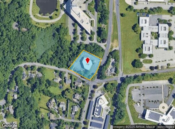
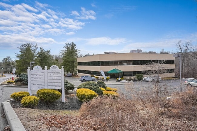
401 Columbus Ave, Valhalla, NY 10595
This Property Is For Sale
NEARBY LISTINGS FOR SALE OR LEASE
Property Detail
401 Columbus Ave
3489-112-019-00001-001-0000
Westchester
Officebuilding
New York
X
1.000
36119C0257F
1.32 AC
2025
West I-287 Corridor
2024
Westchester/So Connecticut
012000
New York-Jersey City-White Plains, NY-NJ
26,508 SF
DEMOGRAPHICS near 401 Columbus Ave
1 Mile
3 Mile
5 Mile
2024 Total Population
4,534
34,673
148,705
2029 Population
4,390
33,823
146,465
Pop Growth 2024-2029
(3.18%)
(2.45%)
(1.51%)
Average Age
43
41
42
2024 Total Households
1,531
11,233
54,984
HH Growth 2024-2029
(3.46%)
(2.72%)
(1.56%)
Median Household Inc
$120,535
$147,989
$130,330
Avg Household Size
2.90
2.80
2.50
2024 Avg HH Vehicles
2.00
2.00
2.00
Median Home Value
$702,226
$719,170
$691,636
Median Year Built
1956
1958
1963
Nearby Places
Map Layers
Map Styles
 Street
 Aerial
- Restaurants
- Banks
- Shops
- Fitness
- Groceries
PUBLIC TRANSPORTATION
TRANSIT/SUBWAY
Mount Pleasant Station (Harlem Line - Metro-North Commuter Railroad Company (Metro-North))
DRIVE
WALK
Distance
Mount Pleasant Station (Harlem Line - Metro-North Commuter Railroad Company (Metro-North))
3 min
19 min
1.0 mi
COMMUTER RAIL
Mount Pleasant Station (Harlem Line - Metro-North Commuter Railroad Company (Metro-North))
DRIVE
WALK
Distance
Mount Pleasant Station (Harlem Line - Metro-North Commuter Railroad Company (Metro-North))
3 min
19 min
1.0 mi
Hawthorne Station (Harlem Line - Metro-North Commuter Railroad Company (Metro-North))
DRIVE
WALK
Distance
Hawthorne Station (Harlem Line - Metro-North Commuter Railroad Company (Metro-North))
4 min
1.7 mi
AIRPORT
Westchester County
DRIVE
WALK
Distance
Westchester County
18 min
9.7 mi
LaGuardia
DRIVE
WALK
Distance
LaGuardia
48 min
31.8 mi
John F Kennedy International
DRIVE
WALK
Distance
John F Kennedy International
58 min
37.9 mi
Freight Ports
NY - Red Hook Container Terminal
DRIVE
WALK
Distance
NY - Red Hook Container Terminal
61 min
40.0 mi
Nearby Properties
Address
Land Use
TOTAL SIZE
Lot Size
Zoning
Address
Land Use
TOTAL SIZE
Lot Size
Zoning
358.83 AC
Address
Land Use
TOTAL SIZE
Lot Size
Zoning
2,760 SF
60.76 AC
Address
Land Use
TOTAL SIZE
Lot Size
Zoning
24.66 AC
Address
Land Use
TOTAL SIZE
Lot Size
Zoning
Address
Land Use
TOTAL SIZE
Lot Size
Zoning
Address
Land Use
TOTAL SIZE
Lot Size
Zoning
29.42 AC
PUD
Address
Land Use
TOTAL SIZE
Lot Size
Zoning
Address
Land Use
TOTAL SIZE
Lot Size
Zoning
39.83 AC
Address
Land Use
TOTAL SIZE
Lot Size
Zoning
50,000 SF
9.02 AC
PD
Address
Land Use
TOTAL SIZE
Lot Size
Zoning
96,560 SF
12.76 AC
DS
Address
Land Use
TOTAL SIZE
Lot Size
Zoning
29.14 AC
PUD
Address
Land Use
TOTAL SIZE
Lot Size
Zoning
15.96 AC
OB
Address
Land Use
TOTAL SIZE
Lot Size
Zoning
3.56 AC
PD
Address
Land Use
TOTAL SIZE
Lot Size
Zoning
100,000 SF
7.21 AC
PD
Address
Land Use
TOTAL SIZE
Lot Size
Zoning
5.43 AC
R-40
Address
Land Use
TOTAL SIZE
Lot Size
Zoning
10.44 AC
Address
Land Use
TOTAL SIZE
Lot Size
Zoning
196,901 SF
4.76 AC
PD
Address
Land Use
TOTAL SIZE
Lot Size
Zoning
98,800 SF
6.83 AC
PD
Address
Land Use
TOTAL SIZE
Lot Size
Zoning
93,500 SF
7.19 AC
PD
Address
Land Use
TOTAL SIZE
Lot Size
Zoning
Address
Land Use
TOTAL SIZE
Lot Size
Zoning
67.38 AC
R-20
Address
Land Use
TOTAL SIZE
Lot Size
Zoning
94,000 SF
4.69 AC
PD
Address
Land Use
TOTAL SIZE
Lot Size
Zoning
70,000 SF
4 AC
PD
Address
Land Use
TOTAL SIZE
Lot Size
Zoning
Address
Land Use
TOTAL SIZE
Lot Size
Zoning
25,000 SF
6.37 AC
PD
Address
Land Use
TOTAL SIZE
Lot Size
Zoning
80,000 SF
3.66 AC
PD
Address
Land Use
TOTAL SIZE
Lot Size
Zoning
8.36 AC
Address
Land Use
TOTAL SIZE
Lot Size
Zoning
1,404 SF
5.46 AC
IB
Address
Land Use
TOTAL SIZE
Lot Size
Zoning
78,674 SF
8.73 AC
PD
Address
Land Use
TOTAL SIZE
Lot Size
Zoning
92,000 SF
7.33 AC
PD
The World's #1 Commercial Real Estate Marketplace
Connect with us
© 2025 CoStar Group
The information above has been obtained from sources believed reliable. While we do not doubt its accuracy we have not verified it and make no guarantee, warranty or representation about it. It is your responsibility to independently confirm its accuracy and completeness. Any projections, opinions, assumptions, or estimates used are for example only and do not represent the current or future performance of the property. The value of this transaction to you depends on tax and other factors which should be evaluated by your tax, financial, and legal advisors. You and your advisors should conduct a careful, independent investigation of the property to determine to your satisfaction the suitability of the property for your needs.