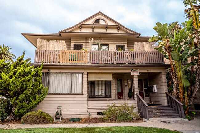
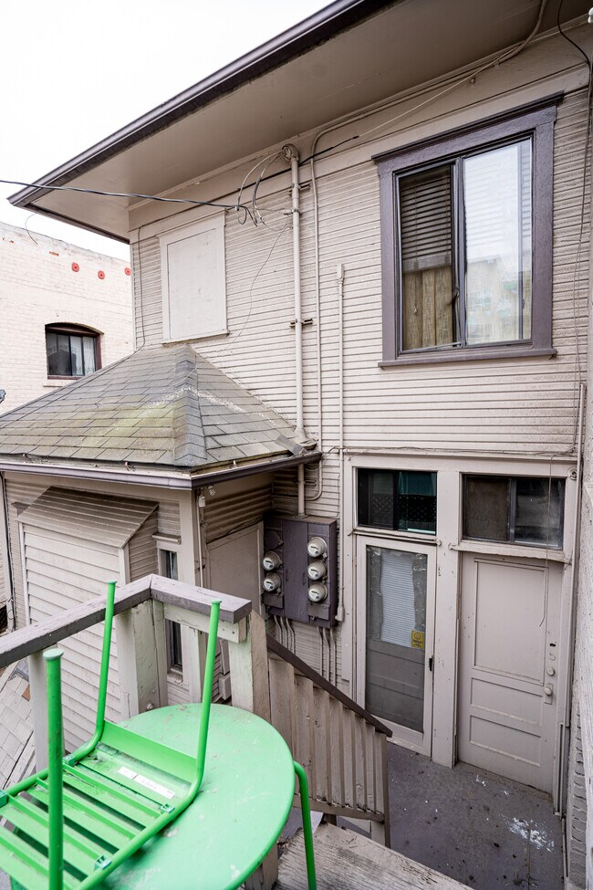
Property Record
401 E 7Th St, Long Beach, CA 90813

NEARBY LISTINGS FOR SALE OR LEASE
Property Detail
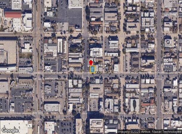
401 E 7Th St
Los Angeles-Long Beach-Glendale, CA
Baxter Todds Subdivision
7273-019-013
BAXTER TODDS SUB OF BLK 29 OF LONG BEACH S 75 FT OF LOT 9
Quadruplex
Los Angeles
X
California
06037C1968G
9
2024
0.09 AC
2025
Downtown Long Beach
576301
Los Angeles
2,886 SF
DEMOGRAPHICS near 401 E 7Th St
1 Mile
3 Mile
5 Mile
2024 Total Population
79,352
235,531
397,254
2029 Population
77,798
228,769
384,836
Pop Growth 2024-2029
(1.96%)
(2.87%)
(3.13%)
Average Age
37
38
39
2024 Total Households
33,436
91,232
147,423
HH Growth 2024-2029
(1.84%)
(2.89%)
(3.21%)
Median Household Inc
$55,065
$63,836
$71,573
Avg Household Size
2.20
2.40
2.50
2024 Avg HH Vehicles
1.00
2.00
2.00
Median Home Value
$569,477
$694,615
$747,374
Median Year Built
1967
1962
1959
Nearby Places
Map Layers
Map Styles
 Street
 Aerial
- Restaurants
- Banks
- Shops
- Fitness
- Groceries
PUBLIC TRANSPORTATION
TRANSIT/SUBWAY
5Th Street Station (Blue Line - Los Angeles County Metropolitan Transportation Authority (Metro))
DRIVE
WALK
Distance
5Th Street Station (Blue Line - Los Angeles County Metropolitan Transportation Authority (Metro))
0 min
4 min
0.2 mi
Anaheim Station (Blue Line - Los Angeles County Metropolitan Transportation Authority (Metro))
DRIVE
WALK
Distance
Anaheim Station (Blue Line - Los Angeles County Metropolitan Transportation Authority (Metro))
2 min
10 min
0.5 mi
1St Street Station (Blue Line - Los Angeles County Metropolitan Transportation Authority (Metro))
DRIVE
WALK
Distance
1St Street Station (Blue Line - Los Angeles County Metropolitan Transportation Authority (Metro))
2 min
11 min
0.6 mi
Pacific Station (Blue Line - Los Angeles County Metropolitan Transportation Authority (Metro))
DRIVE
WALK
Distance
Pacific Station (Blue Line - Los Angeles County Metropolitan Transportation Authority (Metro))
2 min
11 min
0.6 mi
Long Beach Transit Mall (Blue Line - Los Angeles County Metropolitan Transportation Authority (Metro))
DRIVE
WALK
Distance
Long Beach Transit Mall (Blue Line - Los Angeles County Metropolitan Transportation Authority (Metro))
2 min
15 min
0.8 mi
AIRPORT
Long Beach (Daugherty Field)
DRIVE
WALK
Distance
Long Beach (Daugherty Field)
11 min
4.6 mi
John Wayne/Orange County
DRIVE
WALK
Distance
John Wayne/Orange County
31 min
21.1 mi
Los Angeles International
DRIVE
WALK
Distance
Los Angeles International
32 min
22.0 mi
Freight Ports
Port of Long Beach
DRIVE
WALK
Distance
Port of Long Beach
2 min
0.6 mi
SALE & LEASE HISTORY
LISTING DATE
SALE/LEASE

Sep 03, 2021
For Sale
Nearby Properties
Address
Land Use
TOTAL SIZE
Lot Size
Zoning
Address
Land Use
TOTAL SIZE
Lot Size
Zoning
502,333 SF
21.89 AC
LBI
Address
Land Use
TOTAL SIZE
Lot Size
Zoning
402,342 SF
LBPD30
Address
Land Use
TOTAL SIZE
Lot Size
Zoning
845,760 SF
4.01 AC
LBPD6
Address
Land Use
TOTAL SIZE
Lot Size
Zoning
708,409 SF
3.15 AC
LBPD
Address
Land Use
TOTAL SIZE
Lot Size
Zoning
266,158 SF
1 AC
LBPD30
Address
Land Use
TOTAL SIZE
Lot Size
Zoning
617,114 SF
3.53 AC
LBPD
Address
Land Use
TOTAL SIZE
Lot Size
Zoning
918,344 SF
4.14 AC
LBPD30
Address
Land Use
TOTAL SIZE
Lot Size
Zoning
56,300 SF
116.80 AC
LAM3
Address
Land Use
TOTAL SIZE
Lot Size
Zoning
260,804 SF
1.71 AC
LBPD30
Address
Land Use
TOTAL SIZE
Lot Size
Zoning
982,195 SF
1.77 AC
LBPD30
Address
Land Use
TOTAL SIZE
Lot Size
Zoning
182,749 SF
LBPD30
Address
Land Use
TOTAL SIZE
Lot Size
Zoning
393,161 SF
1.11 AC
LBPD30
Address
Land Use
TOTAL SIZE
Lot Size
Zoning
372,367 SF
2.40 AC
LBPD30
Address
Land Use
TOTAL SIZE
Lot Size
Zoning
174,688 SF
0.88 AC
LBI*
Address
Land Use
TOTAL SIZE
Lot Size
Zoning
140,236 SF
9.21 AC
LBR4N
Address
Land Use
TOTAL SIZE
Lot Size
Zoning
199,137 SF
6.39 AC
LBR4R
Address
Land Use
TOTAL SIZE
Lot Size
Zoning
311,796 SF
1.90 AC
LBPD30
Address
Land Use
TOTAL SIZE
Lot Size
Zoning
133,668 SF
0.76 AC
LBCH
Address
Land Use
TOTAL SIZE
Lot Size
Zoning
113,919 SF
0.72 AC
LBPD30
Address
Land Use
TOTAL SIZE
Lot Size
Zoning
194,230 SF
2.58 AC
LBR4N
Address
Land Use
TOTAL SIZE
Lot Size
Zoning
9,629 SF
2.37 AC
LBPD30
Address
Land Use
TOTAL SIZE
Lot Size
Zoning
279,022 SF
1.80 AC
LBCB
Address
Land Use
TOTAL SIZE
Lot Size
Zoning
603,213 SF
4.70 AC
LBI
Address
Land Use
TOTAL SIZE
Lot Size
Zoning
152,584 SF
0.86 AC
LBPD30
Address
Land Use
TOTAL SIZE
Lot Size
Zoning
117,457 SF
0.75 AC
LBPD30
Address
Land Use
TOTAL SIZE
Lot Size
Zoning
84,054 SF
0.34 AC
LBPD
Address
Land Use
TOTAL SIZE
Lot Size
Zoning
74,452 SF
1.05 AC
LBPD30
Address
Land Use
TOTAL SIZE
Lot Size
Zoning
238,914 SF
12.97 AC
LBIP
Address
Land Use
TOTAL SIZE
Lot Size
Zoning
225,486 SF
2.26 AC
LBPD6
The World's #1 Commercial Real Estate Marketplace
Connect with us
© 2025 CoStar Group
The information above has been obtained from sources believed reliable. While we do not doubt its accuracy we have not verified it and make no guarantee, warranty or representation about it. It is your responsibility to independently confirm its accuracy and completeness. Any projections, opinions, assumptions, or estimates used are for example only and do not represent the current or future performance of the property. The value of this transaction to you depends on tax and other factors which should be evaluated by your tax, financial, and legal advisors. You and your advisors should conduct a careful, independent investigation of the property to determine to your satisfaction the suitability of the property for your needs.