Property Record
401 Magrill St, Longview, TX 75601
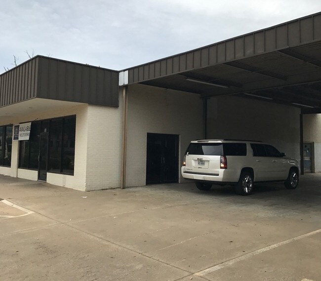

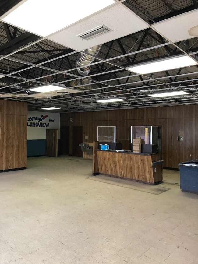
Property Detail
401 Magrill St
Longview, TX
LTS 1 & 2 BLK 36 (NCB82) TEXAS LAND CO & LT 25 NCB 82 MCNUTT ACREAGE
68228
Gregg
Commercialnec
Texas
B and X Area of moderate flood hazard, usually the area between the limits of the 100-year and 500-year floods.
1-2,25
2024
0.63 AC
2025
Longview
001100
Other Market Areas
2,178 SF
NEARBY LISTINGS FOR SALE OR LEASE
DEMOGRAPHICS near 401 Magrill St
1 mile
3 mile
5 mile
2024 Total Population
5,730
45,280
78,904
2029 Population
5,933
46,419
80,544
Pop Growth 2024-2029
+ 3.54%
+ 2.52%
+ 2.08%
Average Age
37
38
38
2024 Total Households
1,909
17,829
31,221
HH Growth 2024-2029
+ 3.82%
+ 2.55%
+ 2.13%
Median Household Inc
$36,582
$57,109
$60,540
Avg Household Size
2.50
2.30
2.40
2024 Avg HH Vehicles
2.00
2.00
2.00
Median Home Value
$97,652
$172,917
$195,697
Median Year Built
1961
1974
1977
Nearby Places
Map Layers
Map Styles
 Street
 Aerial
Transit
 Traffic
 Biking
Places
Listings with unknown addresses are not visible on the map
- Restaurants
- Banks
- Shops
- Fitness
- Groceries
PUBLIC TRANSPORTATION
COMMUTER RAIL
Drive
Walk
Distance
2 min
12 min
0.6 mi
SALE & LEASE HISTORY
LISTING DATE
SALE/LEASE

Sep 22, 2017
For Lease
Nearby Properties
Address
Land Use
TOTAL SIZE
Lot Size
Zoning
Address
Land Use
TOTAL SIZE
Lot Size
Zoning
133.06 AC
Address
Land Use
TOTAL SIZE
Lot Size
Zoning
18,200 SF
151.10 AC
Address
Land Use
TOTAL SIZE
Lot Size
Zoning
372,612 SF
5.72 AC
Address
Land Use
TOTAL SIZE
Lot Size
Zoning
138,850 SF
1.72 AC
Address
Land Use
TOTAL SIZE
Lot Size
Zoning
84,658 SF
24.31 AC
Address
Land Use
TOTAL SIZE
Lot Size
Zoning
116,362 SF
25.20 AC
Address
Land Use
TOTAL SIZE
Lot Size
Zoning
65,115 SF
Address
Land Use
TOTAL SIZE
Lot Size
Zoning
115,023 SF
13.79 AC
Address
Land Use
TOTAL SIZE
Lot Size
Zoning
88,580 SF
21 AC
Address
Land Use
TOTAL SIZE
Lot Size
Zoning
23,556 SF
6.75 AC
Address
Land Use
TOTAL SIZE
Lot Size
Zoning
12.60 AC
Address
Land Use
TOTAL SIZE
Lot Size
Zoning
150,658 SF
32.24 AC
Address
Land Use
TOTAL SIZE
Lot Size
Zoning
58.68 AC
Address
Land Use
TOTAL SIZE
Lot Size
Zoning
92,222 SF
29.77 AC
Address
Land Use
TOTAL SIZE
Lot Size
Zoning
22.75 AC
Address
Land Use
TOTAL SIZE
Lot Size
Zoning
267,277 SF
18.62 AC
Address
Land Use
TOTAL SIZE
Lot Size
Zoning
56,240 SF
90.65 AC
Address
Land Use
TOTAL SIZE
Lot Size
Zoning
181,628 SF
10.35 AC
Address
Land Use
TOTAL SIZE
Lot Size
Zoning
108,356 SF
0.59 AC
Address
Land Use
TOTAL SIZE
Lot Size
Zoning
67,688 SF
7.57 AC
Address
Land Use
TOTAL SIZE
Lot Size
Zoning
10.42 AC
Address
Land Use
TOTAL SIZE
Lot Size
Zoning
11.14 AC
Address
Land Use
TOTAL SIZE
Lot Size
Zoning
Address
Land Use
TOTAL SIZE
Lot Size
Zoning
34,978 SF
11.62 AC
Address
Land Use
TOTAL SIZE
Lot Size
Zoning
9.86 AC
Address
Land Use
TOTAL SIZE
Lot Size
Zoning
67,860 SF
12.52 AC
Address
Land Use
TOTAL SIZE
Lot Size
Zoning
81,648 SF
Address
Land Use
TOTAL SIZE
Lot Size
Zoning
131,046 SF
10.16 AC
Address
Land Use
TOTAL SIZE
Lot Size
Zoning
6.66 AC
Address
Land Use
TOTAL SIZE
Lot Size
Zoning
32,236 SF
15.10 AC
The World's #1 Commercial Real Estate Marketplace
Connect with us
© 2026 CoStar Group
The information above has been obtained from sources believed reliable. While we do not doubt its accuracy we have not verified it and make no guarantee, warranty or representation about it. It is your responsibility to independently confirm its accuracy and completeness. Any projections, opinions, assumptions, or estimates used are for example only and do not represent the current or future performance of the property. The value of this transaction to you depends on tax and other factors which should be evaluated by your tax, financial, and legal advisors. You and your advisors should conduct a careful, independent investigation of the property to determine to your satisfaction the suitability of the property for your needs.