Property Record
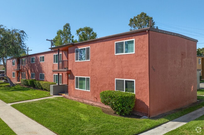
401 Oaklawn Ave, Chula Vista, CA 91910


NEARBY LISTINGS FOR SALE OR LEASE
Property Detail
401 Oaklawn Ave
567-201-02
Chula Vista
Multifamilydwelling
1/4 SEC 163 /EXC ST OP/ & /EXC SLY 190 FT/ W 1/2 OF NE 1/4 OF TR 505
X
San Diego
06073C1914G
California
2025
15 AC
2025
Downtown Chula Vista
012501
San Diego
99,999 SF
San Diego-Carlsbad, CA
DEMOGRAPHICS near 401 Oaklawn Ave
1 Mile
3 Mile
5 Mile
2024 Total Population
25,454
135,454
393,105
2029 Population
25,230
134,150
388,963
Pop Growth 2024-2029
(0.88%)
(0.96%)
(1.05%)
Average Age
38
39
38
2024 Total Households
8,645
43,781
116,907
HH Growth 2024-2029
(1.05%)
(1.13%)
(1.22%)
Median Household Inc
$54,132
$63,857
$70,731
Avg Household Size
2.80
3.00
3.20
2024 Avg HH Vehicles
2.00
2.00
2.00
Median Home Value
$445,034
$598,188
$610,171
Median Year Built
1964
1967
1972
Nearby Places
Map Layers
Map Styles
 Street
 Aerial
- Restaurants
- Banks
- Shops
- Fitness
- Groceries
PUBLIC TRANSPORTATION
TRANSIT/SUBWAY
H Street (Blue Line - San Diego Metropolitan Transit System Trolley (San Diego Trolley))
DRIVE
WALK
Distance
H Street (Blue Line - San Diego Metropolitan Transit System Trolley (San Diego Trolley))
2 min
13 min
0.4 mi
COMMUTER RAIL
San Diego (Santa Fe Depot) (Coaster - San Diego North County Transit District (Coaster/Sprinter/Breeze))
DRIVE
WALK
Distance
San Diego (Santa Fe Depot) (Coaster - San Diego North County Transit District (Coaster/Sprinter/Breeze))
14 min
9.3 mi
AIRPORT
San Diego International
DRIVE
WALK
Distance
San Diego International
17 min
11.9 mi
Freight Ports
Port of San Diego
DRIVE
WALK
Distance
Port of San Diego
12 min
7.8 mi
Nearby Properties
Address
Land Use
TOTAL SIZE
Lot Size
Zoning
Address
Land Use
TOTAL SIZE
Lot Size
Zoning
19.28 AC
60
Address
Land Use
TOTAL SIZE
Lot Size
Zoning
11.42 AC
CP
Address
Land Use
TOTAL SIZE
Lot Size
Zoning
6.55 AC
MXD-2
Address
Land Use
TOTAL SIZE
Lot Size
Zoning
115.70 AC
Marine Ter
Address
Land Use
TOTAL SIZE
Lot Size
Zoning
24.70 AC
C-6
Address
Land Use
TOTAL SIZE
Lot Size
Zoning
9.84 AC
C
Address
Land Use
TOTAL SIZE
Lot Size
Zoning
19.90 AC
C
Address
Land Use
TOTAL SIZE
Lot Size
Zoning
24.06 AC
R3
Address
Land Use
TOTAL SIZE
Lot Size
Zoning
7.52 AC
MCR-2
Address
Land Use
TOTAL SIZE
Lot Size
Zoning
8.96 AC
UC-4
Address
Land Use
TOTAL SIZE
Lot Size
Zoning
6.03 AC
R3
Address
Land Use
TOTAL SIZE
Lot Size
Zoning
2.81 AC
IP
Address
Land Use
TOTAL SIZE
Lot Size
Zoning
6.85 AC
IL
Address
Land Use
TOTAL SIZE
Lot Size
Zoning
4.70 AC
R3
Address
Land Use
TOTAL SIZE
Lot Size
Zoning
16,410 SF
UNZ
Address
Land Use
TOTAL SIZE
Lot Size
Zoning
4.80 AC
MXD-2
Address
Land Use
TOTAL SIZE
Lot Size
Zoning
Address
Land Use
TOTAL SIZE
Lot Size
Zoning
7.52 AC
CTP
Address
Land Use
TOTAL SIZE
Lot Size
Zoning
1.05 AC
C-1
Address
Land Use
TOTAL SIZE
Lot Size
Zoning
9.44 AC
PC
Address
Land Use
TOTAL SIZE
Lot Size
Zoning
1.43 AC
UC-2
Address
Land Use
TOTAL SIZE
Lot Size
Zoning
86,920 SF
2.38 AC
RM-2
Address
Land Use
TOTAL SIZE
Lot Size
Zoning
1.88 AC
UC-2
Address
Land Use
TOTAL SIZE
Lot Size
Zoning
2.24 AC
MXD-2
Address
Land Use
TOTAL SIZE
Lot Size
Zoning
0.89 AC
MXU
Address
Land Use
TOTAL SIZE
Lot Size
Zoning
1.43 AC
UC-2
Address
Land Use
TOTAL SIZE
Lot Size
Zoning
4.71 AC
R3
Address
Land Use
TOTAL SIZE
Lot Size
Zoning
4.42 AC
MM
Address
Land Use
TOTAL SIZE
Lot Size
Zoning
13.87 AC
MXD-2
The World's #1 Commercial Real Estate Marketplace
Connect with us
© 2025 CoStar Group
The information above has been obtained from sources believed reliable. While we do not doubt its accuracy we have not verified it and make no guarantee, warranty or representation about it. It is your responsibility to independently confirm its accuracy and completeness. Any projections, opinions, assumptions, or estimates used are for example only and do not represent the current or future performance of the property. The value of this transaction to you depends on tax and other factors which should be evaluated by your tax, financial, and legal advisors. You and your advisors should conduct a careful, independent investigation of the property to determine to your satisfaction the suitability of the property for your needs.