Property Record
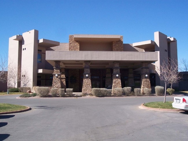
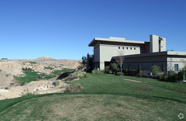
401 Paradise Pky, Mesquite, NV 89027


Property Detail
401 Paradise Pky
001-04-701-036
PARCEL MAP FILE 97 PAGE 66 LOT 1
Recreationalentertainmentgeneral
Clark
PUD
Nevada
B and X Area of moderate flood hazard, usually the area between the limits of the 100-year and 500-year floods.
1
2026
1.97 AC
2026
Outlying NE Clark County
005905
Las Vegas
16,572 SF
Las Vegas-Henderson-North Las Vegas, NV
NEARBY LISTINGS FOR SALE OR LEASE
DEMOGRAPHICS near 401 Paradise Pky
1 mile
3 mile
5 mile
2025 Total Population
5,217
20,426
26,321
2030 Population
5,675
22,049
28,394
Pop Growth 2025-2030
+ 8.78%
+ 7.95%
+ 7.88%
Average Age
59
53
55
2025 Total Households
2,716
9,220
12,165
HH Growth 2025-2030
+ 8.80%
+ 8.08%
+ 8.04%
Median Household Inc
$67,663
$75,802
$75,720
Avg Household Size
1.90
2.20
2.10
2025 Avg HH Vehicles
2.00
2.00
2.00
Median Home Value
$431,124
$426,764
$427,649
Median Year Built
2001
2003
2004
Nearby Places
Map Layers
Map Styles
 Street
 Aerial
Layers
 Traffic
 Biking
Places
Listings with unknown addresses are not visible on the map
- Restaurants
- Banks
- Shops
- Fitness
- Groceries
PUBLIC TRANSPORTATION
AIRPORT
St George Regional
Drive
Walk
Distance
St George Regional
55 min
41.1 mi
SALE & LEASE HISTORY
LISTING DATE
SALE/LEASE

Sep 25, 2016
For Lease
Sep 23, 2016
For Sale
Sep 23, 2016
For Sale
Sep 18, 2018
For Sale
Sep 06, 2019
For Sale
Nearby Properties
Address
Land Use
TOTAL SIZE
Lot Size
Zoning
Address
Land Use
TOTAL SIZE
Lot Size
Zoning
148,373 SF
19.35 AC
HT
Address
Land Use
TOTAL SIZE
Lot Size
Zoning
197,938 SF
35.63 AC
HT
Address
Land Use
TOTAL SIZE
Lot Size
Zoning
123,397 SF
26.60 AC
HT
Address
Land Use
TOTAL SIZE
Lot Size
Zoning
496,775 SF
5.02 AC
HT
Address
Land Use
TOTAL SIZE
Lot Size
Zoning
33.73 AC
PF
Address
Land Use
TOTAL SIZE
Lot Size
Zoning
37.78 AC
PROS
Address
Land Use
TOTAL SIZE
Lot Size
Zoning
12.49 AC
PF
Address
Land Use
TOTAL SIZE
Lot Size
Zoning
67,184 SF
14.69 AC
HT
Address
Land Use
TOTAL SIZE
Lot Size
Zoning
6,831 SF
6.01 AC
CR2
Address
Land Use
TOTAL SIZE
Lot Size
Zoning
10.09 AC
PF
Address
Land Use
TOTAL SIZE
Lot Size
Zoning
73,517 SF
164.64 AC
PF
Address
Land Use
TOTAL SIZE
Lot Size
Zoning
111,642 SF
8.35 AC
IR1
Address
Land Use
TOTAL SIZE
Lot Size
Zoning
47,328 SF
4.65 AC
CR2
Address
Land Use
TOTAL SIZE
Lot Size
Zoning
1,056 SF
5.96 AC
MF4
Address
Land Use
TOTAL SIZE
Lot Size
Zoning
60,114 SF
5.54 AC
HT
Address
Land Use
TOTAL SIZE
Lot Size
Zoning
17,110 SF
2.11 AC
Address
Land Use
TOTAL SIZE
Lot Size
Zoning
13,286 SF
1.63 AC
Address
Land Use
TOTAL SIZE
Lot Size
Zoning
4.11 AC
CR3
Address
Land Use
TOTAL SIZE
Lot Size
Zoning
52,240 SF
3.74 AC
CR2
Address
Land Use
TOTAL SIZE
Lot Size
Zoning
4,577 SF
185.32 AC
PUD
Address
Land Use
TOTAL SIZE
Lot Size
Zoning
36,233 SF
3.31 AC
PUD
Address
Land Use
TOTAL SIZE
Lot Size
Zoning
6.85 AC
PF
Address
Land Use
TOTAL SIZE
Lot Size
Zoning
20,299 SF
0.99 AC
CR2
Address
Land Use
TOTAL SIZE
Lot Size
Zoning
34,737 SF
2.54 AC
Address
Land Use
TOTAL SIZE
Lot Size
Zoning
34,032 SF
3.15 AC
PUD
Address
Land Use
TOTAL SIZE
Lot Size
Zoning
36,011 SF
5.06 AC
CR2
Address
Land Use
TOTAL SIZE
Lot Size
Zoning
35,886 SF
3.03 AC
CR2
The World's #1 Commercial Real Estate Marketplace
Connect with us
© 2026 CoStar Group
The information above has been obtained from sources believed reliable. While we do not doubt its accuracy we have not verified it and make no guarantee, warranty or representation about it. It is your responsibility to independently confirm its accuracy and completeness. Any projections, opinions, assumptions, or estimates used are for example only and do not represent the current or future performance of the property. The value of this transaction to you depends on tax and other factors which should be evaluated by your tax, financial, and legal advisors. You and your advisors should conduct a careful, independent investigation of the property to determine to your satisfaction the suitability of the property for your needs.