Property Record
401 S 2Nd Ave, Marshalltown, IA 50158
NEARBY LISTINGS FOR SALE OR LEASE
-
-
View all Marshalltown listings for lease on LoopNet.com
Property Detail
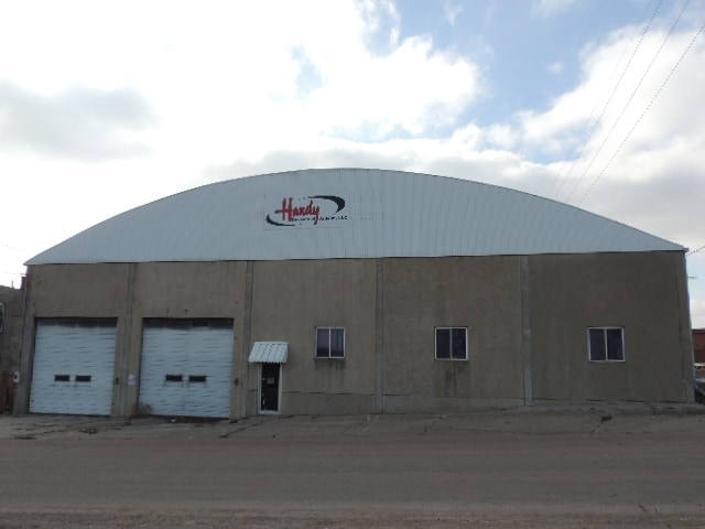
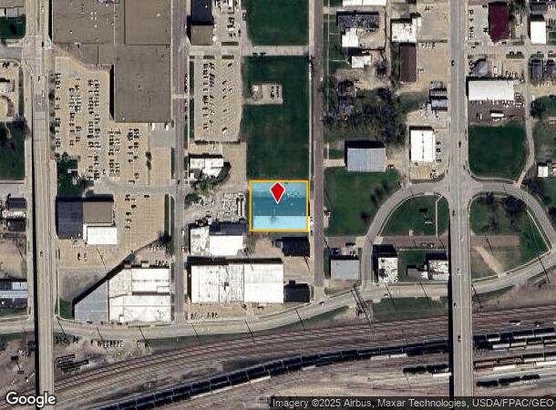
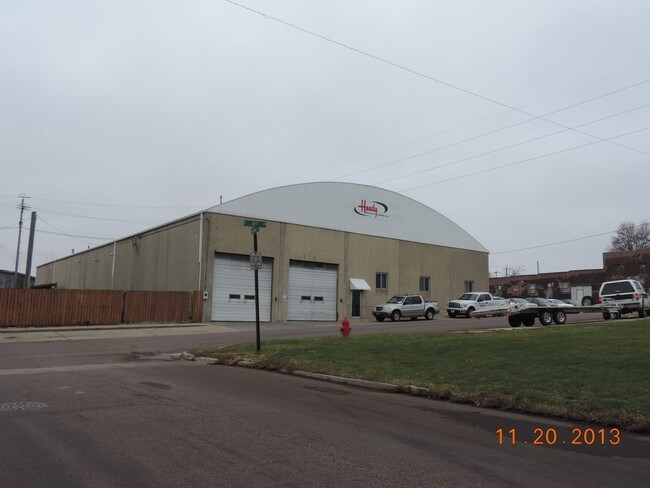
401 S 2Nd Ave
Marshalltown, IA
Ansons First Add
8418-35-256-009
LOT 1 & N 1/2 LOT 2 BLK 10 & THAT PORTION OF E NEVADA ST LYING BETWEEN LOT 1 BLK 10 & LOT 12 BLK 1
Warehouse
Marshall
X
Iowa
19127C0170C
1-2,12
2024
0.65 AC
2025
Fort Dodge/Ames
950900
Other Market Areas
16,200 SF
DEMOGRAPHICS near 401 S 2Nd Ave
1 Mile
3 Mile
5 Mile
2024 Total Population
12,376
27,556
29,582
2029 Population
12,394
27,381
29,406
Pop Growth 2024-2029
+ 0.15%
(0.64%)
(0.59%)
Average Age
36
39
39
2024 Total Households
4,534
10,318
11,135
HH Growth 2024-2029
+ 0.13%
(0.67%)
(0.62%)
Median Household Inc
$52,565
$59,315
$60,989
Avg Household Size
2.50
2.50
2.50
2024 Avg HH Vehicles
2.00
2.00
2.00
Median Home Value
$72,463
$103,008
$110,291
Median Year Built
1949
1957
1958
Nearby Places
Map Layers
Map Styles
 Street
 Aerial
- Restaurants
- Banks
- Shops
- Fitness
- Groceries
SALE & LEASE HISTORY
LISTING DATE
SALE/LEASE

Sep 23, 2016
For Sale
Nov 01, 2016
For Sale
Mar 16, 2018
For Lease
Jul 22, 2019
For Lease
Nearby Properties
Address
Land Use
TOTAL SIZE
Lot Size
Zoning
Address
Land Use
TOTAL SIZE
Lot Size
Zoning
5,436 SF
4.91 AC
OP
Address
Land Use
TOTAL SIZE
Lot Size
Zoning
2,220 SF
14.83 AC
M1
Address
Land Use
TOTAL SIZE
Lot Size
Zoning
936,185 SF
40.27 AC
M2
Address
Land Use
TOTAL SIZE
Lot Size
Zoning
157.52 AC
R2
Address
Land Use
TOTAL SIZE
Lot Size
Zoning
45,868 SF
9.28 AC
Address
Land Use
TOTAL SIZE
Lot Size
Zoning
214,045 SF
24.70 AC
CC
Address
Land Use
TOTAL SIZE
Lot Size
Zoning
234,288 SF
50.35 AC
R2
Address
Land Use
TOTAL SIZE
Lot Size
Zoning
178,452 SF
17.30 AC
Address
Land Use
TOTAL SIZE
Lot Size
Zoning
191,018 SF
35.03 AC
Address
Land Use
TOTAL SIZE
Lot Size
Zoning
240,519 SF
6.64 AC
M2
Address
Land Use
TOTAL SIZE
Lot Size
Zoning
273 SF
19.07 AC
M2
Address
Land Use
TOTAL SIZE
Lot Size
Zoning
72,270 SF
69.27 AC
M2
Address
Land Use
TOTAL SIZE
Lot Size
Zoning
9,404 SF
9.64 AC
Address
Land Use
TOTAL SIZE
Lot Size
Zoning
54,958 SF
Address
Land Use
TOTAL SIZE
Lot Size
Zoning
72,270 SF
Address
Land Use
TOTAL SIZE
Lot Size
Zoning
138,437 SF
3.66 AC
PUD
Address
Land Use
TOTAL SIZE
Lot Size
Zoning
31,698 SF
17.40 AC
R2A
Address
Land Use
TOTAL SIZE
Lot Size
Zoning
71,822 SF
8.58 AC
CC
Address
Land Use
TOTAL SIZE
Lot Size
Zoning
19,896 SF
9.63 AC
Address
Land Use
TOTAL SIZE
Lot Size
Zoning
59,450 SF
4.86 AC
PUD
Address
Land Use
TOTAL SIZE
Lot Size
Zoning
73,368 SF
4.13 AC
PUD
Address
Land Use
TOTAL SIZE
Lot Size
Zoning
108,735 SF
2.42 AC
Address
Land Use
TOTAL SIZE
Lot Size
Zoning
76,696 SF
6.09 AC
R3
Address
Land Use
TOTAL SIZE
Lot Size
Zoning
49,015 SF
11.12 AC
R2
Address
Land Use
TOTAL SIZE
Lot Size
Zoning
33,676 SF
3.12 AC
R4
Address
Land Use
TOTAL SIZE
Lot Size
Zoning
53,446 SF
2.86 AC
Address
Land Use
TOTAL SIZE
Lot Size
Zoning
7,776 SF
7.89 AC
Address
Land Use
TOTAL SIZE
Lot Size
Zoning
32,845 SF
6.70 AC
Address
Land Use
TOTAL SIZE
Lot Size
Zoning
792 SF
49.12 AC
M2
The World's #1 Commercial Real Estate Marketplace
Connect with us
© 2025 CoStar Group
The information above has been obtained from sources believed reliable. While we do not doubt its accuracy we have not verified it and make no guarantee, warranty or representation about it. It is your responsibility to independently confirm its accuracy and completeness. Any projections, opinions, assumptions, or estimates used are for example only and do not represent the current or future performance of the property. The value of this transaction to you depends on tax and other factors which should be evaluated by your tax, financial, and legal advisors. You and your advisors should conduct a careful, independent investigation of the property to determine to your satisfaction the suitability of the property for your needs.