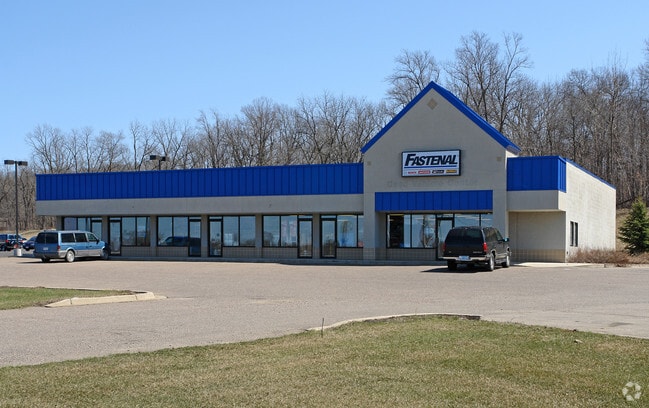
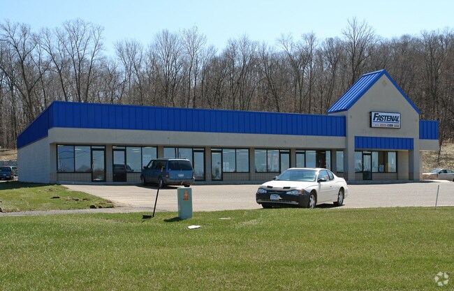
Property Record
401 Stafford Rd N, Dundas, MN 55019

NEARBY LISTINGS FOR SALE OR LEASE
Property Detail
401 Stafford Rd N
17.14.2.00.009
PART N2 N2 NW4 COMG NE COR NW4 TH S89D56'35W 1027.46FT TAP IN SELY R/W LI MN DOT R/W PLAT #66-30 TH S43D22'22W ALG R/W LI
Storebuilding
Rice
X
Minnesota
27131C0162D
0.79 AC
2025
Minnesota South Area
2025
Other Market Areas
070200
Faribault-Northfield, MN
3,960 SF
DEMOGRAPHICS near 401 Stafford Rd N
1 Mile
3 Mile
5 Mile
2024 Total Population
2,895
18,729
25,554
2029 Population
2,950
18,944
25,856
Pop Growth 2024-2029
+ 1.90%
+ 1.15%
+ 1.18%
Average Age
39
37
38
2024 Total Households
1,053
5,970
8,380
HH Growth 2024-2029
+ 2.18%
+ 1.32%
+ 1.36%
Median Household Inc
$90,699
$73,795
$78,020
Avg Household Size
2.70
2.40
2.40
2024 Avg HH Vehicles
2.00
2.00
2.00
Median Home Value
$311,805
$281,534
$297,503
Median Year Built
1997
1981
1983
Nearby Places
Map Layers
Map Styles
 Street
 Aerial
- Restaurants
- Banks
- Shops
- Fitness
- Groceries
PUBLIC TRANSPORTATION
AIRPORT
Minneapolis-St Paul International/Wold-Chamberlain
DRIVE
WALK
Distance
Minneapolis-St Paul International/Wold-Chamberlain
53 min
40.6 mi
Nearby Properties
Address
Land Use
TOTAL SIZE
Lot Size
Zoning
Address
Land Use
TOTAL SIZE
Lot Size
Zoning
15,356 SF
3.05 AC
Address
Land Use
TOTAL SIZE
Lot Size
Zoning
79,085 SF
61.10 AC
Address
Land Use
TOTAL SIZE
Lot Size
Zoning
15,169 SF
8.60 AC
Address
Land Use
TOTAL SIZE
Lot Size
Zoning
180,663 SF
36 AC
Address
Land Use
TOTAL SIZE
Lot Size
Zoning
76,608 SF
30.10 AC
Address
Land Use
TOTAL SIZE
Lot Size
Zoning
23,295 SF
18.20 AC
Address
Land Use
TOTAL SIZE
Lot Size
Zoning
3,080 SF
41.80 AC
Address
Land Use
TOTAL SIZE
Lot Size
Zoning
3,499 SF
13.50 AC
Address
Land Use
TOTAL SIZE
Lot Size
Zoning
58,080 SF
16.90 AC
Address
Land Use
TOTAL SIZE
Lot Size
Zoning
31,200 SF
15.50 AC
Address
Land Use
TOTAL SIZE
Lot Size
Zoning
19,129 SF
0.75 AC
Address
Land Use
TOTAL SIZE
Lot Size
Zoning
11,856 SF
10.80 AC
Address
Land Use
TOTAL SIZE
Lot Size
Zoning
95,400 SF
15.20 AC
Address
Land Use
TOTAL SIZE
Lot Size
Zoning
161,640 SF
15.13 AC
Address
Land Use
TOTAL SIZE
Lot Size
Zoning
9,065 SF
5.10 AC
Address
Land Use
TOTAL SIZE
Lot Size
Zoning
6,000 SF
3.11 AC
Address
Land Use
TOTAL SIZE
Lot Size
Zoning
5,190 SF
1.30 AC
Address
Land Use
TOTAL SIZE
Lot Size
Zoning
126,240 SF
12.18 AC
Address
Land Use
TOTAL SIZE
Lot Size
Zoning
9,600 SF
24.60 AC
Address
Land Use
TOTAL SIZE
Lot Size
Zoning
12,333 SF
1.27 AC
Address
Land Use
TOTAL SIZE
Lot Size
Zoning
46,448 SF
6.50 AC
Address
Land Use
TOTAL SIZE
Lot Size
Zoning
16,991 SF
2.06 AC
Address
Land Use
TOTAL SIZE
Lot Size
Zoning
2,633 SF
2.14 AC
Address
Land Use
TOTAL SIZE
Lot Size
Zoning
12,593 SF
2.21 AC
Address
Land Use
TOTAL SIZE
Lot Size
Zoning
23,579 SF
3.80 AC
Address
Land Use
TOTAL SIZE
Lot Size
Zoning
18,287 SF
1.83 AC
Address
Land Use
TOTAL SIZE
Lot Size
Zoning
1,176 SF
5.20 AC
Address
Land Use
TOTAL SIZE
Lot Size
Zoning
5,259 SF
3 AC
Address
Land Use
TOTAL SIZE
Lot Size
Zoning
5,187 SF
3.76 AC
Address
Land Use
TOTAL SIZE
Lot Size
Zoning
66,264 SF
13.80 AC
The World's #1 Commercial Real Estate Marketplace
Connect with us
© 2026 CoStar Group
The information above has been obtained from sources believed reliable. While we do not doubt its accuracy we have not verified it and make no guarantee, warranty or representation about it. It is your responsibility to independently confirm its accuracy and completeness. Any projections, opinions, assumptions, or estimates used are for example only and do not represent the current or future performance of the property. The value of this transaction to you depends on tax and other factors which should be evaluated by your tax, financial, and legal advisors. You and your advisors should conduct a careful, independent investigation of the property to determine to your satisfaction the suitability of the property for your needs.