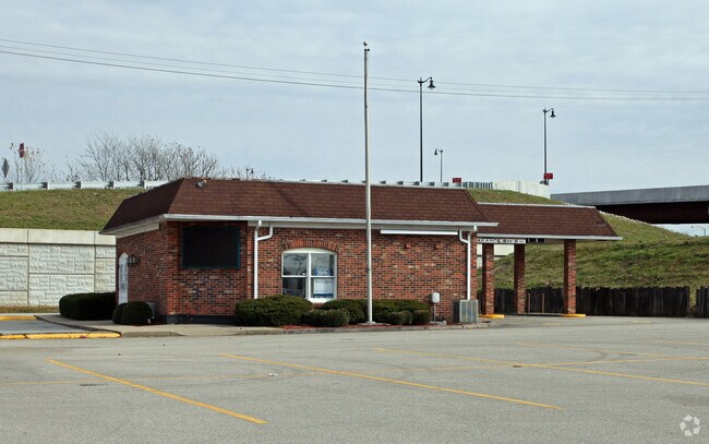
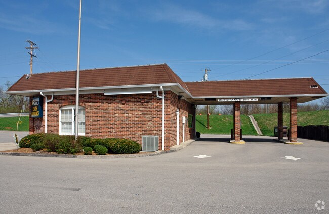
Property Record
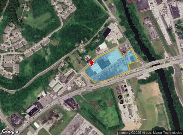
401 W Eads Pkwy, Lawrenceburg, IN 47025
NEARBY LISTINGS FOR SALE OR LEASE
Property Detail
401 W Eads Pkwy
15-07-15-402-001.000-013
08-233 PT 'PLAZA' 15-5-1 10.5819A *** THIS PARCEL IS PART OF 11.6839A TRACT SEE P# 13-344 FOR REMAINDER ***
Stripcommercialcenter
Dearborn
AE
Indiana
18115C0050C
10.50 AC
2024
Dearborn County
2024
Cincinnati/Dayton
080301
Cincinnati, OH-KY-IN
63,980 SF
DEMOGRAPHICS near 401 W Eads Pkwy
1 Mile
3 Mile
5 Mile
2024 Total Population
3,972
12,125
21,186
2029 Population
4,127
12,577
21,936
Pop Growth 2024-2029
+ 3.90%
+ 3.73%
+ 3.54%
Average Age
40
41
41
2024 Total Households
1,652
4,948
8,434
HH Growth 2024-2029
+ 3.93%
+ 3.78%
+ 3.58%
Median Household Inc
$38,382
$57,281
$63,396
Avg Household Size
2.20
2.30
2.40
2024 Avg HH Vehicles
2.00
2.00
2.00
Median Home Value
$152,881
$161,406
$174,335
Median Year Built
1956
1970
1972
Nearby Places
Map Layers
Map Styles
 Street
 Aerial
- Restaurants
- Banks
- Shops
- Fitness
- Groceries
PUBLIC TRANSPORTATION
AIRPORT
Cincinnati/Northern Kentucky International
DRIVE
WALK
Distance
Cincinnati/Northern Kentucky International
34 min
19.5 mi
Freight Ports
Port of Toledo
DRIVE
WALK
Distance
Port of Toledo
261 min
221.6 mi
SALE & LEASE HISTORY
LISTING DATE
SALE/LEASE

Sep 25, 2016
For Lease
Nearby Properties
Address
Land Use
TOTAL SIZE
Lot Size
Zoning
Address
Land Use
TOTAL SIZE
Lot Size
Zoning
491,407 SF
10.84 AC
Address
Land Use
TOTAL SIZE
Lot Size
Zoning
1,712 SF
Address
Land Use
TOTAL SIZE
Lot Size
Zoning
255,203 SF
3.04 AC
Address
Land Use
TOTAL SIZE
Lot Size
Zoning
2.08 AC
Address
Land Use
TOTAL SIZE
Lot Size
Zoning
12,000 SF
61.29 AC
Address
Land Use
TOTAL SIZE
Lot Size
Zoning
205,455 SF
20.32 AC
Address
Land Use
TOTAL SIZE
Lot Size
Zoning
7,180 SF
16 AC
Address
Land Use
TOTAL SIZE
Lot Size
Zoning
60,868 SF
8.90 AC
Address
Land Use
TOTAL SIZE
Lot Size
Zoning
43,895 SF
59.12 AC
Address
Land Use
TOTAL SIZE
Lot Size
Zoning
111,861 SF
11.72 AC
Address
Land Use
TOTAL SIZE
Lot Size
Zoning
18,114 SF
18.96 AC
Address
Land Use
TOTAL SIZE
Lot Size
Zoning
64,875 SF
3.10 AC
Address
Land Use
TOTAL SIZE
Lot Size
Zoning
68,146 SF
7.06 AC
Address
Land Use
TOTAL SIZE
Lot Size
Zoning
1,868 SF
441.70 AC
Address
Land Use
TOTAL SIZE
Lot Size
Zoning
24,487 SF
8.81 AC
Address
Land Use
TOTAL SIZE
Lot Size
Zoning
94,974 SF
8.06 AC
Address
Land Use
TOTAL SIZE
Lot Size
Zoning
35,018 SF
4 AC
Address
Land Use
TOTAL SIZE
Lot Size
Zoning
32,169 SF
5.49 AC
Address
Land Use
TOTAL SIZE
Lot Size
Zoning
19,377 SF
6 AC
Address
Land Use
TOTAL SIZE
Lot Size
Zoning
26,500 SF
14.36 AC
Address
Land Use
TOTAL SIZE
Lot Size
Zoning
242.80 AC
Address
Land Use
TOTAL SIZE
Lot Size
Zoning
43,920 SF
11.46 AC
Address
Land Use
TOTAL SIZE
Lot Size
Zoning
69,075 SF
3.10 AC
Address
Land Use
TOTAL SIZE
Lot Size
Zoning
200 SF
49.08 AC
Address
Land Use
TOTAL SIZE
Lot Size
Zoning
2,853 SF
9 AC
Address
Land Use
TOTAL SIZE
Lot Size
Zoning
38,658 SF
5.38 AC
Address
Land Use
TOTAL SIZE
Lot Size
Zoning
222,717 SF
9.94 AC
Address
Land Use
TOTAL SIZE
Lot Size
Zoning
40,872 SF
1.31 AC
Address
Land Use
TOTAL SIZE
Lot Size
Zoning
210,672 SF
8.15 AC
The World's #1 Commercial Real Estate Marketplace
Connect with us
© 2025 CoStar Group
The information above has been obtained from sources believed reliable. While we do not doubt its accuracy we have not verified it and make no guarantee, warranty or representation about it. It is your responsibility to independently confirm its accuracy and completeness. Any projections, opinions, assumptions, or estimates used are for example only and do not represent the current or future performance of the property. The value of this transaction to you depends on tax and other factors which should be evaluated by your tax, financial, and legal advisors. You and your advisors should conduct a careful, independent investigation of the property to determine to your satisfaction the suitability of the property for your needs.