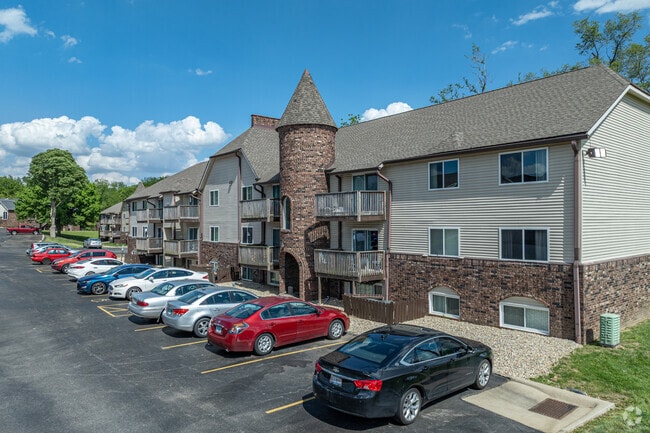
Property Record
4010 N Brandywine Dr, Peoria, IL 61614


NEARBY LISTINGS FOR SALE OR LEASE
-
-
View all Peoria listings for sale on LoopNet.com
Property Detail
4010 N Brandywine Dr
Peoria
Johnson & Weads Sub
Peoria, IL
JOHNSON & WEADS SUB NW 1/4 SEC 29-9-8E 18.066 AC BEG 885.09 E OF NW COR SEC 29: TH E 436.13 S 779.83 SW 803.2 TO N LN RTE #150 NW ALG SD N LN 132.68 NW ALG SD N 329.33 NE 1193.68 TO POB PT LOTS 9 THRU 012
1429101006
Peoria
Commercialnec
Illinois
2024
9-12
2024
18.07 AC
002800
North Peoria
DEMOGRAPHICS near 4010 N Brandywine Dr
1 Mile
3 Mile
5 Mile
2024 Total Population
8,087
78,424
119,634
2029 Population
7,803
76,705
117,394
Pop Growth 2024-2029
(3.51%)
(2.19%)
(1.87%)
Average Age
42
39
39
2024 Total Households
3,748
34,011
51,417
HH Growth 2024-2029
(3.79%)
(2.40%)
(2.12%)
Median Household Inc
$46,763
$51,124
$49,145
Avg Household Size
2.00
2.10
2.20
2024 Avg HH Vehicles
1.00
2.00
1.00
Median Home Value
$127,778
$119,996
$117,165
Median Year Built
1959
1960
1961
Nearby Places
Map Layers
Map Styles
 Street
 Aerial
- Restaurants
- Banks
- Shops
- Fitness
- Groceries
PUBLIC TRANSPORTATION
AIRPORT
General Downing - Peoria International
DRIVE
WALK
Distance
General Downing - Peoria International
19 min
11.2 mi
Freight Ports
Port Milwaukee
DRIVE
WALK
Distance
Port Milwaukee
269 min
226.3 mi
Nearby Properties
Address
Land Use
TOTAL SIZE
Lot Size
Zoning
Address
Land Use
TOTAL SIZE
Lot Size
Zoning
22.13 AC
Address
Land Use
TOTAL SIZE
Lot Size
Zoning
7.75 AC
Address
Land Use
TOTAL SIZE
Lot Size
Zoning
47.89 AC
Address
Land Use
TOTAL SIZE
Lot Size
Zoning
20.08 AC
Address
Land Use
TOTAL SIZE
Lot Size
Zoning
28.05 AC
Address
Land Use
TOTAL SIZE
Lot Size
Zoning
17.65 AC
Address
Land Use
TOTAL SIZE
Lot Size
Zoning
6.05 AC
Address
Land Use
TOTAL SIZE
Lot Size
Zoning
10.41 AC
Address
Land Use
TOTAL SIZE
Lot Size
Zoning
1.32 AC
Address
Land Use
TOTAL SIZE
Lot Size
Zoning
17.21 AC
Address
Land Use
TOTAL SIZE
Lot Size
Zoning
5.50 AC
Address
Land Use
TOTAL SIZE
Lot Size
Zoning
8.74 AC
Address
Land Use
TOTAL SIZE
Lot Size
Zoning
16.70 AC
Address
Land Use
TOTAL SIZE
Lot Size
Zoning
Address
Land Use
TOTAL SIZE
Lot Size
Zoning
18.21 AC
Address
Land Use
TOTAL SIZE
Lot Size
Zoning
20.51 AC
Address
Land Use
TOTAL SIZE
Lot Size
Zoning
0.57 AC
Address
Land Use
TOTAL SIZE
Lot Size
Zoning
25.71 AC
Address
Land Use
TOTAL SIZE
Lot Size
Zoning
0.94 AC
Address
Land Use
TOTAL SIZE
Lot Size
Zoning
7.21 AC
Address
Land Use
TOTAL SIZE
Lot Size
Zoning
9.40 AC
Address
Land Use
TOTAL SIZE
Lot Size
Zoning
0.63 AC
Address
Land Use
TOTAL SIZE
Lot Size
Zoning
Address
Land Use
TOTAL SIZE
Lot Size
Zoning
47,352 SF
Address
Land Use
TOTAL SIZE
Lot Size
Zoning
5.01 AC
Address
Land Use
TOTAL SIZE
Lot Size
Zoning
5.81 AC
Address
Land Use
TOTAL SIZE
Lot Size
Zoning
11.78 AC
Address
Land Use
TOTAL SIZE
Lot Size
Zoning
10.11 AC
Address
Land Use
TOTAL SIZE
Lot Size
Zoning
5.73 AC
The World's #1 Commercial Real Estate Marketplace
Connect with us
© 2025 CoStar Group
The information above has been obtained from sources believed reliable. While we do not doubt its accuracy we have not verified it and make no guarantee, warranty or representation about it. It is your responsibility to independently confirm its accuracy and completeness. Any projections, opinions, assumptions, or estimates used are for example only and do not represent the current or future performance of the property. The value of this transaction to you depends on tax and other factors which should be evaluated by your tax, financial, and legal advisors. You and your advisors should conduct a careful, independent investigation of the property to determine to your satisfaction the suitability of the property for your needs.